This copy is copyright protected.
Copyright © 2024 Geographicus Rare Antique Maps
1960 Winn Historical Pictorail Map of Boston w/ Paul Revere Ride
Boston-winn-1960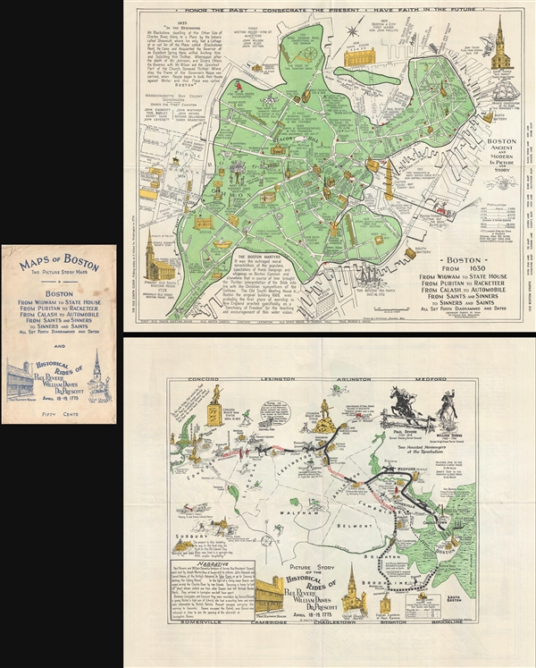

Copyright © 2024 Geographicus Rare Antique Maps | Geographicus Rare Antique Maps
This copy is copyright protected.
Copyright © 2024 Geographicus Rare Antique Maps