This copy is copyright protected.
Copyright © 2024 Geographicus Rare Antique Maps

Details
1890 Imray Chart of Nova Scotia, New Brunswick, Newfoundland, and New England
1890 (dated) $1,200.00
1934 Kenneth Morang Pictorial Map of Cape Cod, Massachusetts
CapeCod-morang-1934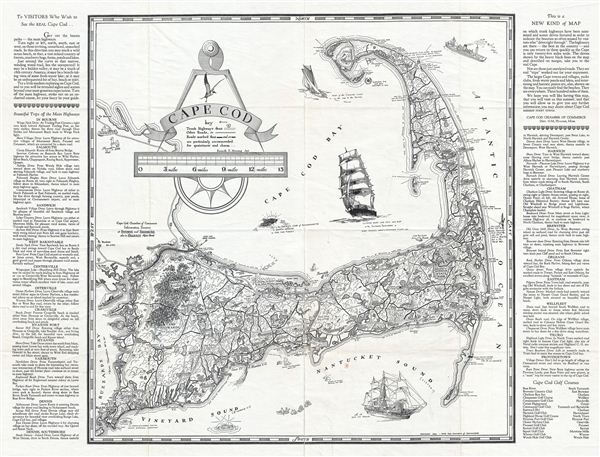

Copyright © 2024 Geographicus Rare Antique Maps | Geographicus Rare Antique Maps
This copy is copyright protected.
Copyright © 2024 Geographicus Rare Antique Maps