This copy is copyright protected.
Copyright © 2024 Geographicus Rare Antique Maps
1933 Sewah Studios Pictorial Map of Ohio (The Chicago World's Fair)
CartographOhio-sewah-1933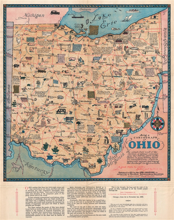

Copyright © 2024 Geographicus Rare Antique Maps | Geographicus Rare Antique Maps
This copy is copyright protected.
Copyright © 2024 Geographicus Rare Antique Maps