This copy is copyright protected.
Copyright © 2024 Geographicus Rare Antique Maps
1950 Snow and Hill Map of Casco Bay, Maine
CascoBay-snow-1950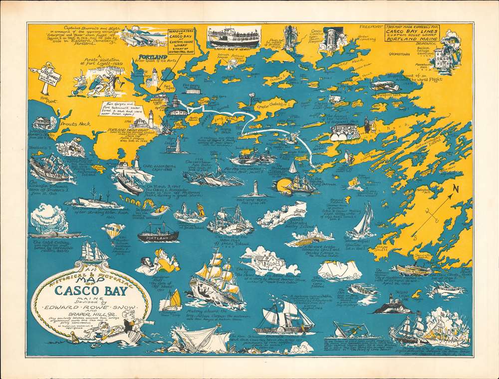

Copyright © 2024 Geographicus Rare Antique Maps | Geographicus Rare Antique Maps
This copy is copyright protected.
Copyright © 2024 Geographicus Rare Antique Maps