This copy is copyright protected.
Copyright © 2024 Geographicus Rare Antique Maps

Details
1661 Elzevir / Cluver map of China, Korea and Japan
1661 (undated) $250.00
1680 Cluver Map of China
China-cluver-1680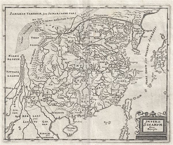

Philipp Clüver (also Klüwer, Cluwer, or Cluvier, Latinized as Philippus Cluverius and Philippi Cluverii) (1580 - December 31, 1622) was a German geographer and historian active in Leiden in the late 16th and early 17th centuries. Clüver was born in the Royal Prussian city of Danzig (Gdansk), then a province of the Kingdom of Poland. He study of law at the University of Leiden before turning his attention to history and geography. Cluver traveled, mostly by foot, extensively throughout Europe, spending time in Germany, England, Scotland, Holland and Italy. On returning to Leiden he was given a special appointment as geographer and put in charge of the university's library. Cluver is best known for his general study of the geography of antiquity. A popular Enlightenment era field of study, antiquarian geography attempted to resolve place names known from classical literature but, by the time of the Renaissance, geographically confused. Cluver based his research not only on classical literary sources, but — and this was his primary contribution to the genre — also his extensive and local inspections of sites. Today he is considered one of the founding fathers of historical geography. Cartographically Cluver's most prominent works include his edition of Ptolemy's Geographia (based on Mercator's edition of 1578) and for miniature atlases that were reprinted for most of the 17thand 18th centuries. Cluver was also known as Klüwer, Cluwer, or Cluvier, Latinized as Philippus Cluverius and Philippi Cluverii. He died in Leiden in 1622. More by this mapmaker...
Copyright © 2024 Geographicus Rare Antique Maps | Geographicus Rare Antique Maps
This copy is copyright protected.
Copyright © 2024 Geographicus Rare Antique Maps