This copy is copyright protected.
Copyright © 2024 Geographicus Rare Antique Maps
1904 Samuel Mann Manuscript Missionary Map of the Congo, on cotton cloth
CongoCentralAfrica-mannsamuel-1904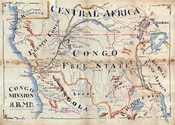

Samuel Eleazer Mann (April 10, 1853 - September 14, 1930) was a Methuen, Massachusetts, based cartographer who produced large format missionary field maps on cloth for the American Baptist Missionary Union (A.B.M.U). Most of Mann's maps appear to have been one-offs designed on cloth using Diamond Dyes, India ink, and stencils. The maps were made to order as field documents for various Baptist missionary societies, most particularly the A.B.M.U. The archives of Mount Holyoke College identify one such map, some 13 feet wide, acquired by the Student Volunteer Band. More by this mapmaker...
American Baptist Missionary Union (1814 - Present) (A.B.M.U) formerly known as the American Baptist Missionary Union and the American Baptist Foreign Mission Society) is an international Protestant Christian missionary society founded in 1814 in the United States. It is a constituent board affiliated with the American Baptist Churches USA. The Society was founded in 1814 at the first Triennial Convention and initially sponsored by two American missionaries in Burma, Adoniram Judson and Ann Hasseltine Judson. The organization is the oldest Baptist missionary organization based in North America. The Society was involved in sending workers to many different countries including China during the late Qing Dynasty. Today, operating as American Baptist International Ministries, the society is active in some 80 countries. Learn More...
Copyright © 2024 Geographicus Rare Antique Maps | Geographicus Rare Antique Maps
This copy is copyright protected.
Copyright © 2024 Geographicus Rare Antique Maps