This copy is copyright protected.
Copyright © 2024 Geographicus Rare Antique Maps
1763 Terreni - Coltellini Map of Cuba and Jamaica
Cuba-terrini-1763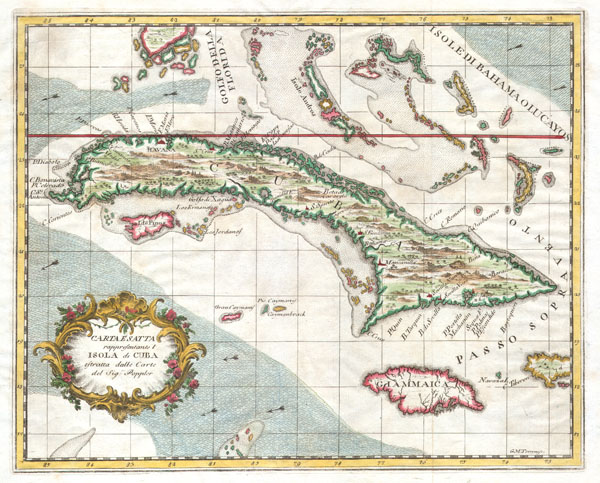

Giuseppe Maria Terreni (1739 - 1811) was an Italian engraver, merchant, artist, and painter active in the middle to latter part of the 19th century. Terreni was born in Livorno, Italy, where he completed most of his artistic works. Between 1783 and 1785 Terreni executed a series of 18 engraved city views of Livorno in the style of Giuseppe Zocchi and Jakob Philipp Hackert. He also published several engraved maps and views in partnership with Lodovico Coltellini for issue in various Italian atlases. He was also, apparently, involved somewhat loosely with the antiquities trade. More by this mapmaker...
Copyright © 2024 Geographicus Rare Antique Maps | Geographicus Rare Antique Maps
This copy is copyright protected.
Copyright © 2024 Geographicus Rare Antique Maps