This copy is copyright protected.
Copyright © 2024 Geographicus Rare Antique Maps
1790 Faden Map of the Roads of Great Britain or England
England-faden-1790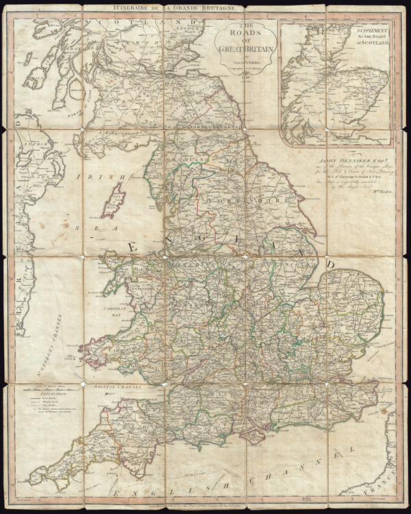

William Faden (July 11, 1749 - March 21, 1836) was a Scottish cartographer and map publisher of the late 18th century. Faden was born in London. His father, William MacFaden, was a well-known London printer and publisher of The Literary Magazine. During the Jacobite Rebellion (1745 - 1746), MacFaden changed his family name to Faden, to avoid anti-Scottish sentiment. Faden apprenticed under the engraver James Wigley (1700 - 1782), attaining his freedom in 1771 - in the same year that Thomas Jefferys Sr. died. While Thomas Jefferys Sr. was an important and masterful mapmaker, he was a terrible businessman and his son, Jefferys Jr. had little interest building on his father's legacy. MacFaden, perhaps recognizing an opportunity, acquired his son a partnership in the Jefferys firm, which subsequently traded as 'Faden and Jefferys'. Jefferys Jr. also inherited Jefferys Sr. title, 'Geographer to the King and to the Prince of Wales'. With little interest in cartography or map publishing Jefferys Jr. increasingly took a back seat to Faden, withdrawing completely from day-to-day management, although retaining his finical stake, by 1776. The American Revolutionary War (1775 - 1783) proved to be a boomtime for the young 'Geographer to the King', who leveraged existing materials and unpublished manuscript maps to which he had access via his official appointment, to publish a wealth of important maps, both for official wartime use and for the curious public. This period of prosperity laid financial underpinning for Faden, who by 1783, at the end of the war, acquired full ownership of the firm and removed the Jefferys imprint. In 1801, he engraved and published the first maps for the British Ordnance Survey. By 1822, Faden published over 350 maps, atlases, and military plans. He retired in 1823, selling his places to James Wyld Sr. Faden died in 1836. More by this mapmaker...
Copyright © 2024 Geographicus Rare Antique Maps | Geographicus Rare Antique Maps
This copy is copyright protected.
Copyright © 2024 Geographicus Rare Antique Maps