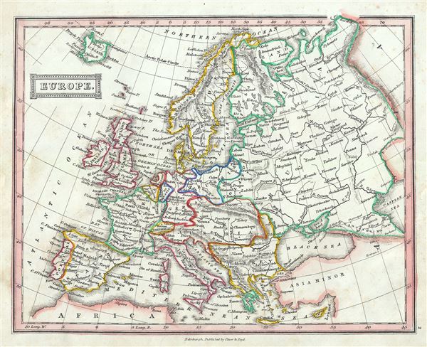
This is an attractive example of Thomas Ewing's 1845 map of Europe. It covers the continent in its entirety from the North Atlantic Ocean to the Caspian Sea and from the Arctic Sea to the Mediterranean Sea, including Iceland. Various towns, cities, rivers, mountains and several other topographical details are noted with relief shown by hachure.
This map was created at a time in history that witnessed the unification of Italy and saw the British Empire rise to its peak. It was also a time of decline for the Ottoman Empire. Issued following the defeat of Napoleonic France and the Congress of Vienna, Europe is shown under a new peaceful balance of power, centered on the five most important powers (also referred to as the five 'Great Powers'): the United Kingdom, France, Russia, Prussia and the Austrian empire. Alas, the 'peace' was but an illusion as the treaties ending the Napoleonic era were inherently flawed. Old rivalries festered and nationalism, liberalism, revolution (industrial and otherwise) was once again on the rise throughout Europe. This map was published in 1845 by Oliver and Boyd as part of Ewing's New General Atlas.
Source
Oliver and Boyd, Ewing's New General Atlas: containing Distinct Maps of all the Principal States and Kingdoms throughout the World, (Edinburgh) 1845.
Very good. Some foxing at places.