This copy is copyright protected.
Copyright © 2024 Geographicus Rare Antique Maps
1939 Pictorial Swiss Tourism Gastronomical Map of Switzerland
GastronomicSwitzerland-tourisme-1939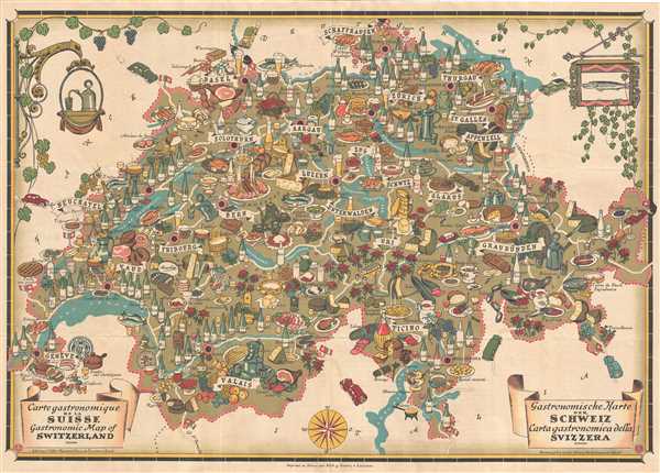

Copyright © 2024 Geographicus Rare Antique Maps | Geographicus Rare Antique Maps
This copy is copyright protected.
Copyright © 2024 Geographicus Rare Antique Maps