This copy is copyright protected.
Copyright © 2024 Geographicus Rare Antique Maps
1912 Taisho 1 Japanese Map of Hawaii
Hawaii2-taisho1-1912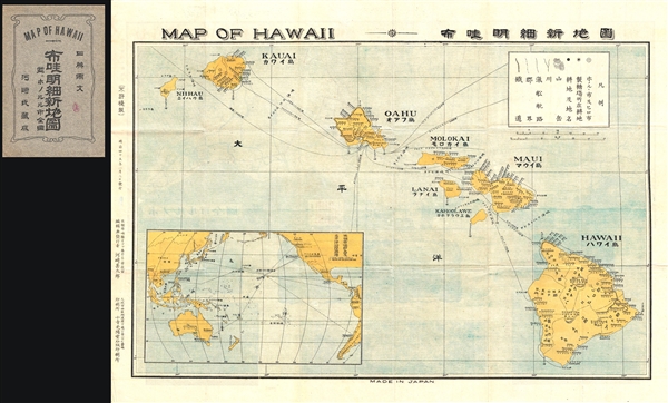

Copyright © 2024 Geographicus Rare Antique Maps | Geographicus Rare Antique Maps
This copy is copyright protected.
Copyright © 2024 Geographicus Rare Antique Maps