This copy is copyright protected.
Copyright © 2024 Geographicus Rare Antique Maps
1759 La Rouge Map of Eastern India or Coromandel (Madras and Pondicherry)
IndiaEast-lerouge-1759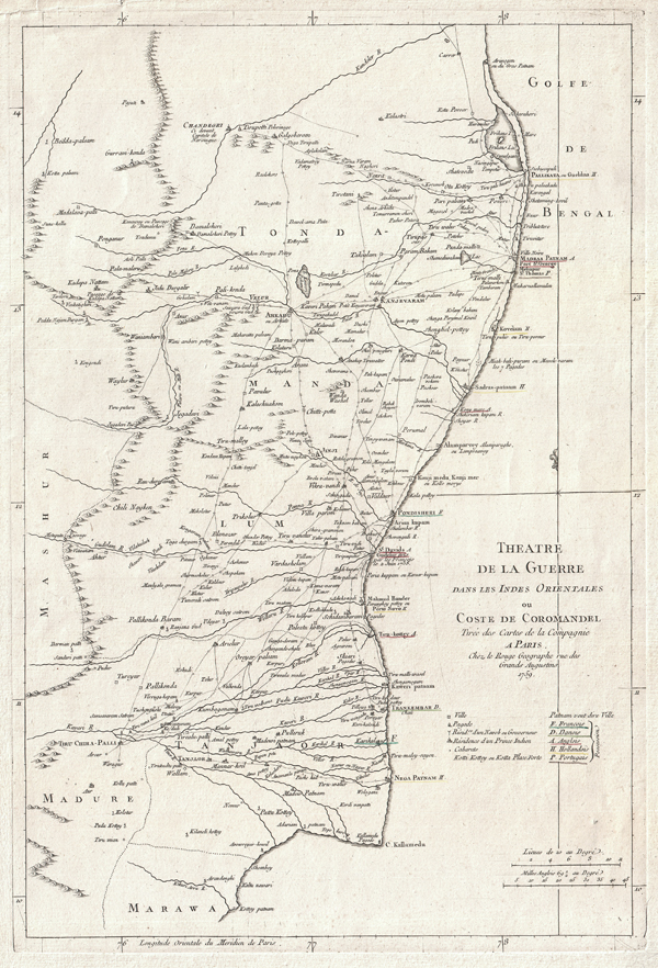

Georges-Louis Le Rouge (c. 1707 - c. 1790) was a Paris based map publisher operating in the middle part of the 18th century. Le Rouge was born in Hanover Germany as Georg Ludwig, where he was educated and employed as a military engineer and surveyor. His father may have been the French architect Louis Remy de la Fosse (1659 - 1726), which would explain his early education in both engineering and draftsmanship. He assisted his father on a large-scale plan of Darmstadt, which he completed following his father's death in 1726. He may have remained in Darmstadt, but little is known of his life from 1726 - 1736, when he appears in Paris. Le Rouge acquired a position as military and civil engineer for King Louis XV and Louis XVI. Around this time, he Francophied his name to 'Le Rouge'. In 1840, he set up shop on the Rue Des Grands Augustins as an engraver, book publisher, and map publisher. He partnered with the English cartographer and engineer John Rocque (1709 - 1762), who became an important source for English maps, which Le Rouge re-engraved for French use. Despite being born German and adopting Paris as his home, Le Rouge was an ardent Anglophile and spent much of his time translating English books and maps into French. During his active period of roughly forty years Le Rouge produced thousands of maps and diagrams ranging from city and town plans, to atlases, plans of military campaigns and sea charts. He was a friend and correspondent of Benjamin Franklin (1706 - 1790), with whom he produced the important 1769 Franklin/Folger Map of the Gulf Stream. Franklin, who met Le Rouge in Paris, writes that 'He [Le Rouge] is, I believe, a proper person.' He was awarded for his diligence with the impressive but unstipended honorific 'Geographe du Roi'. They may not have served him swell during the French Revolution (1789 - 1799), as his last known work was published in 1789, just before the storming of the Bastille. The exact date of Le Rouge's death remains a mystery. By most estimates, he is believed to have been alive in 1790, but may have lived as long as 1794. More by this mapmaker...
Copyright © 2024 Geographicus Rare Antique Maps | Geographicus Rare Antique Maps
This copy is copyright protected.
Copyright © 2024 Geographicus Rare Antique Maps