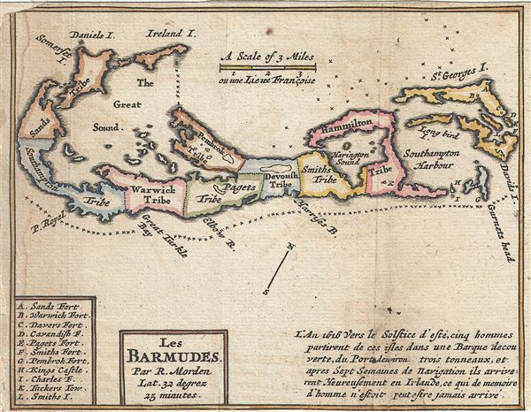
This is a charming 1688 small format map of Bermuda by Robert Morden. It depicts the whole of Bermuda divided into tribes, including the Sands Tribe, Southampton Tribe, Warwick Tribe, Pagets Tribe, Pembrock Tribe, Devonsh Tribe, Smiths Tribe and Hammilton Tribe with forts, castles and Islands for each tribe listed in the lower left quadrant of the map. The lower right quadrant includes a descriptive text about the Island. The map also notes shoals, islands, bays, coral reefs, etc. This map, previously issued in the first edition of Morden's Geography Rectified was issued in the Dutch edition of Richard Blome's 1688The Present State Of His Majesties Isles And Territories In America.
Source
Blome, R., Present State of His Majesties Isles and Territories in America, Amsterdam, 1688.
Very good. Minor wear and toning along original fold lines. Narrow margins. Left margin extended. Some water stains are visible near left margin. Professionally flattened and backed with archival tissue for stability.