This copy is copyright protected.
Copyright © 2024 Geographicus Rare Antique Maps
1888 Bird's Eye View or Map of New York City, New York
NewYork-illustrirte-1885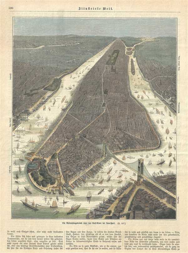

Copyright © 2024 Geographicus Rare Antique Maps | Geographicus Rare Antique Maps
This copy is copyright protected.
Copyright © 2024 Geographicus Rare Antique Maps