This copy is copyright protected.
Copyright © 2024 Geographicus Rare Antique Maps
1934 Davison Pictorial Map or View or Map of the Niagara Falls
NiagarasCombination-davison-1934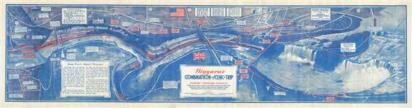

Copyright © 2024 Geographicus Rare Antique Maps | Geographicus Rare Antique Maps
This copy is copyright protected.
Copyright © 2024 Geographicus Rare Antique Maps