This item has been sold, but you can get on the Waitlist to be notified if another example becomes available, or purchase a digital scan.

1901 Land Office Map of the Island of Oahu, Hawaii ( Honolulu )

OhauHawaii-lo-1901
$375.00
Oahu, Hawaiian Islands. - Main View
Processing...

1901 Land Office Map of the Island of Oahu, Hawaii ( Honolulu )

OhauHawaii-lo-1901

The first published large format specific map of Oahu, Hawaii.

Title


Oahu, Hawaiian Islands.
  1901 (dated)     27.5 x 33 in (69.85 x 83.82 cm)

Description


This very large, rare, and extraordinary 1902 map of the island of Oahu, Hawaii, was prepared for the 1906 Report of the Governor of the Territory of Hawaii to the Secretary of the Interior. Honolulu, Pearl Harbor, Diamond Head, Koko Head and Kailua Bay are rendered in considerable, as is the charmingly-named Cocoa-Nut Grove on Mauna Loa Bay, complete with tiny coconut trees. Though the cartographic work that produced this map was started in 1878, during the Hawaiian Monarchy, the map itself, and the report that contained it, was issued following the U.S. Government's 1898 annexation of the Hawaiian Republic. The report was an attempt to assess and examine the newly created Hawaiian Territory's potential for proper administration and development. Consequently the map focuses on Public Lands, Homestead Settlement Tracts, Grazing Lands, Pineapple Lands, Sugar Plantations, Forest Reserves, Forest Lands, Wet Lands, etc. It also features both practical and topographic details for use in administering the region. The territorial governor of Hawaii at this time was George R. Carter. The primary triangulation for this map was accomplished by Walter e. Wall. The map itself was drawn by John M. Donn.

Cartographer


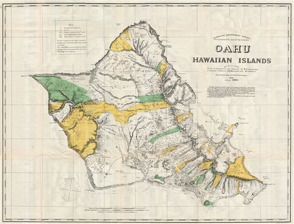
The General Land Office (1812 - 1946) was an independent agency charged with the administration and sale of public lands of the western territories of the United States under the Preemption Act of 1841 and the Homestead Act of 1862. During a time of frenetic energy and rapid westward expansion, the Land Office oversaw the surveying, platting, mapping and eventually the sale of much of the Western United States and Florida. The structural layout of the western United States that we see today, and many of their district and county divisions, are direct result of the early surveying work of the General Land Office. More importantly, as a branch of the Federal Government in Washington D.C. and the only agency able to legally sell and administer public lands in the western territories of the United States, the General Land Office played a pivotal role in consolidating power away from the original states and into the hands of the centralized federal government. The General Land Office was absorbed into the Department of Interior in 1849 and in 1946 merged with the United States Grazing Service to become the Bureau of Land Management. Today the Bureau of Land Management administers the roughly 246 million acres of public land remaining under federal ownership. More by this mapmaker...

Source


Report of the Governor of the Territory of Hawaii to the Secretary of the Interior, 1906.    

Condition


Very Good condition. Minor offsetting and light discoloration on original folds. Else clean and beautiful.

References


Rumsey 3705.009.