This item has been sold, but you can get on the Waitlist to be notified if another example becomes available, or purchase a digital scan.

1947 Taride Plan or Map of Paris, France

ParisPlan-taride-1947
$55.00
Paris Plan d'Ensemble par Arrondissements Metropolitain. - Main View
Processing...

1947 Taride Plan or Map of Paris, France

ParisPlan-taride-1947

Beautiful city plan of Paris, France.

Title


Paris Plan d'Ensemble par Arrondissements Metropolitain.
  1947 (dated)     12 x 15.5 in (30.48 x 39.37 cm)     1 : 33000

Description


This is a beautiful 1947 Plan or Map of the city of Paris, France by the Taride firm. The map, centered on the Seine River, covers the heart of modern Paris from the Bois de Boulogne in the west to the Bois de Vincennes in the east. Although ostensibly designed as a subway map, this map offers much more, with important buildings and monuments identified. Individual streets, parks, rivers, railway stations and bridges are also noted, with the city color coded according to its arrondissements. Paris itself is set as if in a verdant garden surrounded by the Bois de Boulogne in the west, the Bois de Vincennes in the east and various suburban villages. The map was printed by Dufrenoy and issued by the Cartes Taride firm in 1947.

Cartographer


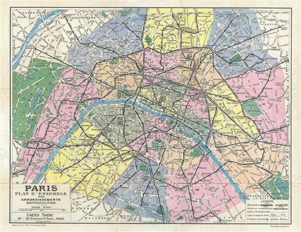
Alphonse Taride (fl. c. 1850 - 1918) was a prolific Paris based publisher active in the late 19th and early 20th century. Publishing as "A. Taride", the firm produced a large corpus of work including numerous maps, tourist guides, histories, and pocket plans of different parts of France. With the advent of the automobile and improved roadways in the early 20th century, the name "Taride" became synonymous with high quality roadmaps. Taride had his offices at 18 - 20 Boulevard St. Denis, Paris. More by this mapmaker...

Condition


Very good. Minor wear along original fold lines with minor verso repair along edges.

References


OCLC: 494640852.