This copy is copyright protected.
Copyright © 2024 Geographicus Rare Antique Maps
1960 Trabacchi Pictorial Map of Rome, Italy
PiantaRoma2-trabacchi-1960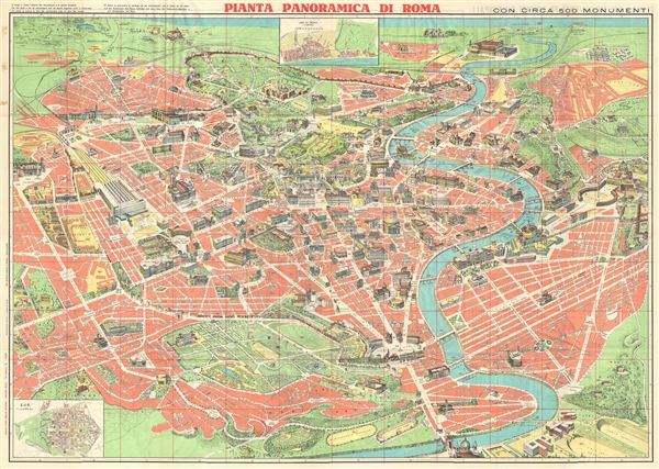

Copyright © 2024 Geographicus Rare Antique Maps | Geographicus Rare Antique Maps
This copy is copyright protected.
Copyright © 2024 Geographicus Rare Antique Maps