This copy is copyright protected.
Copyright © 2024 Geographicus Rare Antique Maps
1903 Pabodie Map or Plan of the City of Providence, Rhode Island
Providence-pabodie-1903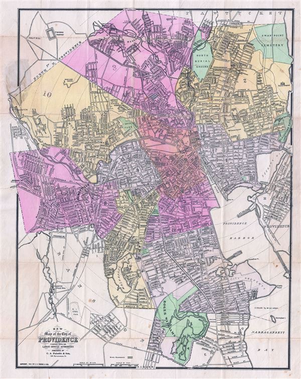

Copyright © 2024 Geographicus Rare Antique Maps | Geographicus Rare Antique Maps
This copy is copyright protected.
Copyright © 2024 Geographicus Rare Antique Maps