This item has been sold, but you can get on the Waitlist to be notified if another example becomes available, or purchase a digital scan.

1932 Candrain Map of San Francisco, California

SanFrancisco-candrian-1932
$125.00
Map of the City & County of San Francisco. - Main View
Processing...

1932 Candrain Map of San Francisco, California

SanFrancisco-candrian-1932

Art deco plan of San Francisco.

Title


Map of the City & County of San Francisco.
  1932 (dated)     22.5 x 26.6 in (57.15 x 67.564 cm)

Description


An appealing 1932 art deco style pocket map of San Francisco, California, by H. A. Candrian. Issued just prior to World War II this map covers the city from Presidio Park as far south as McLaren Park and the Laguna de la Merced. The map names all major and minor streets as well as trolley lines, lakes, golf courses, piers, municipal buildings, colleges, and military installations. Parks and public areas are highlighted in green. Surrounded by an art deco segmented border. Title and legend in the upper right quadrant.

Cartographer


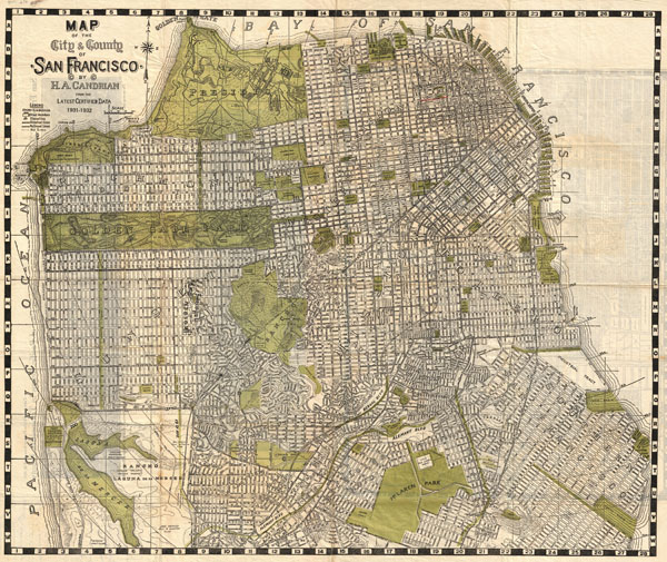
Hermon Anton Candrian (March 28, 1852 - November 28, 1928), commonly publishing as H. A. Candrian, was a Swiss-American map publisher active in San Francisco in the first half of the 20th Century. Candrain was born in Bonaduz, Graubünden, Switzerland. It is unclear when he emigrated to the Untied States, but he working as an insurance agent in Seattle around 1900 and by 1905 had relocated to San Francisco. Candrian’s works focus heavily and tourist and railway guides to the city of San Francisco and the general Bay Area. More by this mapmaker...

Condition


Very good condition. Printed on very thin paper with minor archival repair on verso. Some wear on original fold lines. Additional regional maps and photos on verso. Some manuscript annotations on verso.