This copy is copyright protected.
Copyright © 2024 Geographicus Rare Antique Maps
1929 Fred Wild Street Map or Plan of Chicago, Illinois
StreetMapChicago-wild-1929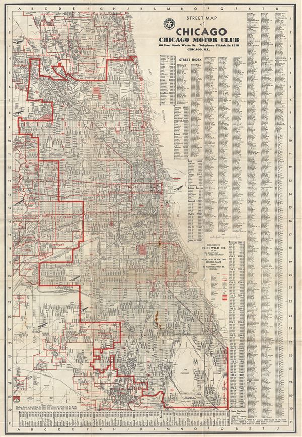

Copyright © 2024 Geographicus Rare Antique Maps | Geographicus Rare Antique Maps
This copy is copyright protected.
Copyright © 2024 Geographicus Rare Antique Maps