This copy is copyright protected.
Copyright © 2024 Geographicus Rare Antique Maps
1940 Foster and Reynolds Map or Plan of Washington D.C.
Washington-reynolds-1940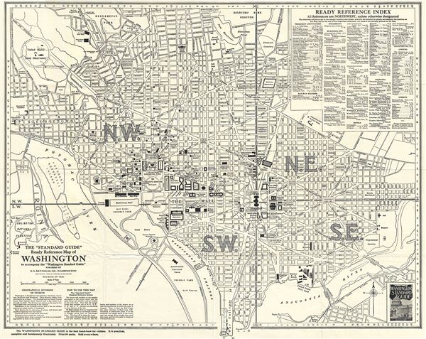

Copyright © 2024 Geographicus Rare Antique Maps | Geographicus Rare Antique Maps
This copy is copyright protected.
Copyright © 2024 Geographicus Rare Antique Maps