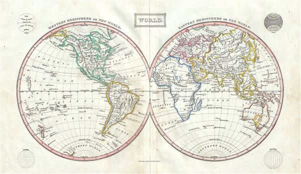
This is a fine example of Thomas Ewing's 1845 map of the World in two hemispheres. Both the Western and Eastern Hemispheres are drawn and offer a fascinating snapshot of the world during a period of rapid globalization and discovery. Africa and Australia are largely unmapped in the interiors with coastlines accurately rendered. The map is color coded according to continents with counties named but their boundaries not defined. Various important cities, rivers, islands, mountain ranges, and several other topographical details are noted with relief shown by hachure. Four diagrams are including on each corner of the map. This map was published in 1845 by Oliver and Boyd as part of Ewing's New General Atlas.
Source
Oliver and Boyd, Ewing's New General Atlas: containing Distinct Maps of all the Principal States and Kingdoms throughout the World, (Edinburgh) 1845.
Very good. Minor wear along original centerfold. Some foxing at places.