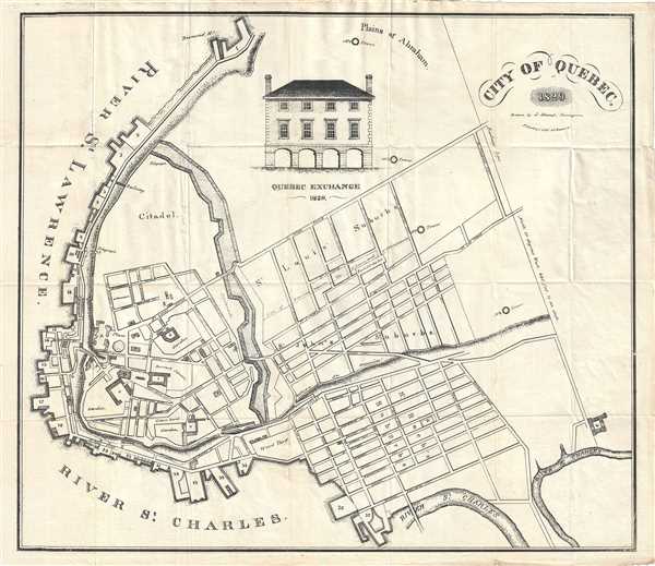
This is a beautiful and extremely rare 1829 map of the city of Quebec, Canada by J. Hamel. Oriented with north at the bottom, the map covers fortified center of Quebec City at the conjunction of the St. Laurence River and the St. Charles estuary. Shows Old Quebec including the citadel and extends west as far as De Salaperry Street (modern day Avenue de Salaberry). Beautifully detailed, the map notes individual streets, railways fortifications, towers, yards, gardens, and other important landmarks of the time. An illustration of the Quebec Exchange in 1829 is included near the top center.
The map was included in the 1830 revised and corrected second edition of P. and W. Ruthven’s The Picture of Quebec and its Vicinity. References to the locations marked on the map are included in the book. The book also includes pictures and important and useful information relating to Quebec. The map was drawn by Joseph Hamel, Surveyor and printed by Prosper Desobry.
Source
Bourne, G., The Picture of Quebec and its Vicinity, (Quebec: P. and W. Ruthven) 1831..
Very good. Minor wear along original fold lines. Minor foxing.
OCLC: 44143271.