This item has been sold, but you can get on the Waitlist to be notified if another example becomes available, or purchase a digital scan.

1846 Lowenberg Whimsical Map of Denmark

Denmark-lowenberg-1846
$75.00
Danemark. - Main View
Processing...

1846 Lowenberg Whimsical Map of Denmark

Denmark-lowenberg-1846


Title


Danemark.
  1846 (undated)     5.5 x 6.5 in (13.97 x 16.51 cm)

Description


A delightfully whimsical 1846 map of Denmark, from a German kinderatlas or children's atlas. The map details all of Denmark with its various duchies divided with color coding. The whole is surrounded by a wide border featuring charming vignettes meant to illustrate the peoples and cultures of the region. The upper left corner features a sub-sketch of Iceland. Other illustrations include a ship at sea, a man standing near a lighthouse, an artesian spring, etc. The map is accompanied by its adjacent page, which includes a poetic history of the Kingdom of Denmark in German gothic type. The wonderful and rare map was drawn by Anst. V A. Boeden of Berlin for inclusion as plate no. X in the 1846 issue of Julius Loewenberg's Geographische Landerfibel.

Cartographer


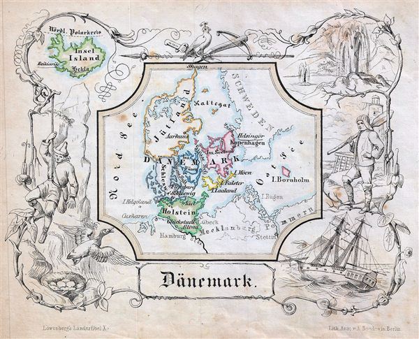
Julius Loewenberg (1800 - December 12, 1893) was a German Jewish printer, geographer, and author active in Berlin during the middle part of the 19th century. Loewenberg was born in the Duchy of Posen. He attended Yeshiva in Kleczewo (Poland) and graduated to the Protestant Gymnasium of Thorn before moving on to study Christian theology and geography at the Universtiy of Berlin. His works include various atlases, histories, and several translations of the works of Alexander von Humboldt, with whom he was apparently close. Loewenberg died in a Jewish retirement home in Berlin. More by this mapmaker...

Source


Lowenberg, J., Geographische Landerfibel, (Berlin: Stern & C.) 1846.    

Condition


Very good. Even overall toning. Blank on verso.