This copy is copyright protected.
Copyright © 2024 Geographicus Rare Antique Maps
1930 Pictorial Map of North America and South America
AmericanContinent-standardoil-1930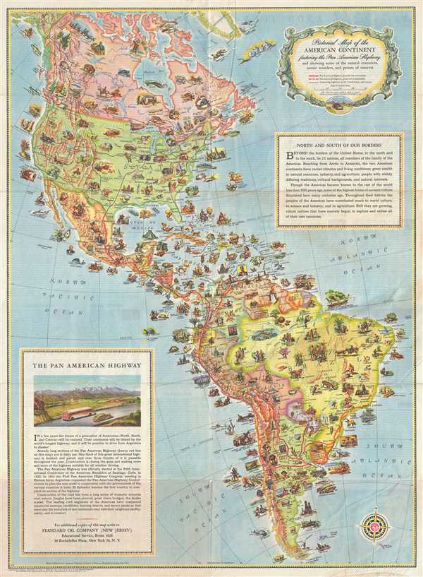

Copyright © 2024 Geographicus Rare Antique Maps | Geographicus Rare Antique Maps
This copy is copyright protected.
Copyright © 2024 Geographicus Rare Antique Maps