This item has been sold, but you can get on the Waitlist to be notified if another example becomes available, or purchase a digital scan.

1851 Whitbread Folding Map of London, England

London-whitbread-1851
$375.00
Whitbread's New Plan of London. - Main View
Processing...

1851 Whitbread Folding Map of London, England

London-whitbread-1851

Anticipating the Great Exposition.

Title


Whitbread's New Plan of London.
  1851 (dated)     17.5 x 25.5 in (44.45 x 64.77 cm)     1 : 21100

Description


This is the 1851 first edition, second state of Josiah Whitbread's New Plan of London. The map is dated February 26, 1851, a little over two months before the May 1st opening of London's 'Great Exhibition of the Works of Industry of All Nations,' or simply the Great Exhibition. The Great Exhibition was the first of many World's Fairs, which became important venues for trade and nationalistic advancement. The exhibition space, known as the 'Crystal Palace', is depicted in Hyde Park. The Exhibition was planned by Prince Albert, Queen Victoria's husband, and became a spectacular financial success. The surplus funds were used to found the Victoria and Albert Museum, the Science Museum, and the Natural History Museum, all of which are located in South Kensington near Hyde Park.
Physical Description
Central London is depicted in detail from Notting Hill to Bow Common and from Islington to Peckham and Camberwell. Many iconic locations in London are identified, including Trafalgar Square, Buckingham Palace, the British Museum, Hyde Park, and the Tower of London. The Houses of Parliament and Westminster Abbey are also labeled. The River Thames dramatically cuts its way through central London and is traversed by several bridges, including Westminster Bridge, Waterloo Bridge, and London Bridge.
Publication History
This map was published by Josiah Whitbread in 1851 in London. Map comes with original cardboard binder and 'Index of Whitbread's New Plan of London'.

Cartographer


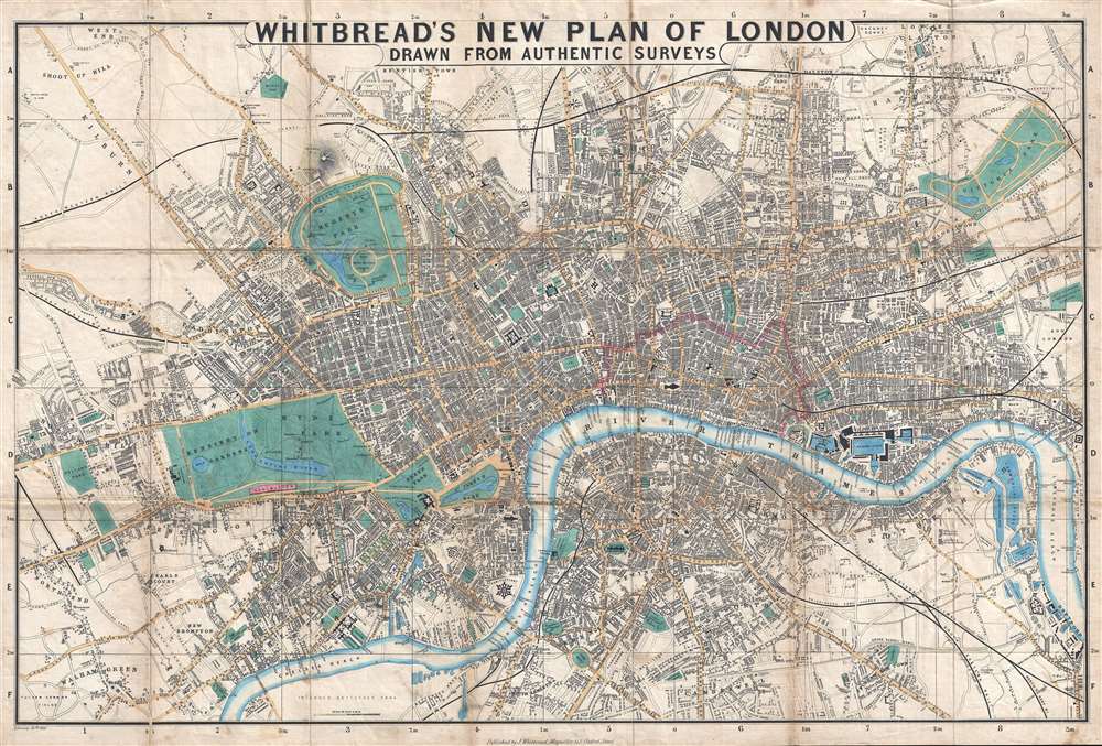
Josiah Whitbread (fl. c. 1864 – 1879) was a London based map publisher active in the middle to later parts of the 19th century. Whitbread was based at 142 Oxford Street London. He published several large format maps and street guides, mostly focusing on London. When he retired his map plates were sold to Philip and Son who republished them under their own imprint. Little else is known of Whitbread's life or publishing history. More by this mapmaker...

Source


Whitbread, J., Whitbread's New Hand-Map of London for 1851, with an Index of Reference to 2,800 Streets, Squares, etc. A list of 350 Churches and Chapels, and a Plan for Viewing London in Seven Days. (London) 1851.    

Condition


Good. Backed on linen. Light soiling. Comes with original cardboard binder. Even overall toning.

References


Hyde, Ralph, Printed Maps of Victorian London, 1851 - 1900, p. 70, no. 24.