This copy is copyright protected.
Copyright © 2024 Geographicus Rare Antique Maps
1872 Sampson and Davenport Map or Plan of Boston, Massachusetts
MapOfBoston-sampson-1872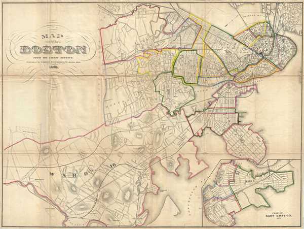

George Sampson (fl. c. 1858 - c. 1930) was a Boston based publisher and printer active in the second half of the 19th century. Sampson initially partnered with George Adams, acquiring a half-share in the Boston Directory or Boston Almanac, and subsequently publishing as Adams, Sampson, and Company. Adams shares were eventually acquired by O.H. Davenport in 1865, when the company named changed to Sampson and Davenport. Working with Davenport, Sampson, expanded the scope of the Boston Directory to incorporate other towns and regions, producing the Massachusetts Register, the New York State Business Directory, the New England Gazetteer, the Roxbury Directory, and the Providence Almanac, among others, as well as various individual maps and guides. Davenport's shares were acquired by A. Murdoch in 1884. As Sampson and Murdoch, the firm expanded again, producing a catalog of over 120 city directories by 1925. The business passed into the hands for R. L. Polk and Company around 1930 and continued to publish directories until about 1980. More by this mapmaker...
Copyright © 2024 Geographicus Rare Antique Maps | Geographicus Rare Antique Maps
This copy is copyright protected.
Copyright © 2024 Geographicus Rare Antique Maps