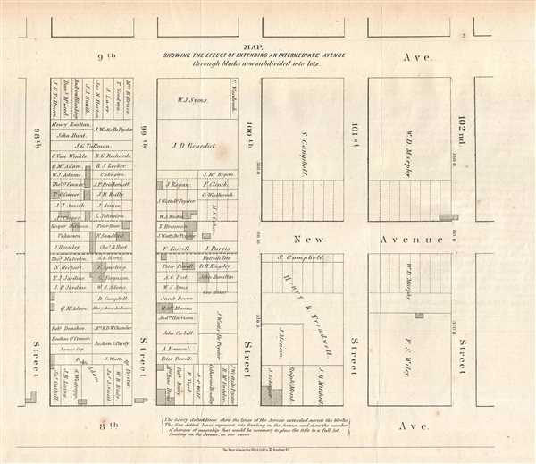
This is an 1868 Major and Knapp map of the Upper West Side in New York City. The map depicts the Upper West Side between 8th and 9th Avenue and 98th Street and 102nd Street. By providing a visualization of a plan proposed by the Board of Commissioners of Central Park, a sketch of life on the Upper West Side is created. The city blocks are divided by owners and the proposed new avenue is depicted by the heavy dotted lines. By extending the avenue, new lots fronting on the avenue would be created, represented by the fine dotted lines. To create these new lots fronting on the avenue, many different owners would have to be displaced. Thus, to extend the avenue, not only would people be displaced by the construction of the avenue, but also by the creation of new lots fronting on the avenue.
This map was created by The Major and Knapp Engineering, Manufacturing, and Lithography Company of New York City for publication in the Eleventh Annual Report of the Board of Commissioners of the Central Park, for the Year Ending with December 31, 1867.
Source
Eleventh Annual Report of the Board of Commissioners of the Central Park, for the Year Ending with December 31, 1867. (New York: WM. C. Bryant and Co., Printers.)
Very good. Light foxing. Blank on verso.
OCLC 79610179.