This copy is copyright protected.
Copyright © 2024 Geographicus Rare Antique Maps
1945 U.S. Army Map of the Philippine Campaign
PhilippineCampaign3-usarmy-1945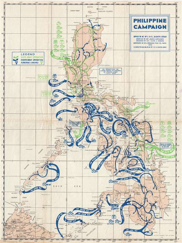

Copyright © 2024 Geographicus Rare Antique Maps | Geographicus Rare Antique Maps
This copy is copyright protected.
Copyright © 2024 Geographicus Rare Antique Maps