This copy is copyright protected.
Copyright © 2024 Geographicus Rare Antique Maps
1910 Atlas of the Sino-Japanese War (25 rare folding maps)
SinoJapanese-japan-1910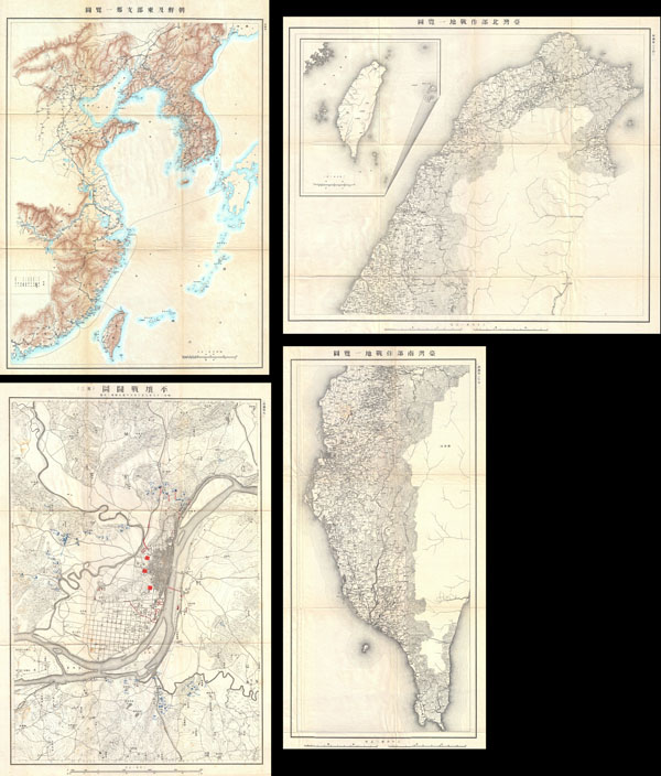

1. KOREA & EAST ASIAMaps vary in size but most are quite large and all fold into their original gray linen binder. All text in Japanese.
2. SOUTH BOUND EXPEDITION FORCE (KOREA)
3. BATTLE FILED NEAR CHEN HUANG (KOREA)
4. BATTLE FIELDS IN KOREA, MANCHURIA AND SHANDONG
5 - 9. BATTLE FILED IN PYONGYANG (DIFFERENT TIME & DATE)
10. MANCHURIA SOUTH
11. PYONGYANG
12. BATTLEFIELD IN HU SHAN (KOREA, NORTH)
13. BATTLEFIELD IN PHOENIX CITY (MANCHURIA)
14. SOUTH TIP OF MANCHURIA (POR ARTHUR)
15. BATTLEFIELD OF PORT ARTHUR
16. LIAO RIVER PLAIN (MANCHURIA)
17. BATTLEFIELD OF GAI PING (MANCHURIA)
18 - 19 BATTLEFIELD OF HAI CHEN (MANCHURIA)
20. BATTLEFIELD OF MT. TAI PING (MANCHURIA)
21. BATTLEFIELD OF TIEN TA CHUANG (MANCHURIA)
22. SHANDONG PENINSULA
23. WEIHAWEI NAVY HARBOR (SHANDONG)
24. TAIWAN NORTH
25. TAIWAN SOUTH
Japanese cartography appears as early as the 1600s. Japanese maps are known for their exceptional beauty and high quality of workmanship. Early Japanese cartography has its own very distinctive projection and layout system. Japanese maps made prior to the appearance of Commodore Perry and the opening of Japan in the mid to late 1850s often have no firm directional orientation, incorporate views into the map proper, and tend to be hand colored woodblock prints. This era, from the 1600s to the c. 1855, which roughly coincides with the Tokugawa or Edo Period (1603-1886), some consider the Golden Age of Japanese Cartography. Most maps from this period, which followed isolationist ideology, predictably focus on Japan. The greatest cartographer of the period, whose work redefined all subsequent cartography, was Ino Tadataka (1745 -1818). Ino's maps of Japan were so detailed that, when the European cartographers arrived they had no need, even with their far more sophisticated survey equipment, to remap the region. Later Japanese maps, produced in the late Edo and throughout the Meiji period, draw heavily upon western maps as models in both their content and overall cartographic style. While many of these later maps maintain elements of traditional Japanese cartography such as the use of rice paper, woodblock printing, and delicate hand color, they also incorporate western directional orientation, projection systems, and structural norms. Even so, Japan's isolationist policy kept most western maps from reaching Japan so even 19th century maps appear extremely out of date. The early Japanese maps copy the great 1602 Chinese world map of the friar Matto Ricci. After Shiba Kokan's 1792 map, most Japanese cartographers used Covens and Mortier's 1730 copy of Jaillot's 1689 double hemisphere work as their base world-view. In 1862 Seiyo Sato based a new world map on Dutch sources dating to 1857, thus introducing the Mercator projection to Japan. By the late Meiji Era, western maps became far more common in Asia and Japanese maps began to follow modern conventions. More by this mapmaker...
Copyright © 2024 Geographicus Rare Antique Maps | Geographicus Rare Antique Maps
This copy is copyright protected.
Copyright © 2024 Geographicus Rare Antique Maps