This item has been sold, but you can get on the Waitlist to be notified if another example becomes available, or purchase a digital scan.

1849 Mitchell Map of Texas (at fullest extent)

Texas2-mitchell-1849
$550.00
Map of Texas from the most recent authorities. - Main View
Processing...

1849 Mitchell Map of Texas (at fullest extent)

Texas2-mitchell-1849

Map of Texas at its fullest extand issued just before the Comprimise of 1850.

Title


Map of Texas from the most recent authorities.
  1849 (dated 1845)     12.5 x 15.5 in (31.75 x 39.37 cm)     1 : 3300000

Description


A fine example of the scarce 1849 Samuel Augustus Mitchell Map of Texas. Based upon the Tanner/Williams map of 1847, this map covers all of Texas according to the original 1836 claims of the Republic of Texas. This includes a vast territory extending from the western Rio Grande to the Sabine River and from the Arkansas River to the mouth of the Rio Grande as it enters the Gulf of Mexico. This included much of modern day New Mexico as far west as Santa Fe. Here the map is clearly divided between Bexar County, in yellow, and the more populated parts of Teas to the east. The county structure there is sophisticated and reflects numerous updates and revisions over the original 1847 Tanner plate.

One year after this map was drawn, the Compromise of 1850, in which much of Texas's western territory would be sacrificed to the federal government in exchange for that entity paying of the state's war debt, dramatically and permanently changed Texas's cartographic profile.

This map was issued in the 1849 edition of S. A. Mitchell's New Universal Atlas. It retains the original 1845 C. S. Williams copyright. This was the last edition of that atlas to be published by Mitchell prior to selling the plates and rights to the atlas to Thomas Cowperthwait late in 1850.

CartographerS


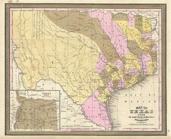
Samuel Augustus Mitchell (March 20, 1792 - December 20, 1868) began his map publishing career in the early 1830s. Mitchell was born in Bristol, Connecticut. He relocated to Philadelphia in 1821. Having worked as a school teacher and a geographical writer, Mitchell was frustrated with the low quality and inaccuracy of school texts of the period. His first maps were an attempt to rectify this problem. In the next 20 years Mitchell would become the most prominent American map publisher of the mid-19th century. Mitchell worked with prominent engravers J. H. Young, H. S. Tanner, and H. N. Burroughs before attaining the full copyright on his maps in 1847. In 1849 Mitchell either partnered with or sold his plates to Thomas, Cowperthwait and Company who continued to publish the Mitchell's Universal Atlas. By about 1856 most of the Mitchell plates and copyrights were acquired by Charles Desilver who continued to publish the maps, many with modified borders and color schemes, until Mitchell's son, Samuel Augustus Mitchell Junior, entered the picture. In 1859, S.A. Mitchell Jr. purchased most of the plates back from Desilver and introduced his own floral motif border. From 1860 on, he published his own editions of the New General Atlas. The younger Mitchell became as prominent as his father, publishing maps and atlases until 1887, when most of the copyrights were again sold and the Mitchell firm closed its doors for the final time. More by this mapmaker...


C. S. Williams (1800 - 18??) was an American engraver and publisher active in Philadelphia during the middle part of the 19th century. Williams is elusive and we have been unable to definitively isolate much information about him. He may have been born in New York. He engraved for Her Schenck Tanner (1796 0 1858) and his imprint and copyright is associated with several important Tanner atlas maps issued between 1845 and 1846. Similarly, his imprint carries over to Tanner legacy maps issued by Samuel Augustus Mitchell (1792 - 1868) maps until about 1850. There are references to an engraver by the name of C. S. Williams in New Haven, Connecticut, active in the 1830s, as well as to a C. S. Williams active in Ohio from around 1850, where he published a various city directories, including one for Cincinnati, Columbia, Dayton, Zanesville, Stubenville, et al.. There is also a C. S. Williams identified as a Surveyor and Land Agent in Iowa City, Iowa, c. 1858. It is unclear if these are the same person, or, completely unrelated individuals. Learn More...

Source


Mitchell, S. A., A New Universal Atlas, (S. A. Mitchell; Philadelphia) 1849.     The New Universal Atlas is one of the great American atlases of the mid-19th century. Samuel Augustus Mitchell first issued the atlas in 1846 when he acquired the map plates and copyright for Tanner's New Universal Atlas from its publisher, Carey and Hart. The first transitional 1846 edition was published jointly with Carey and Hart, but a second edition was published in the same year with the Tanner imprint erased. This edition of the atlas also introduced the signature S. A. Mitchell green and pink color scheme. Most of the maps from the early editions of the atlas were engraved by H. N. Burroughs or C. S. Williams, often bearing their copyright. Burroughs maps also tended to have what map collector David Rumsey refers to as the 'Cary and Hart' borders, which featured a narrow vine motif. These borders were replaced, along with the Burroughs imprint, with the more traditional Mitchell strap work border used in the atlases until 1856. Mitchell published editions until late in 1850, when he sold the rights to Thomas, Cowperthwait and Company of Philadelphia. Under Cowperthwait, the atlases continued to be published and bear the Mitchell name until 1856, when it the plates were again sold, this time to Charles Desilver. Desilver reworked the plates with new border art and a revised color scheme in the style of J. H. Colton. Desilver issued editions from 1857 to 1860, when the atlas was phased out in favor of Samuel Augustus Mitchell Jr.'s New General Atlas.

Condition


Very good condition. Blank on verso. Minor discoloration upper left margin. Otherwise, bright and clean.

References


Rumsey 0545.039, 4835.045.