This copy is copyright protected.
Copyright © 2024 Geographicus Rare Antique Maps

Details
1937 Foster and Reynolds Map or Plan of Washington D.C.
1937 (dated) $500.00
1917 Foster and Reynolds Map or Plan of Washington D.C.
WashingtonDC-fosterreynolds-1917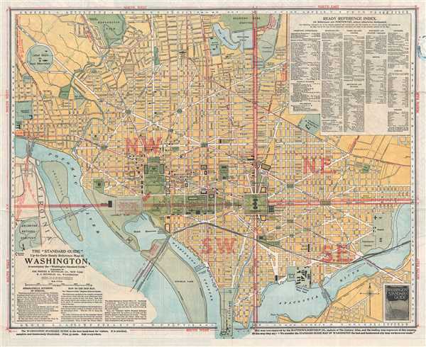

Copyright © 2024 Geographicus Rare Antique Maps | Geographicus Rare Antique Maps
This copy is copyright protected.
Copyright © 2024 Geographicus Rare Antique Maps