This copy is copyright protected.
Copyright © 2024 Geographicus Rare Antique Maps
1846 Hutchings Map of the Collect Pond, New York and Steam Boat (Five Points)
CollectPond2-hutchings-1846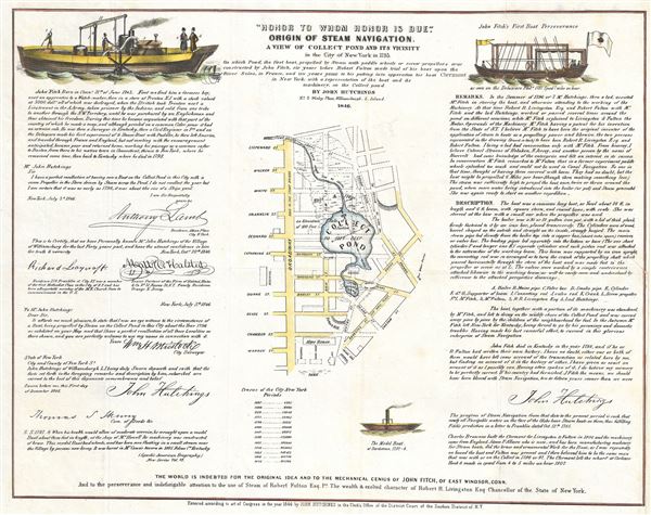

Copyright © 2024 Geographicus Rare Antique Maps | Geographicus Rare Antique Maps
This copy is copyright protected.
Copyright © 2024 Geographicus Rare Antique Maps