This copy is copyright protected.
Copyright © 2024 Geographicus Rare Antique Maps
1910 Japanese Map of Dalian, China
Dalian-japanese-1910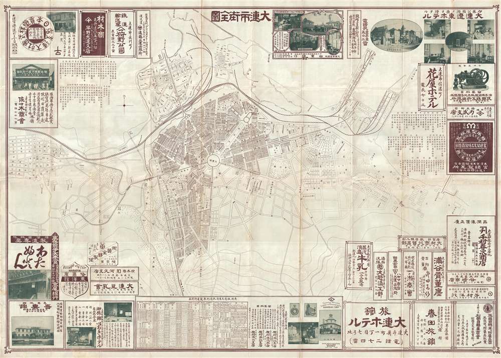


Copyright © 2024 Geographicus Rare Antique Maps | Geographicus Rare Antique Maps
This copy is copyright protected.
Copyright © 2024 Geographicus Rare Antique Maps