This copy is copyright protected.
Copyright © 2024 Geographicus Rare Antique Maps
1876 Walker Map of Southwestern Englewood, New Jersey
EnglewoodSW-walker-1876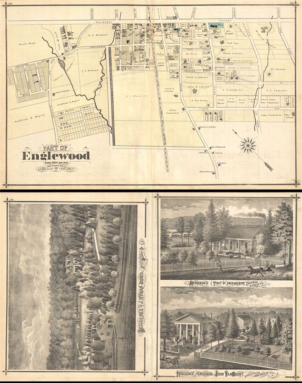

Copyright © 2024 Geographicus Rare Antique Maps | Geographicus Rare Antique Maps
This copy is copyright protected.
Copyright © 2024 Geographicus Rare Antique Maps