This copy is copyright protected.
Copyright © 2024 Geographicus Rare Antique Maps
Details
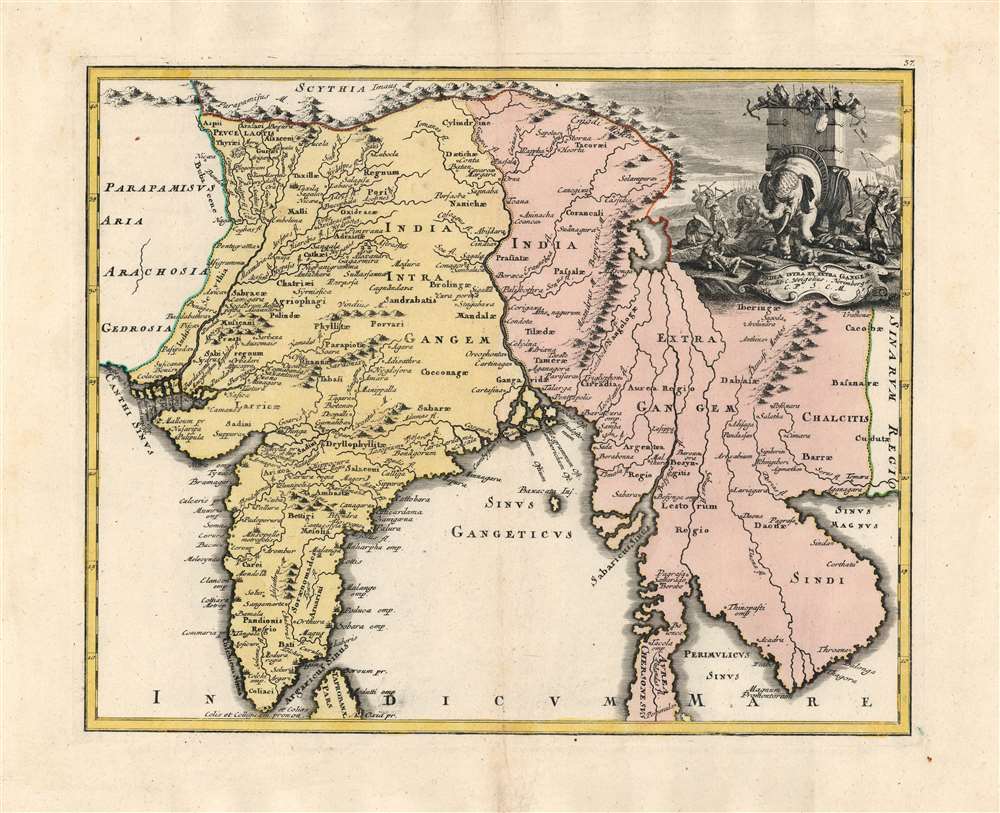
1720 Weigel Map of India and Southeast Asia
1720 (undated) $950.00
1720 Weigel Map of India and Southeast Asia
IndiaIntraExtraGangem-weigel-1720

Christoph Weigel (November 9, 1654 - February 5, 1725) was a German goldsmith, printer, and engraver based in Nuremburg. Weigel apprenticed in engraving in the publishing center of Augsburg after which he held various positions in Vienna and Frankfurt. Eventually Weigel worked his way to 18th century printing Mecca of Nuremburg where, in 1698, he became a citizen of the city and established his own firm. Weigel is known to have worked closely with the most prominent of the Nuremburg map publishers J. B. Homann as well as with with his brother Johann Christoph Weigel (1654 - 1726) and the printer, Kohler. Following Weigel's passing in 1725, control of the firm passed to his widow, who published a number of Weigel's maps and atlases posthumously. The widow Weigel eventually ceded control of the firm to her son, Johann Christoph Weigel the younger (?? - 1746) who partnered with Schneider to publish as Schneider-Weigel. The Schneider-Weigel firm continued to publish until the early 19th century. More by this mapmaker...
Copyright © 2024 Geographicus Rare Antique Maps | Geographicus Rare Antique Maps
This copy is copyright protected.
Copyright © 2024 Geographicus Rare Antique Maps