This copy is copyright protected.
Copyright © 2024 Geographicus Rare Antique Maps
1932 Luther S. Phillips Pictorial Map of Mount Desert Island
MountDesertIsland-phillips-1932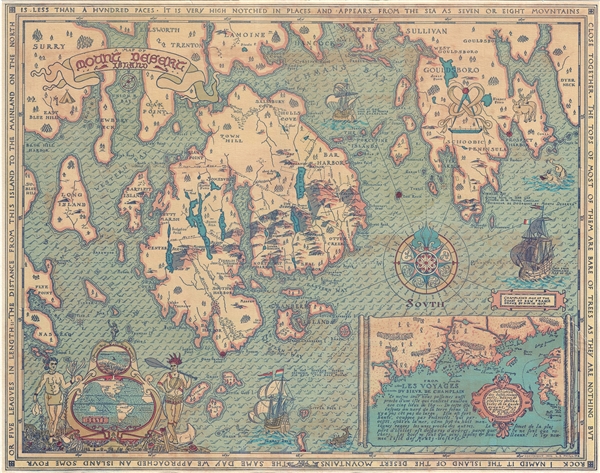

Luther Savage Phillips (May 10, 1891 - 1960) was an American map maker, photographer, architect, and postcard publisher, and is arguably Maine's most significant pictorial cartographer. Born on Mount Desert Island (Acadia National Park), Maine, Phillips studied at Phillips Andover Academy before spending two years at Yale. He graduated with a Bachelor of Science degree from MIT in 1914. In October 1917 Phillips enlisted in the U.S. Navy as a Coxswain and was commissioned as an Ensign in 1918, when he was sent to the U.S. Naval Academy at Annapolis, Maryland. He was later assigned to the U.S.S. Rhode Island and sailed with the ship on a mission to Archangel on April 11, 1919. After his time in the Navy, Phillips established a successful postcard publishing business and became a well-known pictorial mapmaker. Much of his work focused on the Maine coast in the vicinity of Bar Harbor. Based in Northeast Harbor, Mount Desert Island, Maine, his company, 'Map of Maine' produced local pictorial maps for the tourist market. He would tour the state promoting and selling his work, along with his scenic postcards. After Phillips died in 1960, in Togus, Maine, his brother, Augustus Dewey Phillips (1898 - 1975) took over the map and postcard business, which was then continued by his nephew Donald Phillips (1935 - 2009). Philipps married Olympia Meimari on March 24, 1921 in Annapolis. It is unclear whether Olympia died or the couple divorced, but it is known that Phillips remarried, to Mary J. Merrill in 1935. More by this mapmaker...
Copyright © 2024 Geographicus Rare Antique Maps | Geographicus Rare Antique Maps
This copy is copyright protected.
Copyright © 2024 Geographicus Rare Antique Maps