This copy is copyright protected.
Copyright © 2024 Geographicus Rare Antique Maps
1943 Manuscript Map of the United States from the Perspective of Texas
UnitedStatesTexas-anon-1943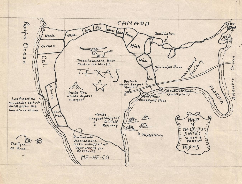

Copyright © 2024 Geographicus Rare Antique Maps | Geographicus Rare Antique Maps
This copy is copyright protected.
Copyright © 2024 Geographicus Rare Antique Maps