1797 Cassini Map of Middle Atlantic and Midwestern States

Virginia-cassini-1797
$1,000.00
Gli Stati uniti dell' America delineati sulle ultime Osservazioni.  Terzo foglio che comprende parte della Virginia. - Main View
Processing...

1797 Cassini Map of Middle Atlantic and Midwestern States

Virginia-cassini-1797

Detailed mapping of American Indian lands between the Mississippi River and the Appalachian Mountains following the American Revolutionary War.
$1,000.00

Title


Gli Stati uniti dell' America delineati sulle ultime Osservazioni. Terzo foglio che comprende parte della Virginia.
  1797 (dated)     15 x 20 in (38.1 x 50.8 cm)     1 : 3400000

Description


A very nice example of Cassini's stunning 1797 map of the eastern Mississippi watershed. The map covers from Lake Michigan to the modern day southern Tennessee border and from central Illinois to the Monongahela River. The focus of the map are the western claims, as far as the Mississippi River, of Virginia, North Carolina, and South Carolina. It provides a detailed accounting of American Indian territories as well as European forts. The Fiume e Porto Chicagou near present-day Chicago is identified. It also identifies trade routes from the coastal states inland to American Indian villages, forts, and trading posts.

Cartographically Cassini derived this map from the 1778 Zatta 12 sheet revision and expansions of the John Mitchell's seminal 1755 map of the eastern part of North America. Cassini published six maps of United States regions based upon Zatta's work, of which this is map no. 3. This work was published in Cassini's 1797 Nuovo Atlante Geografico Universale. Today all maps from this series are highly sought after for their exceptional beauty and fine engraving.

Cartographer


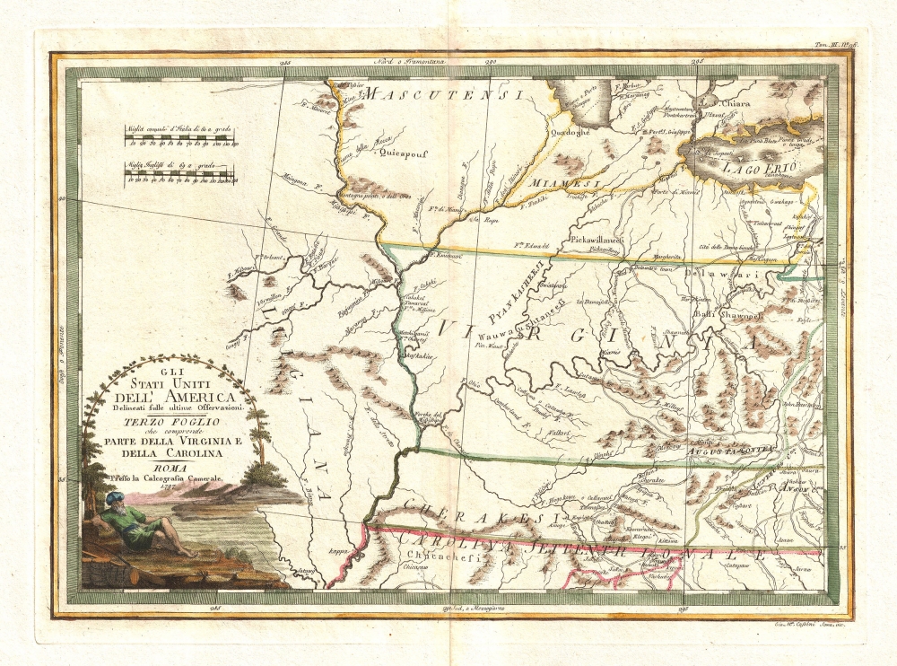
Giovanni Maria Cassini (1745 - 1824) was a Rome based Italian mathematician, globe maker, geographer, engraver, and cartographer active in the later part of the 18th and early 19th century. He was a disciple of Giovanni Battista Piranesi. He invented new form of projection used for an atlas of the kingdom of Naples issued by Giovanni Antonio Rizzi Zannoni. Cassini is best known as a globe maker and is considered the last of the great 18th century globe makers. His maps are distinctive for their fine engraving, dark strong impressions, and elaborate distinctive cartouche work. Unlike many map and atlas publishers of the period, Cassini did all of his own engraving work - this impregnating each map with his unmistakable style. Though he produced a significant corpus of well-regarded work, little is known of Cassini's personal life. G. M. Cassini is often mistakenly associated with the well-known French cartographic family of the same name, however, they are not related. More by this mapmaker...

Source


Cassini, G. M., Nuovo Atlante Geografico Universale, (Roma : Presso la Calcografia Camerale) 1797.    

Condition


Very Good. Minor centerfold wear and toning. Wide margins. Blank on verso. Platemark visible.

References


OCLC 53364287. McCorkle, B. B, New England in Early Printed Maps 1513 - 1800, #797.3. Portinaro, P., and Knirsch, F., The Cartography of North America 1500-1800, #166.