|
|||
New Acquisitions
|
|||
1941 Manuscript Map of Mayfair and Soho (Nightlife during the Blitz)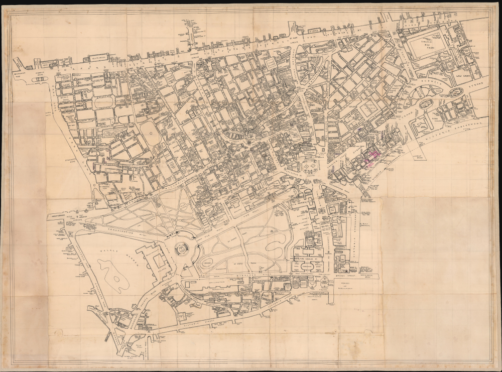
[Mayfair / Soho, London] Unique record of Mayfair WWII nightlife at the height of the Blitz. 40.5 x 54.5 inches An extraordinary artifact of wartime London, this unique 1941 manuscript map captures the theaters, nightclubs, restaurants, hotels, pubs, illicit establishments, and air-raid shelters of Mayfair, Soho, and the West End at the height of the Blitz.
|
|||
1851 / 1885 Parke and Kern Map of New Mexico Territory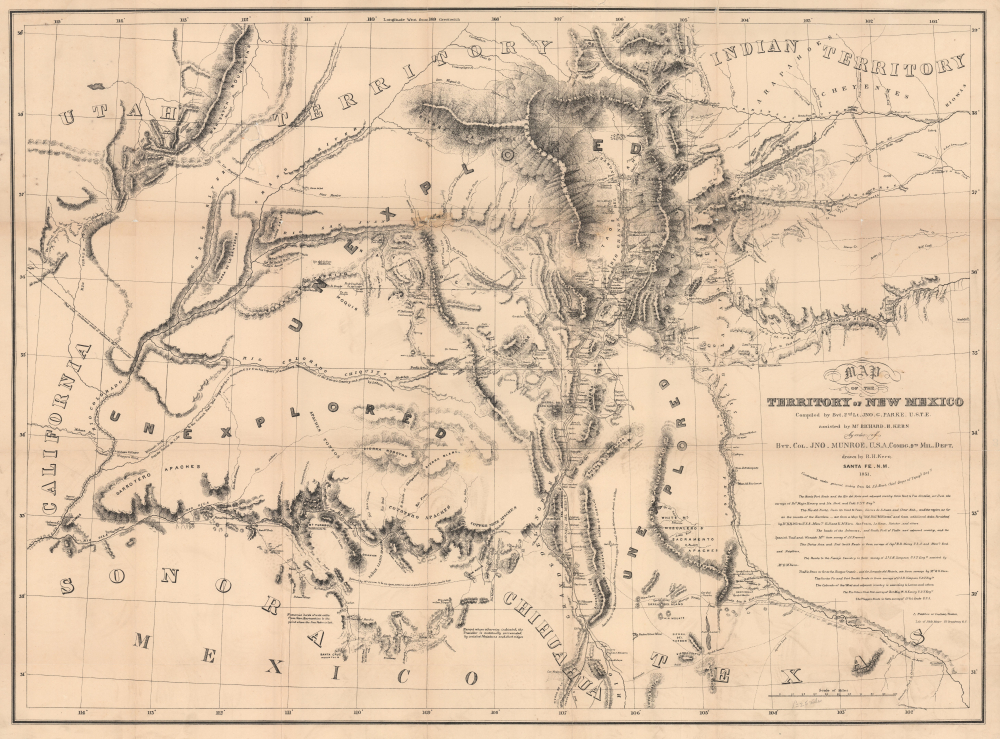
Map of the Territory of New Mexico... Most Important Early Map of the New Mexico Territory. 25 x 34 inches This is the extremely rare, unpublished 1851 map of the Territory of New Mexico produced by John G. Parke and Richard Kern.
|
|||
1982 J. Clark Henley 'Butch' Map of the United States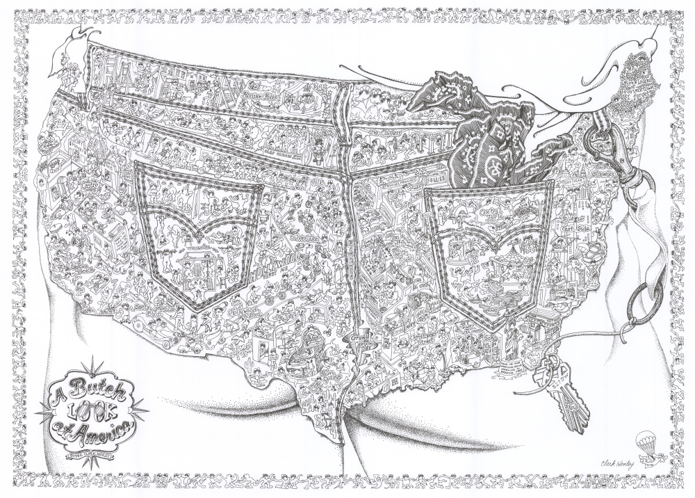
A Butch Look at America. Mapping 'butchness' in America. 18.25 x 25 inches A rare and humorous 1982 J. Clark Henley pictorial map of the United States as a 'butch' alli-GAY-der paradise.
|
|||
1976 Henley Pictorial Map of 'Gay' San Francisco as 'Alligator Oz'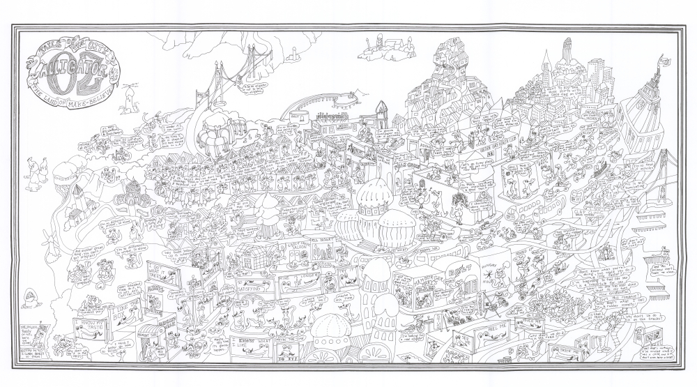
Tales of the City Alligator Oz The land of Make-Believe. San Francisco as Ali'gay'tor heaven! 15.25 x 26.5 inches A rare and exuberantly humorous 1976 pictorial map by J. Clark Henley presenting San Francisco as the gay paradise of 'Alligator Oz.' Best known for satirizing 'butch' culture within the city's gay community, Henley produced only two known maps: this work and his related 1982 map of the United States ( ButchMapUSA-henley-1982 ).
|
|||
1914 Pierre Quiroule Map of the Utopian American Anarchist City w/ Book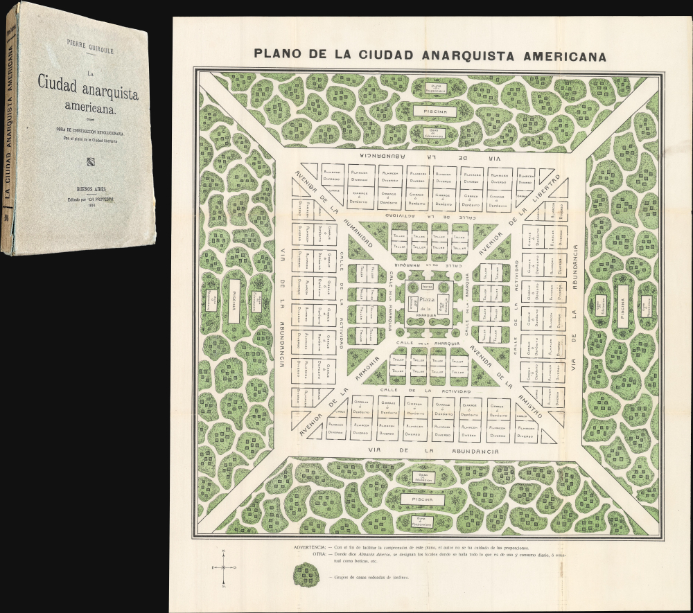
La Ciudad Anarquista Americana. / La Ciudad Anarquista Americana: Obra de Construcción Revolucionaria. Futuristic city of Anarchy, with a death ray. 21 x 18.5 inches This is a rare 1914 color-printed folding plan of French-Argentine Pierre Quiroule's Ciudad Anarquista Americana, a cartographic vision of an ideal anarchist city.
|
|||
1860 Colton / Phelps and Watson Wall Map of the United States, Eve of the Civil War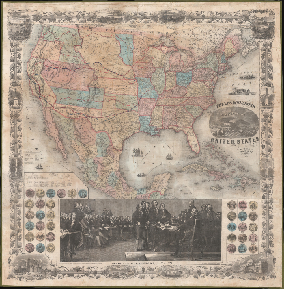
Phelps and Watson's New Map of the United States. Ephemeral Territories in the American West. 37 x 37.5 inches This is a rare 1860 wall map of the United States published by Phelps and Watson. It presents the territorial configuration of U.S. states and territories on the eve of the U.S.
|
|||
1950 Capp Satirical Map of China, Japan, and Korea during Korean War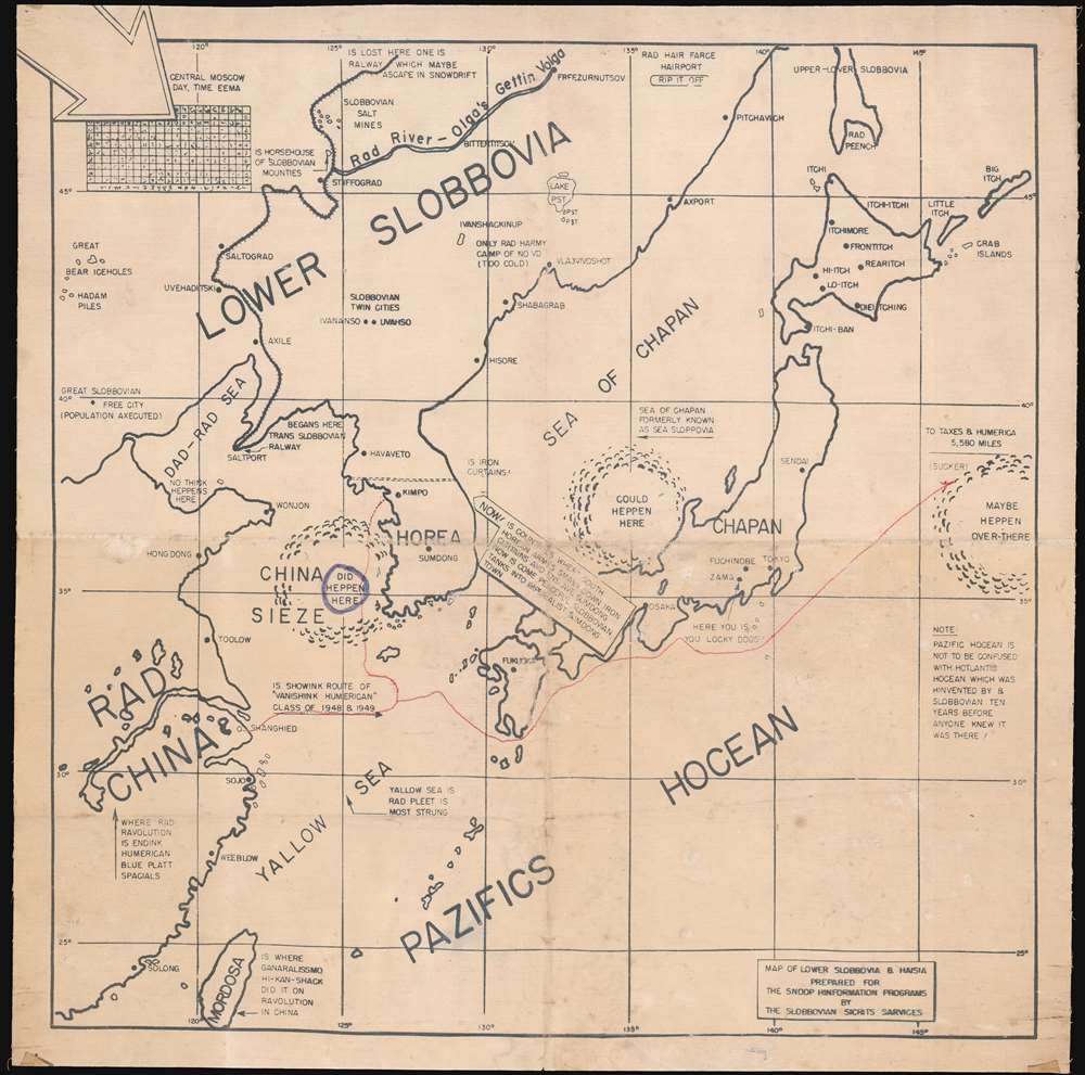
[Lower Slobbovia]. Capp's satirical look at East Asian situation at the outbreak of the Korean War. 17.5 x 17.5 inches The only known example of a c. 1950 Al Capp-inspired map of Korea, China, and Japan, satirizing the Communist Revolution in China and the outbreak of the Korean War. The map illustrates much of East Asia, including all of Japan and Korea, as well as Manchuria, Taiwan, and the eastern parts of communist 'Rad' China.
|
|||
1913 Waterlow Republic of China Bond, Reorganization Gold Loan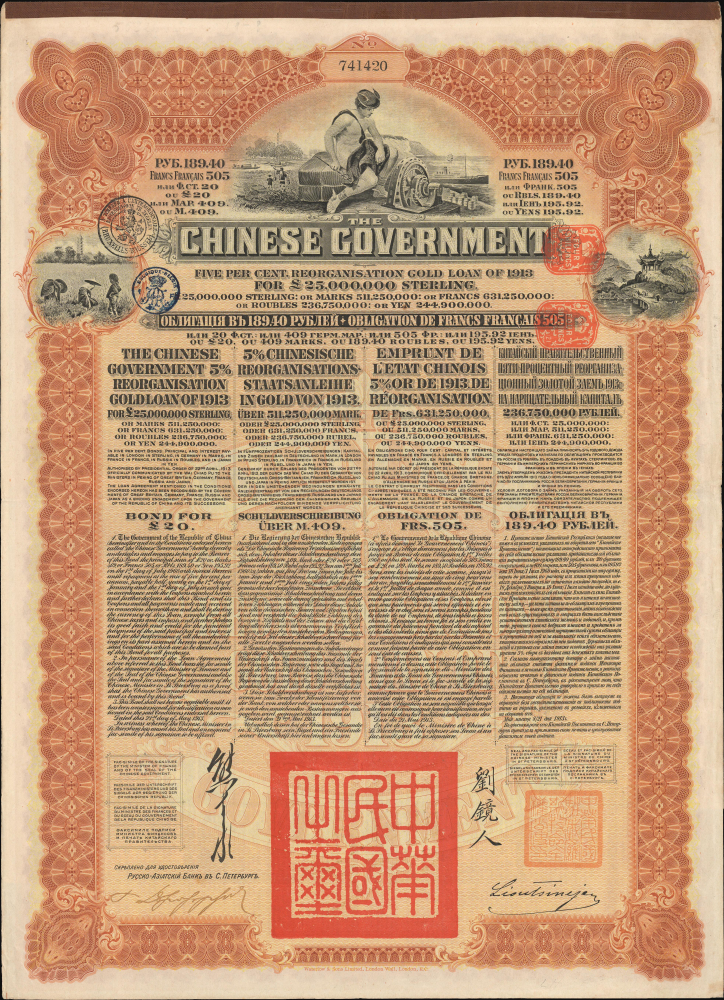
The Chinese Government Five Per Cent. Reorganisation Gold Loan of 1913 for L25,000,000 Sterling. Foreign Funds and Yuan Shikai's Power Grab 16 x 13 inches This is a 1913 government £20 bond printed by Waterlow and Sons and issued by the new Republic of China to finance the Chinese Reorganization Gold Loan of 1913. It is a relic of an oft-forgotten period of the early Chinese republic, defined by dynamism and optimism but saddled with a host of problems which it struggled to overcome.
|
|||
1899 Graham Map of the Ralston Divide, Placer County, California Gold Country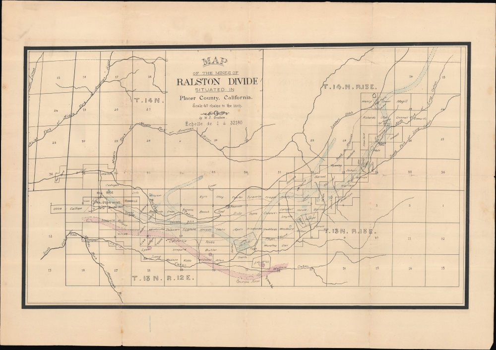
Map of the Mines of Ralston Divide situated in Placer County, California. No More Gold, but Plenty of Other Stuff in Them there Hills. 16 x 26.75 inches An unrecorded 1899 survey and plat map of the Ralston Divide in Placer County, California, prepared by William S. Graham, the County Surveyor.
|
|||
1913 Dinsmore Large Two-Sheet Map of California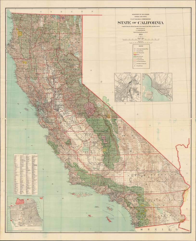
State of California compiled from the official Records of the General Land Office and other sources. Indigenous Americans and the Water Wars. 58.5 x 47.5 inches An epic two-sheet 1913 wall map of California, standing nearly five feet tall, compiled by Andrew Dinsmore of the General Land Office. The map illustrates California's complex interrelations with indigenous peoples and water supply.
|
|||
1942 Robinson Map of the Philippines during World War II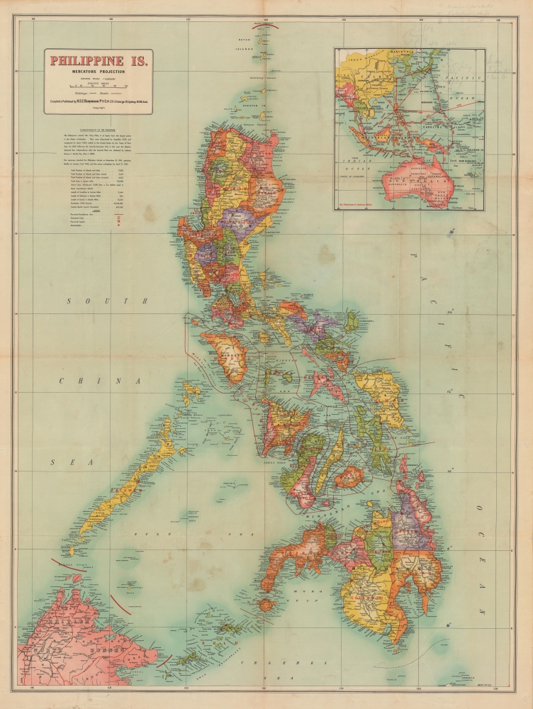
Philippine Is. Philippines under Japanese Occupation. 39.5 x 29.75 inches A colorful, large-format 1942 map of the Philippine Islands by H.E.C. Robinson, published soon after the islands' capture by Japanese forces in the opening phase of the Pacific War during World War II (1939 - 1945).
|
|||
1945 Army Newsmap of Japan and China - Atomic Bomb Issue! (signed by Tibbets)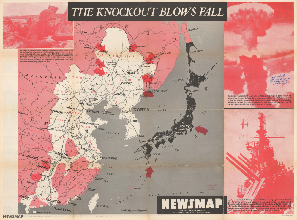
NEWSMAP For the Armed Forces. V-E Day + 15 Weeks - 192nd Week of U.S. Participation in the War. Signed by Paul Tibbets - the Pilot of the Enola Gay, the B-29 that Dropped the Atomic Bomb on Hiroshima. 34.25 x 46.75 inches This is the chilling Atomic Bomb issue from the iconic World War II Newsmap series. It was issued in 1945, days after the bombing of Hiroshima and Nagasaki, and one week before the Japanese announced their surrender to the Allies to end the Pacific War and World War II (1939 - 1945).
|
|||
1894 Rand McNally Map of the Pacific Coast from San Diego to Chilkat, Alaska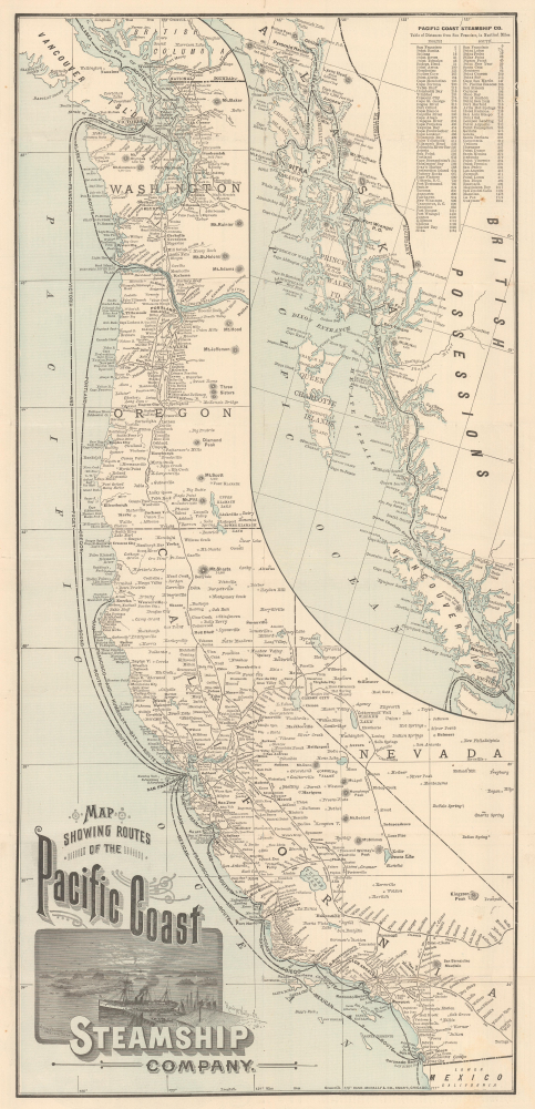
Map Showing Routes of the Pacific Coast Steamship Company. Tourism from Chilkat, Alaska, to San Diego, California. 27 x 12.75 inches This is a scarce 1894 Rand McNally map of the Pacific Coast of North America, produced to promote tourism and travel with the Pacific Coast Steamship Company just a few years before the Klondike Gold Rush (1896 - 1898). The map illustrates the Pacific Coast from the Mexican border to British Columbia and Vancouver Island; an inset details the route north to 'Mousouah Lake' (Mosquito Lake) in Alaska.
|
|||
1930 Zhengwen Bookstore City Map or Plan of Beijing, China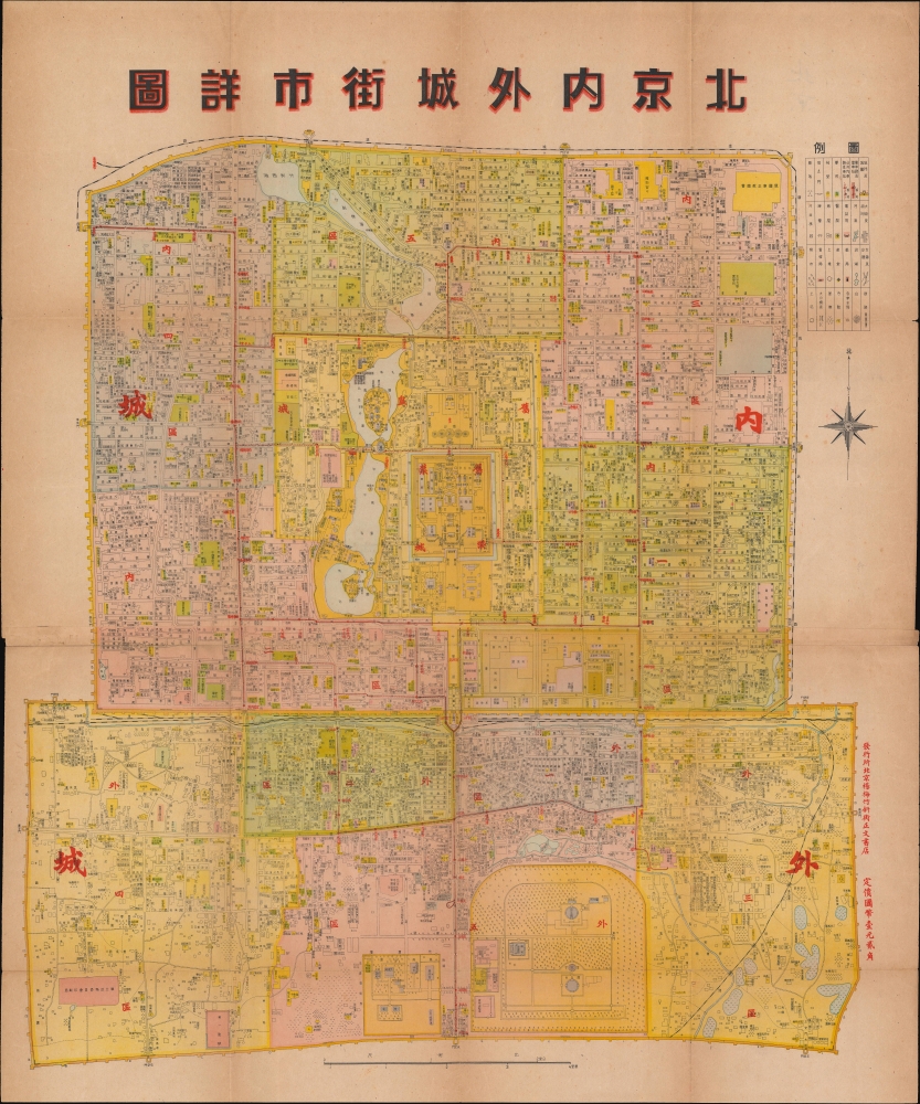
北京内外城街市詳圖 / [Detailed Street Map of the Inner and Outer Cities of Beijing]. From imperial capital to modern metropolis. 22.25 x 19 inches This is a c. 1930 Chinese-language map of Beijing published by the Zhengwen Bookstore. It illustrates the city's transition from imperial capital to modern city, fitted out with streetcars, plumbing, railway stations,and telegraphs.
|
|||
1636 / 1680 Jansson/ Pitt Map of Livonia (Latvia and Estonia)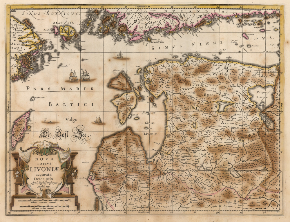
Nova Totius Livoniae accurata Descriptio. Apud Janssonio Waesbergios et Mosem Pitt. Estonia and Latvia as the Swedish Frontier 15.5 x 20.25 inches A beautifully engraved map of Livonia and the Duchy of Estonia - encompassing much of modern Latvia and Estonia - originally published in Jan Jansson's Atlas and revised for inclusion in Moses Pitt's rare 1680 English Atlas. Derived from Anders Bure's seminal map of the Swedish Empire, it depicts the region during Swedish rule following Sweden's victories over the Polish-Lithuanian Commonwealth.
|
|||
1751 Daniele Farlati Map of Ancient Salona (Solin, Croatia)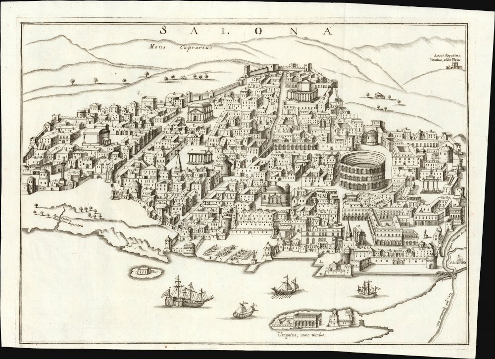
Salona. The Roman Capital of Dalmatia in the early Christian Era. 13.25 x 18.5 inches This is Daniele Farlati's rare 1751 bird's-eye view of ancient Salona, now Solin, in Croatia. Though now a suburb of Split, in the 5th century it was the capital not only of the Roman province of Dalmatia but also the seat of Julius Nepos, the last western Roman Emperor, making it the de facto capital of the Western Roman Empire.
|
|||
1561 Ruscelli / Gastaldi map of Prussia, Latvia and Estonia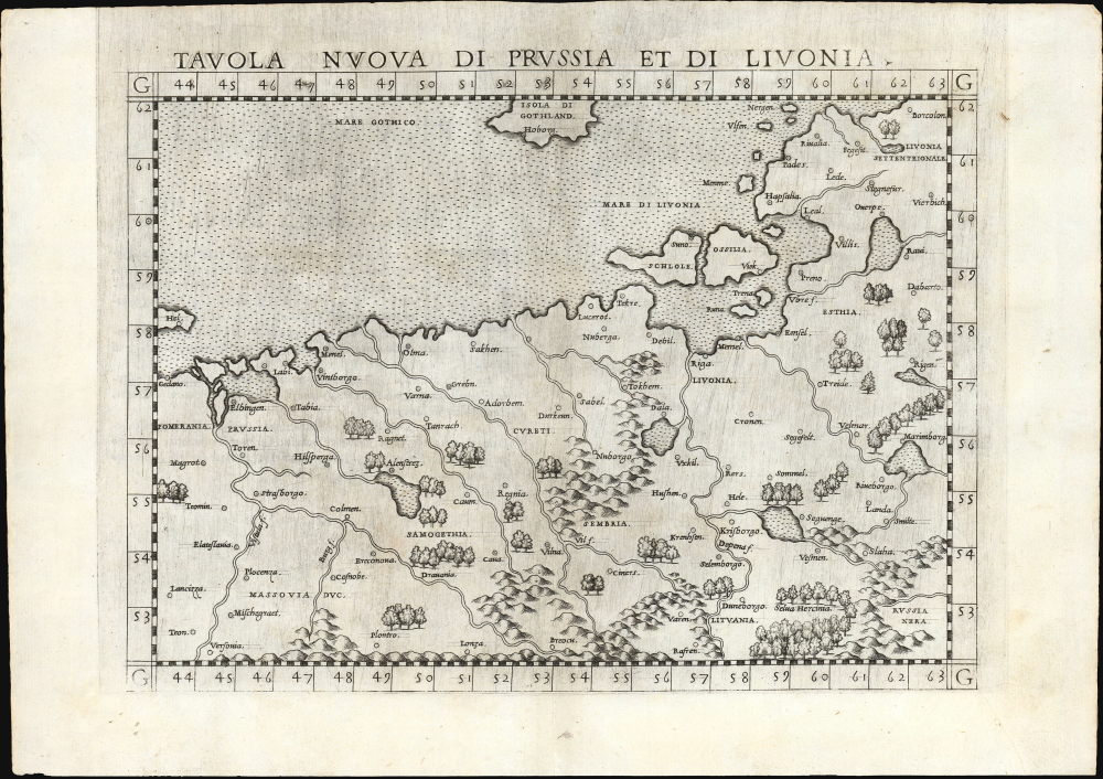
Tavola nuova di Prussia et di Livonia. Among the Earliest Acquirable Contemporary Maps of the Baltic Coast. 7.25 x 9.75 inches This is the 1561 first Ruscelli edition of Giacomo Gastaldi's map of the Baltic Coast of Prussia and Livonia, now the coastline of Poland, Lithuania, Latvia, and Estonia. It is among the earliest detailed maps of this part of the world based on contemporary geographical knowledge, particularly with respect to the Gulf of Riga.
|
|||
1900 Meekham Map of Raquette Lake, Hamilton County, New York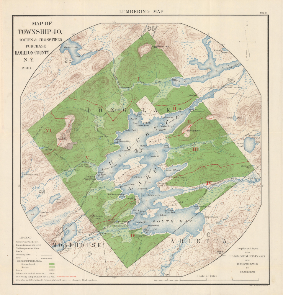
Lumbering Map. Map of Township 40, Totten and Crossfield Purchase. Hamilton County, N.Y. 'Forever Wild' 22.5 x 29.75 inches This is a 1900 H.S. Meekham 'lumbering map' of Raquette Lake and environs in Hamilton County, New York, at the heart of the Adirondacks.
|
|||
1937 Wakimizu / Hinode Global Map of National Defenses, World War II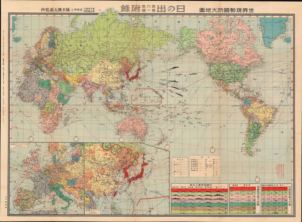
世界現勢國防大地圖 / [Current Map of Global National Defenses]. Battleships and cosmetics. 31.25 x 42.5 inches This is a rare 1936 world map published in Hinode (日の出), a popular Japanese magazine, showing the comparative military strength of major world powers. The map augurs Japan's coming conflicts with China in 1937 and Western powers in 1941.
|
|||
1631 / 1635 Blaeu Map of Gascony (Bordeaux, Medoc, Béarn)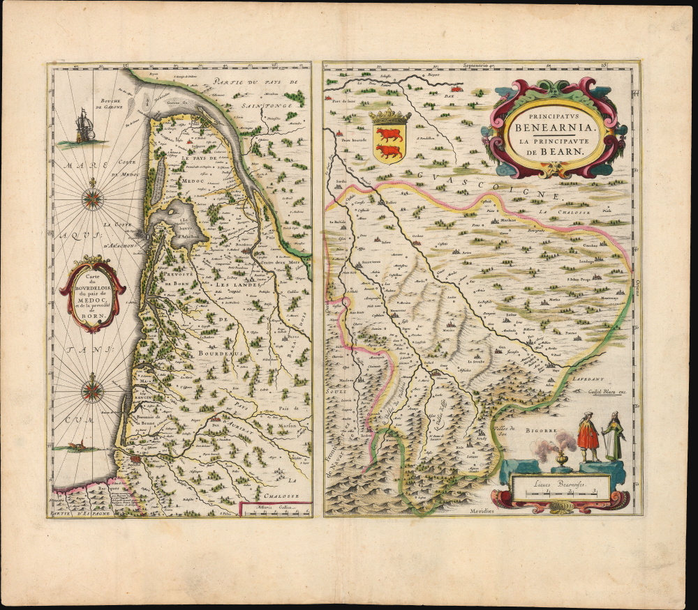
Carte du Bourdelois, du pais de Medoc, et de la prevosté de Born. / Principatus Benearnia. La Principaute de Bearn. Mapping Gascony. 15.25 x 20 inches This is Willem Blaeu's 1631 map of the Basque country of Gascony in southwestern France, including the wine country of Bordeaux and Medoc. It is printed along with a map focusing on the Principality of Béarn, also part of the Duchy of Gascony.
|
|||
1932 Cui Manuscript Map of Jilin Province, Manchuria, China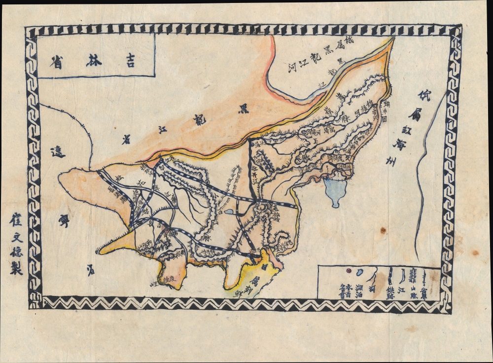
吉林省 / [Jilin Province]. Manchuria just after the establishment of Manchukuo. 10.5 x 16 inches This is a c. 1932 manuscript map of Jilin Province, Manchuria, China, drawn by Cui Wende. Drawn just after the establishment of the Japanese puppet state of Manchukuo, ithighlights critical rail infrastructure, the backbone of Japanese influence in Manchuria even before the establishment of Manchukuo.
|
|||
1980 Lipe Map of East Asia w/ Japanese World War II POW Camps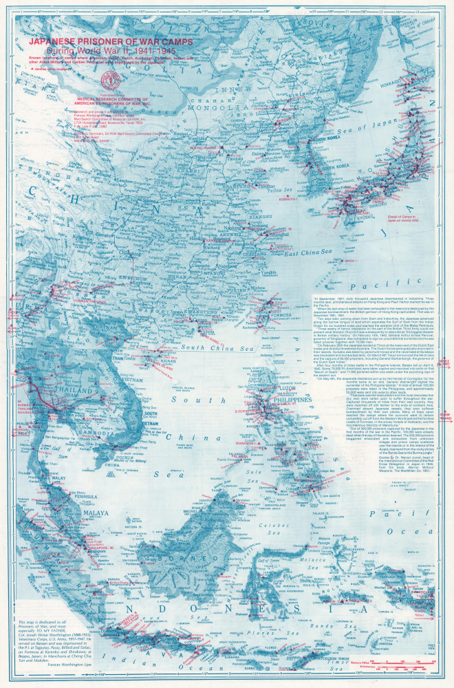
Japanese Prisoner of War Camps During World War II, 1941 - 1945. Known locations of camps where American, British, Dutch, Australian, Canadian, Indian, and other Allied Military and Civilian Personnel were imprisoned by the Japanese. Japanese WWII POW camps. 31.25 x 20.25 inches This is a 1980 Frances Worthington Lipe map of East Asia highlighting World War II (1939 - 1945) Japanese prisoner-of-war camps. Lipe dedicates her research and this map to her father, Josiah Wistar Worthington, who survived 2.5 years in several such camps.
|
|||
1783 Nicolas Gabriel Clerc Plan of the Kungur Ice Cave, Russia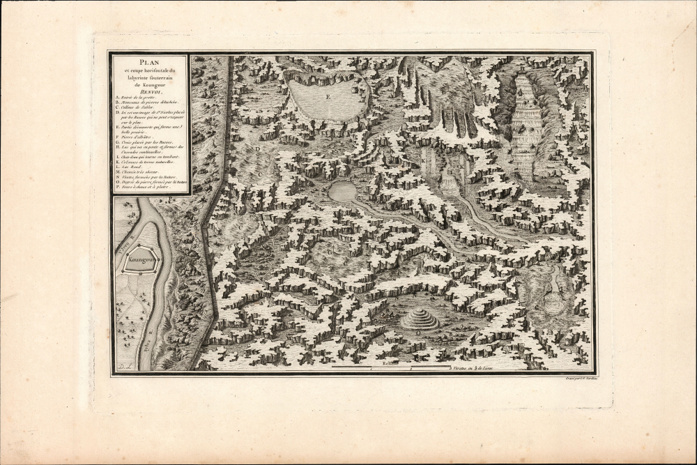
Plan et coupe horisontale du labyrinte souterrain de Koungour Renvoi. Earliest printed depiction of the Kungur Ice Cave 8.5 x 13 inches This is a fascinating cross-section view of the Kungur Ice Cave, a karst cave in the Ural Mountains, memorialized in Nicolas Gabriel Clerc's 1783 Histoire Physique, Morale, Civile et Politique de la Russie. Le Clerc was tasked by Louis XV to produce a history of Russia; his work included wonders such as this view of these sprawling caves, which to this day have not been fully explored.
|
|||
1952 Pacific Stars and Stripes Map of the Korean War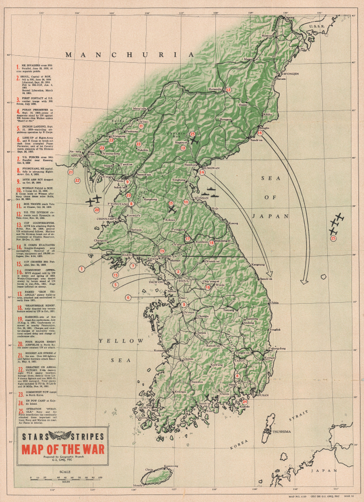
Map of the War. Height of the Korean War. 20.5 x 14.75 inches This is a 1952 Pacific Stars and Stripes map of the Korean War. It traces events from the North Korean invasion of South Korea on June 25, 1950, through Operation Strangle, a sustained attack on North Korean communication and supply lines in late August 1951.
|
|||
1975 McGuinness Pictorial Map of the United States, Indian Tribes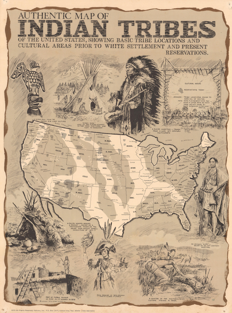
Authentic Map of Indian Tribes of the United States... Echo of the Red Power Movement. 18 x 13.5 inches This is a 1975 pictorial map of the United States focusing on Native American groups, drawn by Nevada-based artist Bob McGuinness for Hickory, Inc. It was published in the wake of the Red Power movement, which heightened awareness of issues facing Native Americans and reevaluated standard American historical narratives.
|
|||
Continue ExploringOur online gallery is updated daily with newly cataloged maps and related cartographic material.
|
|||
|
|||
|
|||
|
|||
|
Facebook Instagram Email Geographicus Geographicus Antique Maps Copyright © 2026 Geographicus Antique Maps. |