Authenticity Guaranteed — We sell only original antique maps.
Geographicus Rare Antique Maps
Authenticity Guaranteed — We sell only original antique maps.
Navigation
Shopping Cart
Sort By Price: highest first

CartoCuriosity Podcast
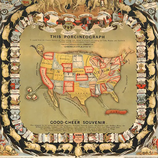

Porcineograph: One Nation Under Hog

Porcineograph: One Nation Under Hog

Perhaps the greatest pig map ever made!
Discover William Emerson Baker’s extraordinary Porcineograph, an 1875 pictorial map that transforms the United States into a pig, complete with a Maine snout, an Alaska tail, and Cuba as a sausage. In this episode of CartoCuriosity, Kevin Brown of Geographicus Rare Antique Maps explores how this colorful chromolithograph became a lavish party favor promoting Baker’s sanitary piggery and the Pure Food Movement. Packed with regional pork dishes, Reconstruction-era politics, and hints of territorial expansion, this rare antique map offers a wonderfully eccentric window into American food history, social reform, and the art of "ge'hog'raphy."
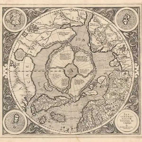
CartoCuriosity: The First Map of the North Pole

CartoCuriosity: The First Map of the North Pole

At the top of the world, Mercator mapped the unknown with science, myth, and imagination.
In this episode of CartoCuriosity, Kevin Brown of Geographicus Rare Antique Maps explores Gerard Mercator’s extraordinary first map of the North Pole—a landmark of 16th-century Arctic cartography where geographic knowledge, scientific theory, maritime legend, and pure imagination converge. Discover how the creator of the Mercator projection envisioned a vast polar maelstrom, four mysterious Arctic islands, and a magnetic mountain at the top of the world, drawing upon explorers’ reports, medieval sources, and lost works such as the Inventio Fortunata. Rare, visually striking, and historically influential, Mercator’s speculative map reveals how early cartographers transformed the unknown Arctic into a compelling geography that shaped European thought about the high Arctic for generations.
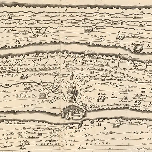
CartoCuriosity - The Peutinger Table, an Ancient Roman Map

CartoCuriosity - The Peutinger Table, an Ancient Roman Map

How Ancient Romans conceived of and navigated their expansive empire.
In this episode of CartoCuriosity, Kevin Brown of Geographicus Rare Antique Maps explores the Peutinger Table, or Tabula Peutingeriana - an extraordinary 12-foot-long Roman road map that reveals how the ancient world understood geography, travel, and imperial infrastructure. Stretching from Britain across Europe, the Mediterranean, Persia, and India, this remarkable itinerary sacrifices geographic accuracy to trace the roads, cities, ports, and staging posts that connected the Roman Empire. From its possible origins in the monumental map of Marcus Vipsanius Agrippa to its survival as a medieval vellum manuscript and later publication by Abraham Ortelius and Jan Jansson, the Peutinger Table offers an unparalleled window into Roman cartography and a radically different way of seeing the ancient world.
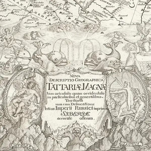
CartoCuriosity - Strahlenberg, A Mapmaker's Misfortune

CartoCuriosity - Strahlenberg, A Mapmaker's Misfortune

A Swedish Prisoner of War, against all odds, revolutionizes the mapping of Siberia.
In this episode of CartoCuriosity, James Roy of Geographicus Rare Antique Maps uncovers the extraordinary story of Philipp Johann von Strahlenberg (1676 - 1747), the Swedish soldier, prisoner of war, ethnographer, and pioneering cartographer whose groundbreaking maps transformed European understanding of Siberia, Central Asia, Great Tartary, and the Russian Empire. Captured at the Battle of Poltava (1709) and exiled to Tobolsk during the Great Northern War (1700 - 1721), Strahlenberg devoted his captivity to documenting the geography, languages, cultures, and histories of Russia's remote eastern territories - only to see his manuscripts lost in a fire, confiscated by a powerful governor, stolen, and published without attribution. It is a compelling tale of antique maps, geographic discovery, intellectual theft, and remarkable perseverance, revealing how one mapmaker's misfortunes shaped the eighteenth-century cartography of northern Asia.
CartoCuriosity -  World War II Route Maps

CartoCuriosity - World War II Route Maps

World War II, mapped by the soldiers who lived it.
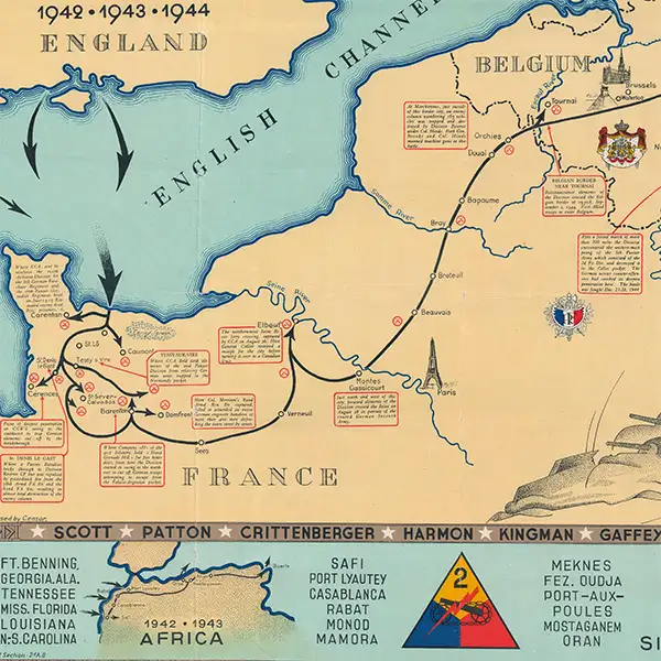
World War II route maps offer an extraordinary view of the conflict through the eyes of the soldiers who fought it. Created by military artists, engineers, draftsmen, and infantrymen, these rare pictorial maps trace individual units across the battlefields of Europe, recording campaigns, river crossings, command posts, engineering works, and moments of humor amid the devastation of war. Produced in small numbers as commemorative keepsakes rather than official military documents, they combine cartographic precision, firsthand testimony, illustration, and personal memory. The Geographicus WWII Route Map Archive preserves this overlooked category of wartime cartography - maps made by soldiers, for soldiers, as enduring visual records of service, survival, and shared experience.
CartoCuriosity - Franklin's Lost Expedition

CartoCuriosity - Franklin's Lost Expedition

Franklin failed to complete the Northwest Passage, but the search for him helped map the Arctic world.
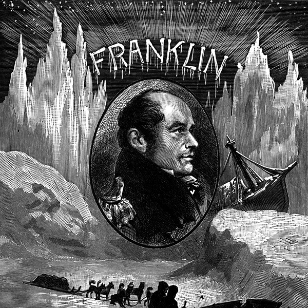
The fate of Sir John Franklin's lost expedition is one of the most enduring mysteries in Arctic exploration. In 1845, Franklin sailed from England aboard the HMS Erebus and HMS Terror in search of the elusive Northwest Passage, only to disappear in the Canadian Arctic with all 129 men. The massive international search that followed - led by explorers including John Rae and Francis Leopold McClintock - not only uncovered clues to Franklin's tragic fate but also produced some of the most important maps ever made of the Canadian Arctic. In this episode of CartoCuriosity, Spencer Hunt explores the remarkable story behind the Franklin Expedition, the maps it inspired, and how the search for one lost explorer forever changed the cartography of the Far North.
CartoCuriosity - The Zendian Problem

CartoCuriosity - The Zendian Problem

Invading Cuba, cartography, game design, and military intelligence.
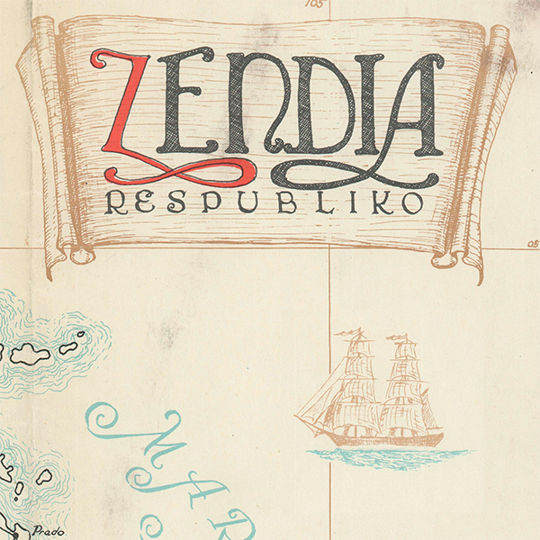
What if one of the most remarkable fantasy maps ever created wasn’t designed for a novel or a game, but for the CIA? In this episode of CartoCuriosity, Kevin Brown of Geographicus Rare Antique Maps uncovers the extraordinary story of The Zendian Problem, a top-secret Cold War cryptography training exercise created by eccentric American cryptologist Lambros D. Callimahos. Blending fantasy cartography, military intelligence, codebreaking, espionage, and geopolitical strategy, the fictional Kingdom of Zendia became an immersive world where intelligence officers learned to analyze maps, decipher encrypted communications, and anticipate military operations. Through a rare surviving set of Zendian maps, this episode explores the surprising intersection of cartographic history, cryptology, Cold War history, and one of the most unusual intelligence training programs ever devised.
CartoCuriosity - Buried Ships of San Francisco

CartoCuriosity - Buried Ships of San Francisco

During the California Gold Rush, fortune seekers scoured the earth for buried treasure. In the process, they left behind something unexpected: ships that would themselves become buried treasures.
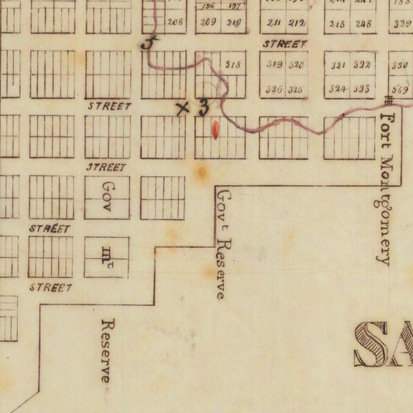
Discover the hidden history beneath the streets of San Francisco in this episode of CartoCuriosity, where Kevin Brown of Geographicus Rare Antique Maps and Michael Jennings of Neatline Antique Maps examine a unique 1850 manuscript map documenting the city's legendary buried ships. Created during the height of the California Gold Rush, this extraordinary map captures the explosive growth of early San Francisco, revealing its original shoreline, Central Wharf, and abandoned vessels that were engulfed by land reclamation as the city expanded. Learn how one of these ships, the Arkansas, was identified through modern archaeology, and discover why this remarkable artifact offers an unparalleled window into Gold Rush history, 19th-century cartography, maritime archaeology, and the forgotten city buried beneath modern San Francisco.
CartoCuriosity - Selling off the Bastille

CartoCuriosity - Selling off the Bastille

Revolution, demolition, and how commercialization created a French national symbol.
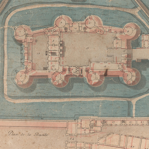
In this episode of CartoCuriosity, Spencer Hunt of Geographicus Rare Antique Maps explores the Storming of the Bastille, the event that ignited the French Revolution, and the unlikely entrepreneur who profited from its destruction. While the Bastille has become synonymous with the fall of royal authority, its enduring place in history owes much to Pierre-François Palloy, a Parisian entrepreneur who transformed the fortress's demolition into a public spectacle, a propaganda campaign, and a thriving business. Through broadsides, souvenirs, and relentless self-promotion, Palloy helped turn a prison into a revolutionary icon and ensured that the Bastille would live on long after it disappeared.
CartoCuriosity - Royal Siamese Maps

CartoCuriosity - Royal Siamese Maps

Challenging long-held assumptions about Siamese cartography - or lack thereof.
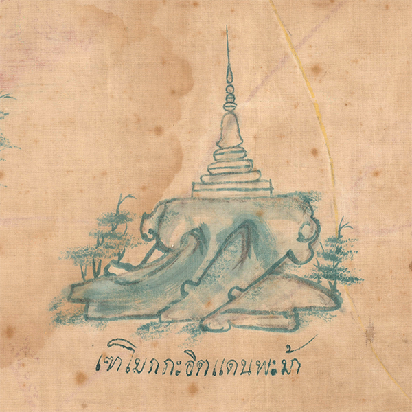
In this episode of CartoCuriosity, Kevin Brown of Geographicus Rare Antique Maps explores one of the most remarkable discoveries in Southeast Asian cartography: a rare hand-painted Siamese textile map that may predate the famed Royal Siamese Maps. Long believed to lack an indigenous mapping tradition, Siam (Thailand) is revealed to have produced sophisticated geographic documents blending Thai, Chinese, and regional cartographic concepts. Acquired from an obscure antique shop and ultimately placed with the Library of Congress, this extraordinary map offers new insight into the history of Thai cartography, the reign of Rama I, and the evolution of mapping in Southeast Asia.
CartoCuriosity - Formosa, a propaganda con-job on the Qing.

CartoCuriosity - Formosa, a propaganda con-job on the Qing.

How the Japanese used Persuasive Cartography to take over Taiwan.
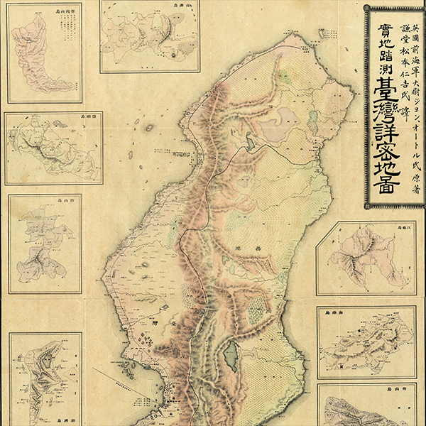
What if a map could justify the conquest of a nation? In 1895, as China and Japan negotiated the end of the First Sino-Japanese War (1894 - 1895), Japanese publisher Nakamura Yoshimatsu issued a remarkable map of Taiwan. Disguised as the work of a British naval officer, it subtly redrew the island to exaggerate vast 'ungoverned' tribal regions and diminish Qing authority. The result was one of the most consequential examples of persuasive cartography, a map that may have helped shape the negotiations leading to Japan's acquisition of Taiwan. Today, we explore the map, the politics behind it, and the extraordinary role cartography played in the transfer of an empire.
CartoCuriosity - Frisland, Zeno's attempt to co-opt Columbus

CartoCuriosity - Frisland, Zeno's attempt to co-opt Columbus

Story a Venetian nobleman's attempt to Co-Opt Columbus's discovery of America, and in doing so influenced cartography for centuries.

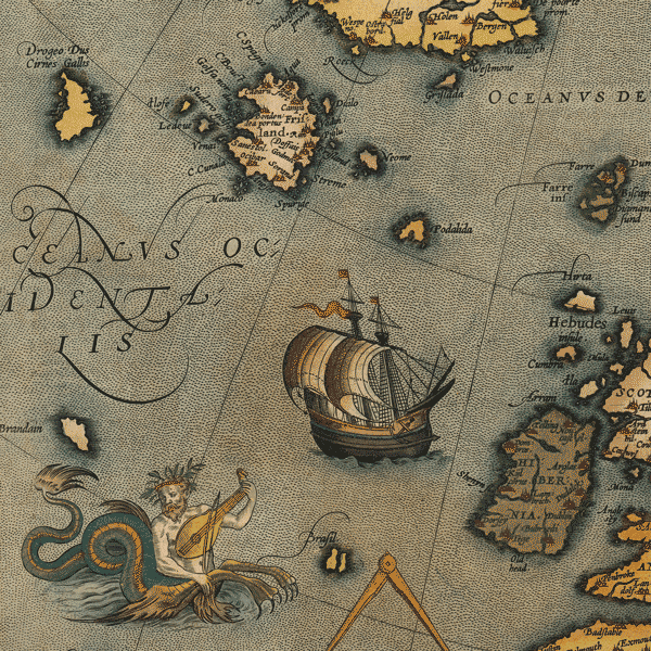
History's most successful cartographic hoax, this tale of Nicoló Zeno’s 1557 map is one of ambition, nationalism, and invention. Seeking to wrest the discovery of America from the hated Genoese navigator Christopher Columbus, Zeno fabricated a grand alternative history - one that credited his own illustrious Venetian family with crossing the Atlantic more than a century earlier. Though entirely fictitious, the Zeno Map was accepted as genuine by scholars and mapmakers for over three centuries.

Kevin J. Brown, Cory Choy, Tom Fama, Christian Cuciniello

2025-04-03
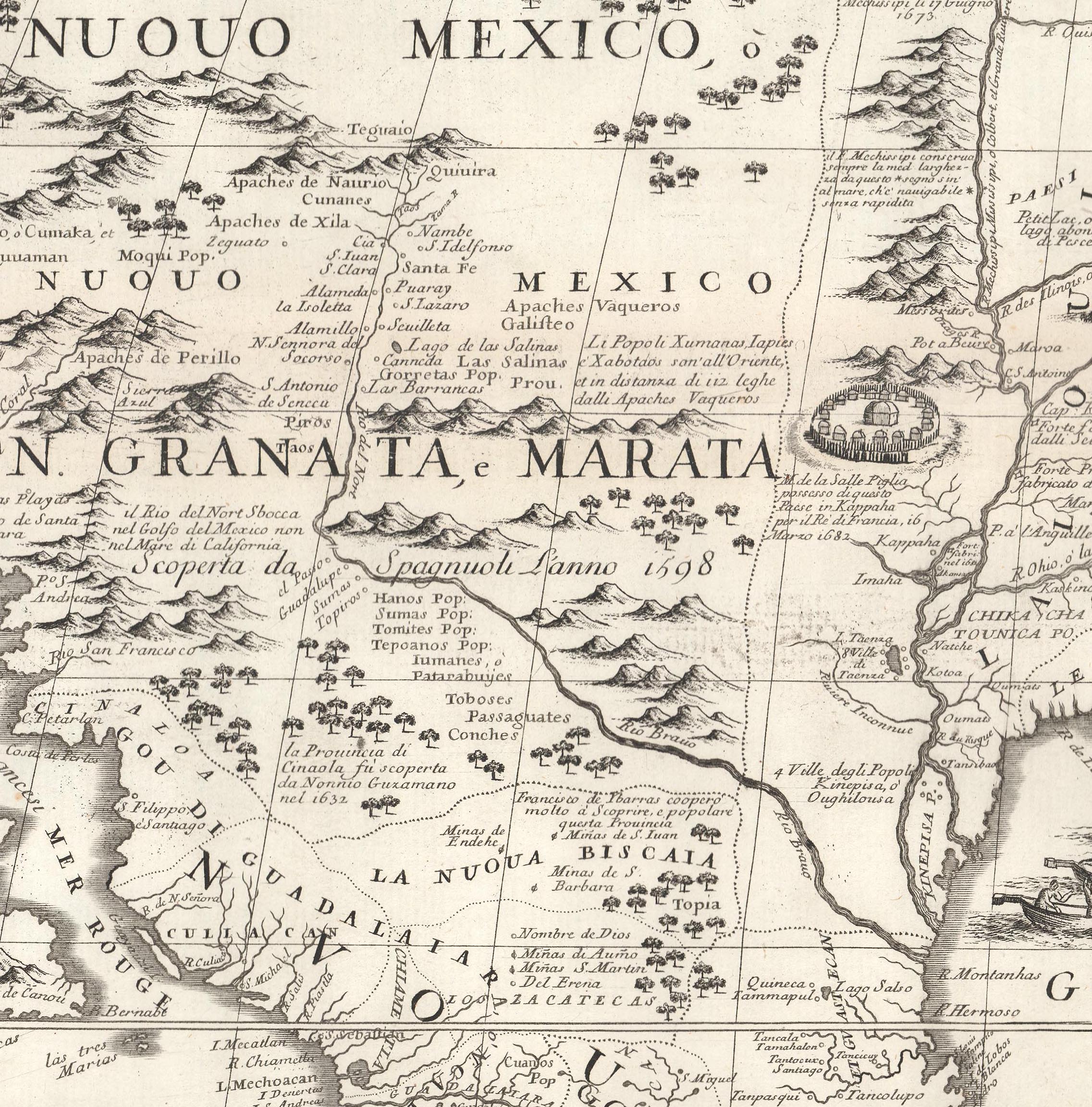
CartoCuriosity - Would-Be Conquistador, Real-World Con-man

CartoCuriosity - Would-Be Conquistador, Real-World Con-man

Tale of exploration, ambition, lost cities of gold, and treachery in the American Southwest.

Diego Dionisio de Peñalosa - count, conquistador, would-be king, and confidence man - is one of history’s great forgotten maverick adventurers. Born in Peru in the shadow of Pizarro’s conquest of the Inca Empire, Peñalosa imagined himself a latter-day Cortés, destined to carve out a new empire in the uncharted north. Through charm, cunning, and deception, he rose through the Spanish colonial bureaucracy to become provincial governor of New Mexico. There, he conceived an audacious plan: to discover and conquer Quivira and Gran Teguayo, mythical kingdoms of gold and silver hidden in the mountains of North America. Peñalosa’s life was a blend of ambition and illusion - a tale of imperial dreams, deception, and the thin line between conquest and con.

Kevin J. Brown, Cory Choy, Tom Fama, Christian Cuciniello

2025-03-20
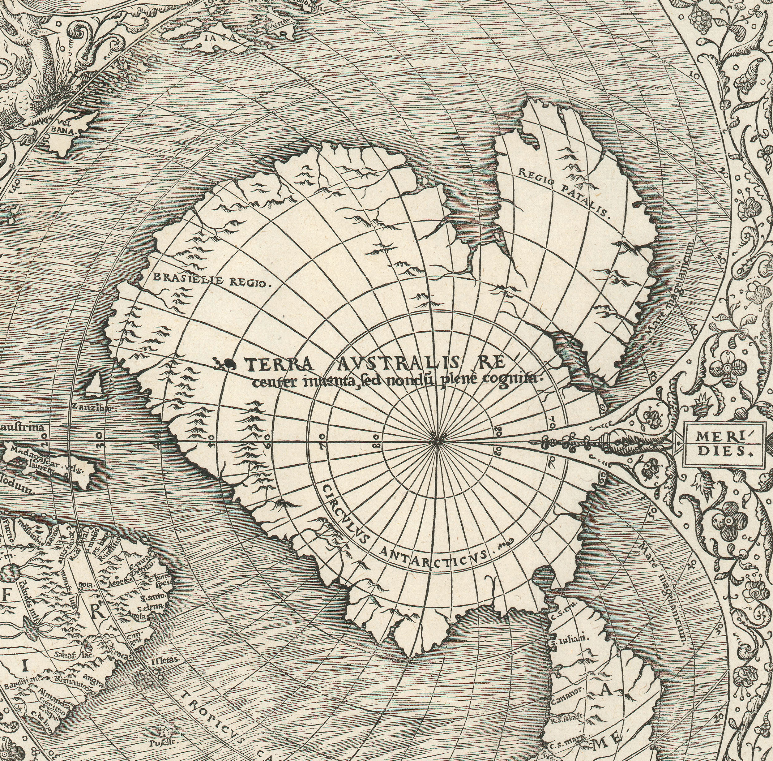
 CartoCuriosity - Terre Australis, the Great Southern Continent

CartoCuriosity - Terre Australis, the Great Southern Continent

Long before European navigators got even close to Antarctica, cartographers were mapping Terre Australis - a massive apocryphal continent at the base of the Earth.

Centuries before Young John Gore, Captain James Cook’s cabin boy on his second voyage, supposedly climbed the mast and became the first to glimpse Antarctica, mapmakers in Europe were already charting a vast southern continent. But how did they imagine a land no one had seen — and what exactly were they mapping? This episode explores how early European cartographers, drawing on the writings of classical antiquity, constructed and populated the mythic realm of Terra Australis Incognita - a continent born not from discovery, but from belief, speculation, and imagination.

Kevin J. Brown, Cory Choy, Tom Fama, Christian Cuciniello

2025-03-13
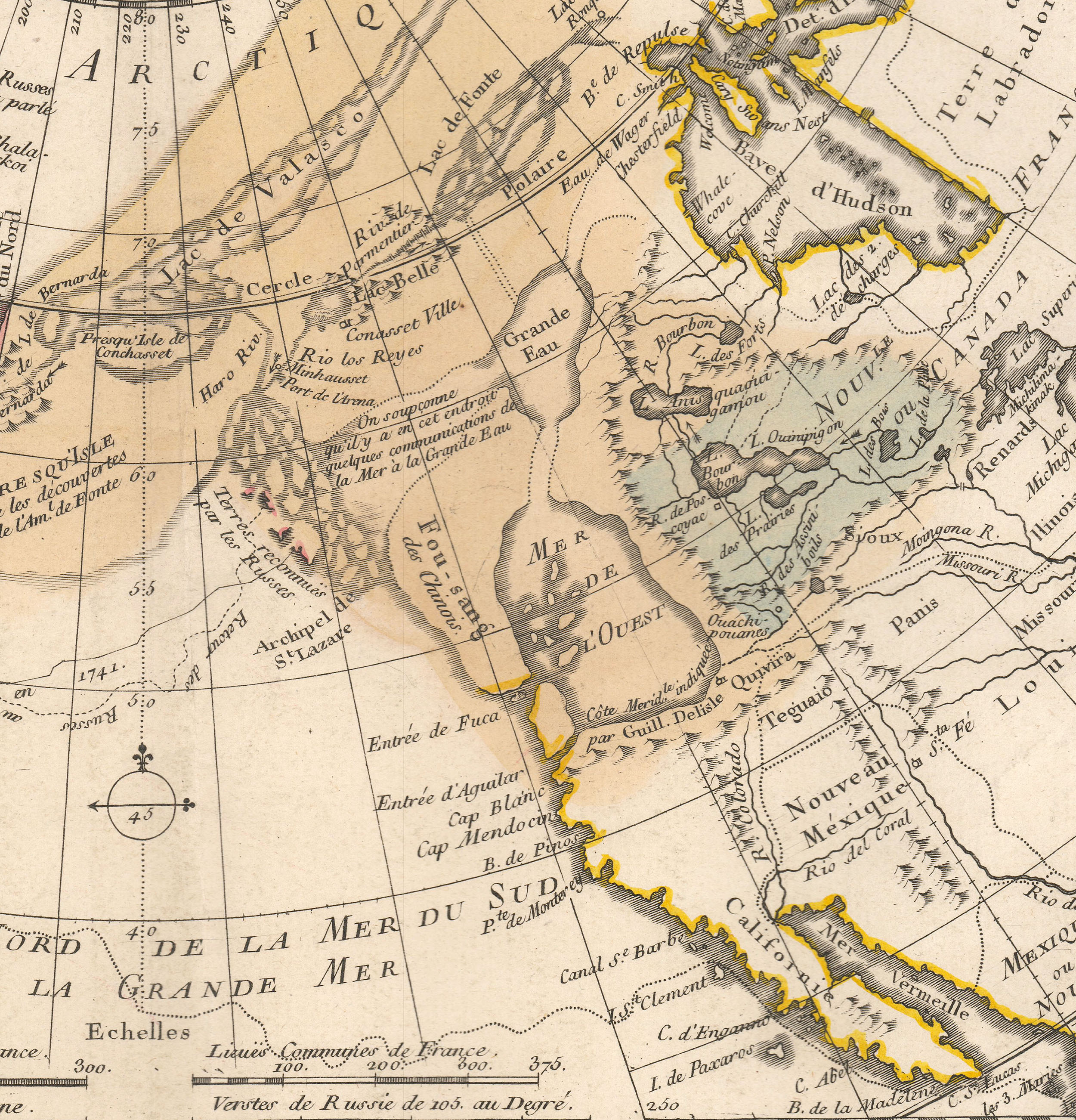
 CartoCuriosity - Fu Sang, 5th Century Chinese Colony in North America

CartoCuriosity - Fu Sang, 5th Century Chinese Colony in North America

Fact or Fiction? A Chinese Colony in North America 1000 years before Columbus.

In the 18th century, Europe became enamored of a startling idea - that ancient Chinese explorers had reached North America more than a 1000 years before Columbus. Drawn from Chinese administrative records, historical chronicles, and classical poetry, the legend of Fusang ignited debate across the European intellectual world. Whether the tale held a grain of truth or not, it resonated deeply with the era's philosophical and moral values, challenging prevailing notions of discovery, civilization, and the origins of the American continent and its indigenous peoples.

Kevin J. Brown, Cory Choy, Tom Fama, Christian Cuciniello

2025-02-13

Stay Informed

First Look at New Acquisitions

New inventory updates delivered directly to your inbox.