
Benazech, Peter Paul

Peter Paul Benazech (c. 1730 - 1783) was a British painter and engraver. He was born in England, but his date of birth is disputed in biographies. It must have been about 1730, given that he became an apprentice to the French landscape engraver François Vivarès (1709 - 1780) in 1746. Later, he and Vivarès partnered and produced work in both London and Paris. His son, Charles Benazech (1767 - 1794), was also a historical artist. Benazech worked with drypoint, etching, and burin. He was primarily an interpreter, specializing in the reproduction of landscapes by masters of the previous century and the Rococo period, but also contemporary maps and topographies. However, his work also included genre scenes and ancient ruins of his own invention, inspired by Rome. His name, Benazech, suggests family origins in the Tarn region of France.
Victim of the French and Indian War.
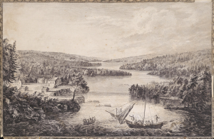
[A View of Miramichi, a French Settlement in the Gulf of St Laurence, destroyed by Brigadier Murray detached by General Wolfe for that purpose, from the Bay of Gaspe / Vue de Miramichi Établissement François dans le Golfe de St Laurent, détruit par le Brigadier Murray, détaché à cet e effet de la Baye de Gaspé, par le Général Wolfe].
$1,500.00
Acquire
- Digital Map Information
- Suitable for large format printing
- Full resolution TIFF file
- ICC color profile embedded
- Delivered instantly via download link
This is Hervey Smyth and Paul Sandby's portrayal of the settlement of Miramichi on the Miramichi River in New Brunswick that appeared in the 1760 Six Views of the Most Remarkable Places of the Gulf and River St. Laurence (later Scenographia Americana), published in London. The strategically located settlement was targeted by the British during the French and Indian War (Seven Years' War) and completely sacked. (more details)
Seminal view of Quebec shortly after the French and Indian War.
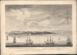
A View of the City of Quebec, the capital of Canada, taken partly from the Pointe des Peres, and partly on Board the Vanguard Man of War. / Vue de la Ville de Québec, capitale du Canada, prise en partie de la Pointe des Peres, et en partie abord de l'Avantgarde Vaisseau de Guerre.
$5,500.00
Acquire
- Digital Map Information
- Suitable for large format printing
- File Size: 25.18 MB
- File Type: ZIP / TIFF
- ICC color profile embedded
- Delivered instantly via download link
This is the rare 1868 Hervey Smyth view of Quebec City, published in 1768. It is one of the earliest obtainable views of Quebec City, offering a look at the city shortly after the French and Indian War (1754 - 1763). The view was published for the Scenographia Americana, one of the most influential and monumental pre-Revolutionary graphic works on North America. (more details)