
Cartifacts
Among the Earliest Commercially Produced Relief Maps
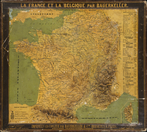
La France et la Belgique par Bauerkeller.
$4,500.00
Acquire
- Digital Map Information
- Suitable for large format printing
- Full resolution TIFF file
- ICC color profile embedded
- Delivered instantly via download link
This is an exceptionally rare c. 1844 raised relief map of France and Belgium, produced by the revolutionary German-born Parisian mapmaker Georg Michael Bauerkeller. Like Bauerkeller's other early works, this was one of the earliest commercially-available relief maps, produced in small numbers in a meticulous patented process. (more details)
Competitor of the Marine Chronometer.
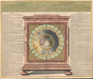
Geographische Universal - Zeig Und Schlag-Uhr.
$2,250.00
Acquire
- Digital Map Information
- Suitable for large format printing
- File Size: 27.03 MB
- File Type: ZIP / TIFF
- ICC color profile embedded
- Delivered instantly via download link
A remarkable 1735 Zacharias Landteck and J. B. Homman diagram of a 'universal clock,' with instructions in German (left) and Dutch (right) on how to use it to determine the time and thus longitude at sea - an age-old problem for mariners. This advertising piece for Landteck's clock, known as Geographische Universal Zeig und SchlagUhr an (Universal Pointing and Chiming Clock), was published in 1735, not by chance, for this was the same year that Englishman John Harrison claimed the Royal 'Longitude Act' prize for his own groundbreaking invention, the marine chronometer. (more details)
French SAS operations in Brittany, France, in June 1944.
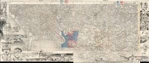
This is a c. 1950 map and with additional original c. 2004 artwork commemorating the French SAS (Special Air Service) operations in Brittany, France, in June 1944, both before and after the June 6, 1944, D-Day landings in Normandy. Bré, a French artist and historian, combined 3 Institut Géographique National maps, upon which he added his own artwork. The map directly references 3 of these SAS missions: Operation Dingson, Operation Cooney (also known as Operation Cooney Parties), and Operation Lost. (more details)
The Americas crafted into a unique puzzle!
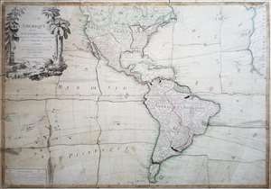
L'Amerique divisée en ses principaux états, assujetie aux observations astronomiques par le Sr. Janvier Geographe. A Paris.
$2,000.00
Acquire
This is Jean Janvier's 1760 rare, separately issued map of the western hemisphere, in its 1784 Paris edition. This map has, at an early date, been pasted down and hand-cut to form a simple jigsaw puzzle. Although the map does not name the new country, the colored national borders reflect the formation of the United States, which had been set according to the Treaty of Paris the year before this map was printed. The substance of the map is somewhat changed - dotted colonial borders have been burnished out and replaced with new ones, but the bulk of the engraving remains true to the 1760 edition. (more details)
Wipe the sweat from your brown and navigate the elevated train!
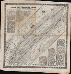
McIntire's Pocket Handkerchief and Guide of New York City.
$1,900.00
Acquire
- Digital Map Information
- Suitable for large format printing
- File Size: 28.99 MB
- File Type: ZIP / TIFF
- ICC color profile embedded
- Delivered instantly via download link
This is a rare c. 1869 Bridgman and McIntire pocket guide map of New York City. It follows shortly after the development of New York's Elevated Train System - the city's first viable public transportation and the precursor of the modern system. Straphangers need a practical guide, and what could be better than the 'weatherproof,' 'tearproof,' and utilitarian handkerchief map - wipe the sweat from your brow and find your way! Published as 'McIntire's Pocket Handkerchief Guide of New York City,' the map depicts Manhattan from the Battery north to West 155th Street and the southern Bronx. (more details)
Identifies many of the ancient ruins surrounding the bay!
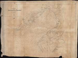
Coast of Syria. Iyskanderin Latakiah and Markhab.
$1,500.00
Acquire
- Digital Map Information
- Suitable for large format printing
- File Size: 32.45 MB
- File Type: ZIP / TIFF
- ICC color profile embedded
- Delivered instantly via download link
This is a c.1858 manuscript nautical chart or maritime map of the Bay of Iskenderun in modern-day Turkey. Copied by hand from a British Admiralty chart, this map's creator exhibits extreme care and attention to detail, positioning nearly every depth sounding almost precisely where it appears on the printed version. Notes along the coastline provide landmarks and understanding and identify various landscapes, including 'very low sand hills,' 'cultivated and uncultivated plains', 'low swampy ground and shallow lakes,' and 'barren hills covered with brush wood.' Alexandretta, also known as Iskenderun, appears on the right side of the bay. Villages are labeled all around the bay, and the areas extensive river and stream network is depicted in detail. (more details)
Rare relief map of Hong Kong.
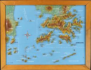
A most curious c. 1975 relief map of Hong Kong created by Chung-to Lo of the Kowloon-based Relief Map Service. Centered on Lan Tao, coverage extends to all of Hong Kong, the New Territories, and Kowloon, reaching as far as Macau, and north to Mount Tung Shan. The map is made of plaster bonded to fiberboard, with a maximum elevation of about 3cm. Topography is precisely hand molded, with terrain, major roads, trains, and placenames hand painted. The map is embraced in its original frame, with the 'Lo Chung To Relief Map Service' placard on the verso. (more details)
'In the same way that uncle same and his navy are maintaining the peace of nations, so does the Pro-phy-lac-tic Tooth Brush contribute its share to the upbuilding of the world'.
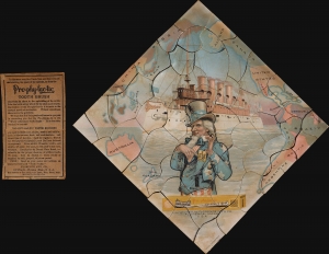
Pro-phy-lac-tic Tooth Brush.
$950.00
Acquire
- Digital Map Information
- Suitable for large format printing
- File Size: 1.94 MB
- File Type: ZIP / TIFF
- ICC color profile embedded
- Delivered instantly via download link
An exceptional 1907 advertising chromolithograph advertising map and puzzle promoting the Pro-phy-lac-tic Tooth Brush. The image capitalizes on patriotism and national enthusiasm surrounding the 1907 launch of the Great White Fleet (an American International Naval Review - see below) to promote its signature product - a toothbrush - perhaps comparing the whiteness of the fleet with the bright white teeth of Pro-phy-lac-tic users. (more details)
The Heavens without a Telescope, The Only Practical Combination Star, Planet, and Sun and Moon Map. - Barritt
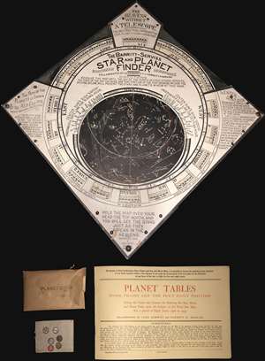
An unusual tool for the amateur astronomer, this is Leon Barritt and Garrett Serviss's 1906 star and planet finder. The tool consists of a celestial map set into a frame. The map can be rotated to reveal the night sky of the Northern Hemisphere on each day of the month. The chart is surrounded by a wealth of additional astronomical information associated with Ellipses, the Elliptic, the sun, and more. The tool is further accompanied by a book of planetary Tables as well as six pushpin planet disks covering the Sun, Mercury, Mars, Venus, Jupiter, and Saturn. It is promoted as 'The Heavens without a Telescope, The Only Practical Combination Star, Planet, and Sun and Moon Map.' (more details)
Solving the fundamental problem of navigation.
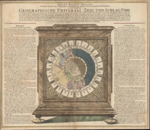
Geographische Universal - Zeig Und Schlag-Uhr.
$600.00
Acquire
- Digital Map Information
- Suitable for large format printing
- DPI: 600
- File Size: 63.8 MB
- File Type: ZIP / TIFF
- ICC color profile embedded
- Delivered instantly via download link
A remarkable c. 1735 Zacharias Landteck and J. B. Homman 'universal clock' with instructions on how to use time to determine longitude at sea - a perennial problem for mariners. The piece advocates for Homann's invention of the universal clock, known as Geographische Universal Zeig und SchlagUhr an (Universal Pointing and Chiming Clock), but this is unverified. (more details)
The absolute pinnacle of 1970s scientific infographic design.
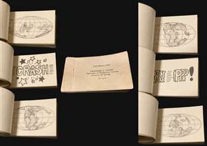
The absolute pinnacle of 1970s scientific infographic design. A delightful 1979 flipbook illustrating continental drift by the scientist Christopher R. Scotese. There are 46 miniature plates in the book, which, when flipped, illustrate theories of continental drift from the Cambrian to the Miocene eras, or from roughly 535 million years ago to about 5 million years ago. There are three comic-bookesque plates indicating moments when continents collided 'CRASH!', move apart 'RRRIPPP!', and come back together 'CRUNCH!' (more details)
Incredible complete McLoughlin puzzle map of the United States.
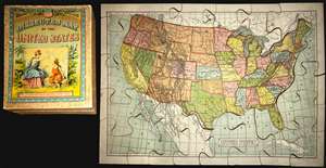
This is a rare complete 1887 McLoughlin Brothers puzzle map of the United States. This map depicts the continental United States from California to the East Coast and from the Canadian border in the north to the southern border with Mexico. The map depicts ... (more details)
Wipe the sweat from your brow, find your way, and enjoy the 1930 Stockholm Exhibition.
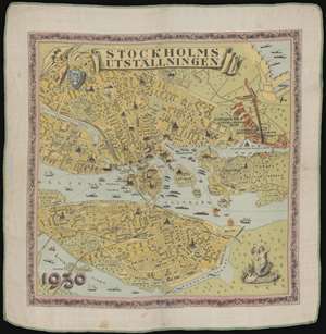
Stockholmsutställningen.
$350.00
Acquire
- Digital Map Information
- Suitable for large format printing
- File Size: 22.29 MB
- File Type: ZIP / TIFF
- ICC color profile embedded
- Delivered instantly via download link
This is a 1930 Max Söderholm silk pictorial tourist hankerchief map of Stockholm, Sweden. Produced for the 1930 Stockholm Exhibition (Stockholmsutställningen in Swedish), lays out the city for visitors. The exhibition is situated along the right border, shaded orange, and labeled with the exhibition's 'Flying V' logo. Profile views of numerous sites around the city highlight places of interest, including the National Museum, the Royal Palace, the Parliament House, the Storkyrkan, and Stockholm City Hall. The unique format, a handkerchief, was more resistant to wear, dampness, and other damage than traditional paper maps. Visitors could wipe the sweat from their brow while navigating the fair! (more details)
An interactive spinning disk featuring information about the Unbited States.
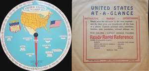
United States At-a-Glance.
$350.00
Acquire
- Digital Map Information
- Suitable for large format printing
- File Size: 1.31 MB
- File Type: ZIP / TIFF
- ICC color profile embedded
- Delivered instantly via download link
This is a 1931 International At-a-Glance Chart Company map of the United States. Created in the form of an interactive disk, the map depicts the entire continental United States from the Pacific Ocean to the Atlantic Ocean and from Canada to Mexico. Meant ... (more details)
An interactive disk featuring information concerning the countries of the Western Hemisphere.
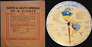
North and South America At-A-Glance.
$350.00
Acquire
- Digital Map Information
- Suitable for large format printing
- File Size: 0.68 MB
- File Type: ZIP / TIFF
- ICC color profile embedded
- Delivered instantly via download link
This is a 1931 International At-A-Glance Chart Company map of the Western Hemisphere. Created in the form of an interactive disk, the map depicts the entirety of North, Central, and South America. Meant to be spun, the user rotates the inner disk bearing ... (more details)
Short Route to India.
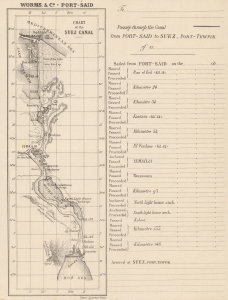
Chart of the Suez Canal. Passage through the Canal from Suez Port-Tewfik to Port-Said.
$300.00
Acquire
- Digital Map Information
- Suitable for large format printing
- File Size: 3.18 MB
- File Type: ZIP / TIFF
- ICC color profile embedded
- Delivered instantly via download link
This c. 1875 souvenir lettersheet map records the early days of the Suez Canal. The map and table were designed to chart the progress of a ship and its passengers through the canal. (more details)
Delicious slice of Americana.
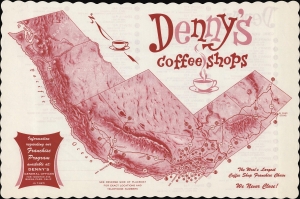
Denny's Coffee Shops: The West's Largest Coffee Shop Franchise Chain. We Never Close!
$300.00
Acquire
A playful c. 1962 placemat view of the Western United States, indicating the locations of Denny's Coffee Shops. It was produced during a period of transition for the company, on the eve of even greater national expansion, as both its name and business model changed. (more details)
Get Your Kicks (and Chicken In A Basket) On Route 66.
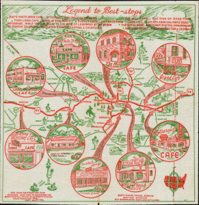
Legend to Best-Stops.
$275.00
Acquire
- Digital Map Information
- Suitable for large format printing
- Full resolution TIFF file
- ICC color profile embedded
- Delivered instantly via download link
This is a 1952 map of northern Arizona, printed in two colors on a diner napkin. This 'Mapkin', produced by the Best Stops Travel Service of Salt Lake City, Utah, represents a pictorial icon of the pre-interstate Arizona road trip, focusing specifically on the region along the fabled Route 66 from Gallup, New Mexico to Barstow California. The region covered runs from Phoenix, Arizona in the south, up to the Grand Canyon in the north. This was an area that BestOPS had covered in 1948; the present work not only features different restaurants, but also sharpens the focus on Route 66 as the major corridor of the region. (more details)
Hottest Place on Earth.
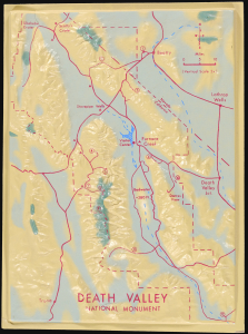
This is an unusual c. 1968 three-dimensional raised relief model of Death Valley National Monument (now a national park) along the California-Nevada border. It demonstrates the uniquely dramatic and harsh terrain of the region, where extreme temperatures at its lowest points (well below sea level) have led it to be dubbed 'the hottest place on earth.' (more details)
Largest Trees on Earth.
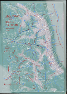
This is an unusual c. 1968 three-dimensional raised relief model of Sequoia and Kings Canyon National Parks in California. It highlights the stunning landscape and steep topography of the region, from the foothills of the Sierra Nevada (below 1,000 feet above sea level) to the peak of Mt. Whitney, at roughly 14,500 feet. (more details)
Mid-Century Tourist Placemat Map of Florida.
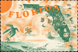
This is a charming c. 1955 pictorial placemat map produced by Roylprint. It reflects the state's development as a national destination for tourists and seasonal migrants in the Postwar period. (more details)