
Views
Greatest view of San Francisco.
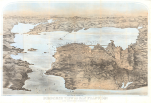
Birdseye View of San Francisco and Surrounding Country.
$22,000.00
Acquire
- Digital Map Information
- Suitable for large format printing
- Full resolution TIFF file
- ICC color profile embedded
- Delivered instantly via download link
This is George Henry Goddard's stunning chromolithograph bird's-eye view of San Francisco Bay, city, and environs, here in its 1880 edition. A product of Goddard's artistic virtuosity, this is not only the best early view of the San Francisco Bay area but also one of the finest American views ever made, offering a unique and outstanding artistic take on the genre. (more details)
First large-scale view of Paris published in Paris.
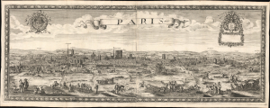
Paris 1660.
$22,000.00
Acquire
- Digital Map Information
- Suitable for large format printing
- File Size: 58.35 MB
- File Type: ZIP / TIFF
- ICC color profile embedded
- Delivered instantly via download link
This is the only known example of Nöel Cochin and Nicolas Berey's 1660 view of Paris - the earliest known large-format view of Paris published in Paris (an earlier large view was issued in Amsterdam). This view is likely a proof state or perhaps a study for a larger view of the same issued two years later in 1662 (c.f. Boutier #105). (more details)
The Finest View of Nantucket Town
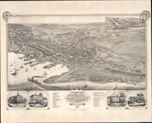
Bird's Eye View of the Town of Nantucket in the State of Massachusetts. Looking Southwest.
$16,000.00
Acquire
- Digital Map Information
- Suitable for large format printing
- File Size: 109.45 MB
- File Type: ZIP / TIFF
- ICC color profile embedded
- Delivered instantly via download link
An impressive 1881 bird's-eye view map of the town of Nantucket, Massachusetts, by Joseph Stoner. This is considered the largest and best bird's-eye view of Nantucket. It emerged as the city was transitioning from a maritime whaling hub to a resort economy. (more details)
The only contemporaneous view to illustrate Seneca Village, New York's first African American community.
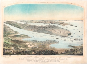
Panorama of Manhattan Island, City of New York and Environs.
$10,000.00
Acquire
- Digital Map Information
- Suitable for large format printing
- Full resolution TIFF file
- ICC color profile embedded
- Delivered instantly via download link
This is a gorgeous c. 1854 John Bornet panoramic bird's-eye view of the city on the cusp of its monumental expansion northwards in the second half of the 19th century. Among other points of interest, this is the only view we are aware of to show the buildings of Seneca Village, New York City's first African American community, in what is today Central Park. (more details)
First published image of New Orleans.
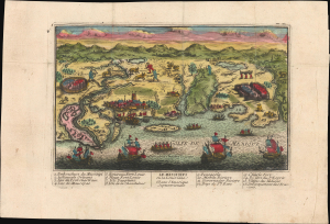
Le Mississipi ou la Louisiane dans l'Amerique Septentrionale.
$9,500.00
Acquire
- Digital Map Information
- Suitable for large format printing
- Full resolution TIFF file
- ICC color profile embedded
- Delivered instantly via download link
This is a rare c. 1720 Chéreau broadside leaflet map-view of the Gulf of Mexico littoral, just a few years after New Orleans was founded. It is likely the earliest printed view of New Orleans - though admittedly, it is not an accurate representation of the city at the time. The map was issued as a propaganda leaflet to promote New Orleans and French Louisiana, and thus coverage extends east to encompass most of the Florida Panhandle. It is among the earliest maps to include a view of New Orleans and the indigenous peoples of the Gulf. The present example is the first state, with extraordinary period color. (more details)
First Clash of Ironclads - by America's first female professional artist.
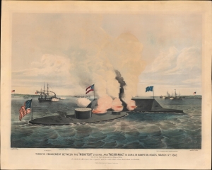
Terrific Engagement Between the 'Monitor' 2 guns, and 'Merrimac' 10 guns, in Hampton Roads, March 9th 1862. The First Fight between Iron Ships of War. In which the Merrimac was ripped, and the whole Rebel Fleet driven back to Norfolk.
$8,500.00
Acquire
- Digital Map Information
- Suitable for large format printing
- Full resolution TIFF file
- ICC color profile embedded
- Delivered instantly via download link
A striking 1862 Currier and Ives original lithograph view of the historic American Civil War battle of the Monitor and Merrimac. Considered the first clash of Ironclads, this was one of the most important naval engagements in the American Civil War (1861 - 1865), transforming future naval warfare. This is one of the first images of the historic battle that would have been available to the general public. Moreover, it is the work of Frances 'Fanny' Palmer, the first American woman to work as a professional artist. (more details)
California gold-rush boomtowns.
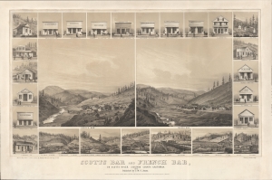
Scotts Bar and French Bar, on Scotts River, Siskiyou County, California.
$8,000.00
Acquire
- Digital Map Information
- Suitable for large format printing
- File Size: 737.07 MB
- File Type: ZIP / TIFF
- ICC color profile embedded
- Delivered instantly via download link
A remarkable 1856 two-color chromolithograph bird's-eye view of California gold mining boomtowns Scotts Bar and French Bar, Siskiyou County, California. The view reveals these boomtowns on Scotts River - a 60-mile-long tributary of the Klamath River - at the height of the Northern California Gold Rush. Today, they are both ghost towns. (more details)
New York in the mid-19th century.
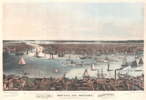
New-York and Environs, from Williamsburgh.
$8,000.00
Acquire
- Digital Map Information
- Suitable for large format printing
- DPI: 600
- File Size: 107.61 MB
- File Type: ZIP / TIFF
- ICC color profile embedded
- Delivered instantly via download link
This is an 1848 Edgar W. Foreman and Eliphalet M. Brown, Jr. bird's-eye view of New York City. Looking west over the East River and Manhattan from Williamsburg, ships navigating the East River, particularly several side-wheel steamers (one of which is named for Cornelius Vanderbilt) act as focal points. Manhattan's East River wharves, warehouses, and factories are also particularly well illustrated. Ships then pass between Manhattan and Brooklyn (with Brooklyn Heights and the Navy Yard well depicted) and into New York Harbor in the background. New Jersey and Staten Island appear along the horizon. (more details)
Capital of New England - one of the earliest views of Boston based on actual observation.

A View of the City of Boston the Capital of New England, in North America. / Vue de la Ville de Boston Capitale de la Nouvelle Angleterre, dans l'Amérique Septentrionale.
$6,500.00
Acquire
- Digital Map Information
- Suitable for large format printing
- File Size: 29.58 MB
- File Type: ZIP / TIFF
- ICC color profile embedded
- Delivered instantly via download link
This is the rare Thomas Pownall view of Boston, published in 1768. It is one of the earliest obtainable views of Boston, offering a glimpse of the city shortly after the French and Indian War (1754-1763). (more details)
Superbly executed Panorama of Westminster, West London.
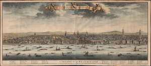
La Ville de Westmunster. / A Prospect of Westminster.
$6,500.00
Acquire
- Digital Map Information
- Suitable for large format printing
- File Size: 65.47 MB
- File Type: ZIP / TIFF
- ICC color profile embedded
- Delivered instantly via download link
This beautiful, meticulously detailed 1724 panorama of West London was produced by Dutch engravers Johannes Kip and Leonard Knyff for inclusion in Britannia Illustrata. It is one of the grandest views of West London obtainable. (more details)
Ornate Wartime Bird's-Eye View of Mecca.
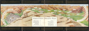
رسم مشاعر الحج : نقلا عن كتاب مراة الحرمين لأمير الحج اللواء ابراهيم رفعت باشا / [Depicting the Emotions of Hajj: Excerpted from the book Mir'at al-Haramayn by the Commander of the Hajj Caravan, Major General Ibrahim Rifaat Pasha].
$6,000.00
Acquire
- Digital Map Information
- Suitable for large format printing
- Full resolution TIFF file
- ICC color profile embedded
- Delivered instantly via download link
This is a c. 1942 decorative Hajj souvenir view of the Muslim holy city of Mecca (Makkah) and surroundings, based on the work of Ibrahim Rifat Pasha. Taking in the Kabaa, the Great Mosque, and the Plain of Arafat, it would have been intended for a Hajji to remind them of the apex and core ritual components of their pilgrimage. (more details)
Seminal view of Quebec shortly after the French and Indian War.
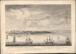
A View of the City of Quebec, the capital of Canada, taken partly from the Pointe des Peres, and partly on Board the Vanguard Man of War. / Vue de la Ville de Québec, capitale du Canada, prise en partie de la Pointe des Peres, et en partie abord de l'Avantgarde Vaisseau de Guerre.
$5,500.00
Acquire
- Digital Map Information
- Suitable for large format printing
- File Size: 25.18 MB
- File Type: ZIP / TIFF
- ICC color profile embedded
- Delivered instantly via download link
This is the rare 1868 Hervey Smyth view of Quebec City, published in 1768. It is one of the earliest obtainable views of Quebec City, offering a look at the city shortly after the French and Indian War (1754 - 1763). The view was published for the Scenographia Americana, one of the most influential and monumental pre-Revolutionary graphic works on North America. (more details)
Foreigners so strange.
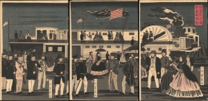
亜墨利加國蒸気車往來 / [The Comings and Goings of an American Steamship].
$5,500.00
Acquire
- Digital Map Information
- Suitable for large format printing
- Full resolution TIFF file
- ICC color profile embedded
- Delivered instantly via download link
This is Utagawa Yoshikazu's 1861 ukiyo-e woodblock triptych of an American steamship and passengers at Yokohama, an intriguing depiction of foreigners in Japan from the early days after Yokohama's opening as a treaty port. It is notable for reflecting both the curiosity of Japanese artists about the new arrivals and their imperfect understanding of these visitors. (more details)
Showcasing the Brooklyn Bridge.
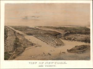
View of New-York. And Vicinity.
$5,500.00
Acquire
- Digital Map Information
- Suitable for large format printing
- File Size: 32.81 MB
- File Type: ZIP / TIFF
- ICC color profile embedded
- Delivered instantly via download link
This is a c. 1885 John Bachmann chromolithograph bird's-eye view of New York City and its vicinity, including Brooklyn, Jersey City, and Hoboken. The work captures the city flourishing as a hub of commerce as it roared towards the absorption of its neighbors: Brooklyn and Queens. The harbor is busy with steamships and sailboats, and the railheads in Jersey City are depicted with trains steaming west - engines of the Industrial Revolution. (more details)
New York in the mid-19th century.
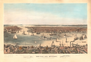
New-York and Environs, from Williamsburgh.
$5,500.00
Acquire
- Digital Map Information
- Suitable for large format printing
- File Size: 38.43 MB
- File Type: ZIP / TIFF
- ICC color profile embedded
- Delivered instantly via download link
This is an 1848 Edgar W. Foreman and Eliphalet M. Brown, Jr. bird's-eye view of New York City. The view looks west over the East River from Williamsburg towards lower Manhattan, offering a unique look at the Brooklyn waterfront life before the Civil War. (more details)
One of the Earliest Acquirable Views of New York City.
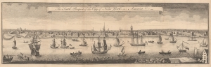
The South Prospect of the City of New York, in America.
$5,500.00
Acquire
- Digital Map Information
- Suitable for large format printing
- File Size: 10.15 MB
- File Type: ZIP / TIFF
- ICC color profile embedded
- Delivered instantly via download link
This is a superb example of the 1761 London Magazine edition of the famous Burgis view of New York City, one of the earliest generally acquirable dedicated views of the city. The bustling, nautical view shows the city as viewed from Brooklyn Heights. It illustrates from the battery in the south to the stockade of Wall Street. The East River teems with sailing ships, including three great warships. Fort George, the Exchange, City Hall, and a variety of churches can be seen, along with a shipyard. The Long Island terminus of the ferry across the East River is visible in the foreground. (more details)
Uniquely British Cheap Print: Earliest printed representation of Wellington's victory at the Battle of Vitoria.
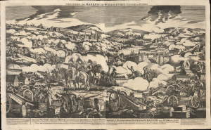
Field Marshal the Marquis of Wellington's Victory of Vittoria.
$5,000.00
Acquire
- Digital Map Information
- Suitable for large format printing
- Full resolution TIFF file
- ICC color profile embedded
- Delivered instantly via download link
The only known surviving example of this large-format woodcut 'cheap print' issued by George Thompson in 1813, celebrating the Duke of Wellington's stunning triumph over French forces at the Battle of Vitoria (June 21, 1813), a decisive battle in the years-long Peninsular War (1808 - 1814). It is likely the earliest printed representation of the battle, being a news-as-it-happened publication. The victory helped to solidify Wellington's stature as the ablest British commander of land forces, earning him the rank of field marshal and later the title of Duke. The 'cheap print' is a uniquely British form of graphic news publishing issued for distribution among the uneducated but engaged populace. (more details)
Iconic panorama of Manhattan.
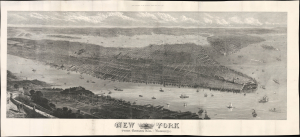
New York from Bergen Hill : Hoboken.
$5,000.00
Acquire
- Digital Map Information
- Suitable for large format printing
- Full resolution TIFF file
- ICC color profile embedded
- Delivered instantly via download link
This is a large-format (20.75 x 45.5 in.) bird's-eye view map of New York City published in 1876 as a supplement to the Illustrated London News. It captures the city the same year Central Park was completed, following decades of population growth and on the cusp of even greater transformation at the turn of the 20th century, which would bring skyscrapers, bridges, and the subway. (more details)
'Towards thee I roll, thou all-destroying but unconquering whale...' -Melville
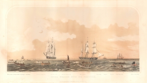
Sperm Whaling with Its Varieties.
$5,000.00
Acquire
- Digital Map Information
- Suitable for large format printing
- File Size: 21.24 MB
- File Type: ZIP / TIFF
- ICC color profile embedded
- Delivered instantly via download link
This is Benjamin Russell's stunning 1870 chromolithograph view of the American sperm whaling industry, printed by John Henry Bufford. (more details)
Celebrating the revival of Portland, Maine!
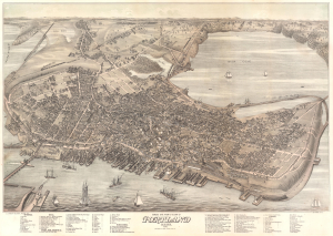
Bird's Eye View of the City of Portland Maine, 1876.
$5,000.00
Acquire
- Digital Map Information
- Suitable for large format printing
- DPI: 600
- File Size: 60.8 MB
- File Type: ZIP / TIFF
- ICC color profile embedded
- Delivered instantly via download link
An exceptional 1876 bird's-eye view map of Portland, Maine, by Joseph Warner - one of only three known views by Warner. It is considered to be the largest and best aerial view of Portland issued in the 19th century. (more details)
Bestiary of fantastical northern monsters - in a rare superior edition.
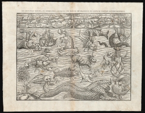
Les Monstres Marins, et Terrestres, Lesquelles on Trouve en Beaucoup di Lieux es Parties Septentrionales.
$5,000.00
Acquire
- Digital Map Information
- Suitable for large format printing
- Full resolution TIFF file
- ICC color profile embedded
- Delivered instantly via download link
Euphemistically referred to as Munster's Monsters, this is the rare 1575 Belleforest edition of Münster's bestiary of sea serpents and other astonishing monsters. Bellforest editions are highly desirable for their superior presentation and engraving. The image first appeared in the expanded 1550 editions of Munster's Cosmographia, a work which, for more than half a century, provided the European literate layperson their best source of information about the world. This scarce second block was cut in Paris for inclusion in the 1575 Belleforest edition of Cosmographia. (more details)
Japan's first train.
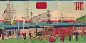
橫濱往返鐵道蒸氣車海上之圖 / [View of Steam Engine on the Seaside Yokohama Line].
$4,500.00
Acquire
- Digital Map Information
- Suitable for large format printing
- Full resolution TIFF file
- ICC color profile embedded
- Delivered instantly via download link
A fascinating 1874 ukiyo-e triptych by Utagawa Hiroshige III celebrating Japan's first passenger railway and the astonishing modernization of Yokohama under the Meiji. Opened between Yokohama and Tokyo in 1872, the steam railway became one of the most potent symbols of a country transforming itself at extraordinary speed, linking Japan's leading international treaty port with the imperial capital. Published two years after the railway's inauguration, the triptych captures not simply a train, but a defining moment in the Meiji Restoration, when foreign technology was being rapidly absorbed and transformed into the infrastructure of modern Japan. (more details)
Tokyo's Foreign Quarter in the Early Meiji Period.
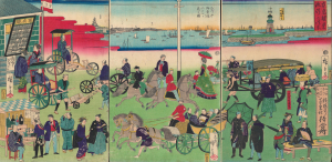
東京繁榮流行の往来 / [The Comings and Goings of Prosperity and Fashions in Tokyo].
$4,500.00
Acquire
- Digital Map Information
- Suitable for large format printing
- Full resolution TIFF file
- ICC color profile embedded
- Delivered instantly via download link
This is an 1870 ukiyo-e depiction of the Tsukiji neighborhood of Tokyo, drawn by Utagawa Hiroshige III and published by Masadaya Heikichi. It displays the neighborhood just months after it was designated as the foreign residence quarter of Tokyo following the Meiji Restoration, emphasizing the rapid importation of foreign technologies, fashion, and manners. (more details)
Iconic View of Victorian London.
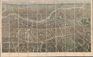
A Balloon View of London [As Seen from Hempstead].
$4,500.00
Acquire
- Digital Map Information
- Suitable for large format printing
- File Size: 107.04 MB
- File Type: ZIP / TIFF
- ICC color profile embedded
- Delivered instantly via download link
This is a spectacular example of John Henry Banks' iconic 1851 bird's-eye view of London, published by Effingham Wilson. The magnificent view illustrates countless individual buildings, a monumental accomplishment. It was produced in conjunction with the 1851 Crystal Palace Exhibition, considered the first world's fair. (more details)
Vineyard Haven at the height of its Whaling Boom.
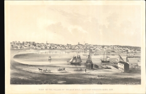
View of the Village of Holmes' Hole, Marthas Vineyard, Mass. 1856.
$4,500.00
Acquire
- Digital Map Information
- Suitable for large format printing
- File Size: 78.72 MB
- File Type: ZIP / TIFF
- ICC color profile embedded
- Delivered instantly via download link
This is a striking 1856 bird's-eye view of Vineyard Haven, Martha's Vineyard, by William H. Sturtevant and J. H. Bufford. It depicts Vineyard Haven when it was emerging as a center of whaling and a stop on the Underground Railroad. (more details)
Oldest Town in New England.
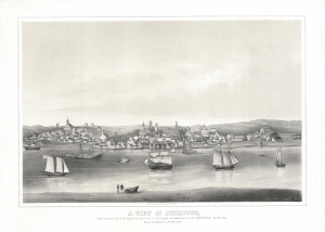
A View of Plymouth, from the beach east of the Harbor - the oldest town in New England and landing place of the Pilgrim Fathers. Dec. 22d. 1620.
$4,500.00
Acquire
- Digital Map Information
- Suitable for large format printing
- File Size: 18.05 MB
- File Type: ZIP / TIFF
- ICC color profile embedded
- Delivered instantly via download link
This is a rare lithograph view of Plymouth, Massachusetts, drawn by Timothy Barry and printed in Boston by J. H. Bufford between 1851 and 1855. Although outstripped in growth by nearby Boston, Plymouth is one of the oldest cities in the United States and was the first permanent settlement of Europeans in New England. (more details)
Dramatic view of Long Island.
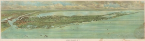
Long Island, N.Y.
$4,500.00
Acquire
- Digital Map Information
- Suitable for large format printing
- File Size: 43.06 MB
- File Type: ZIP / TIFF
- ICC color profile embedded
- Delivered instantly via download link
This is a dramatic 1902 F. W. Fells chromolithograph panoramic view of Long Island, New York. The stunning view was issued to promote the Long Island Railroad and Long Island in general, at the time undergoing an explosion of development and economic growth. (more details)
'Versailles of the Atlantic' - the epitome of steamship luxury in the post-Titanic age.
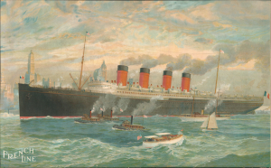
French Line.
$4,200.00
Acquire
- Digital Map Information
- Suitable for large format printing
- File Size: 78.32 MB
- File Type: ZIP / TIFF
- ICC color profile embedded
- Delivered instantly via download link
This is a rare c. 1912 Richard Rummell chromolithograph view of the French Line steamship France on the Hudson River with New York City in the background. The France was the epitome of luxury in the post-Titanic age, dubbed the 'Versailles of the Atlantic'. (more details)
Yokohama emerging as an international port.
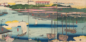
橫濱海岸圖會 / [View of the Coast at Yokohama.]
$4,000.00
Acquire
- Digital Map Information
- Suitable for large format printing
- Full resolution TIFF file
- ICC color profile embedded
- Delivered instantly via download link
An early 1860 ukiyo-e triptych by Utagawa Hiroshige II, capturing Yokohama, Japan, as it emerged as an international treaty port. Published just months after Yokohama opened to foreign trade in 1859, this panoramic view presents a city poised between the insular world of Tokugawa Japan and the profound transformations that would soon accompany sustained contact with the West. Among the earliest printed views of Yokohama, it offers a Japanese vision of the nascent port: cherry blossoms, temples, teahouses, theaters, and the notorious Miyozaki pleasure quarter occupy a landscape only beginning to accommodate global commerce. Most evocative is a woman seated in a waterfront teahouse, telescope in hand, gazing across the harbor - an image that seems to encapsulate Japan itself, watching with fascination as an unfamiliar world approaches. (more details)
Japan's First True Railway.
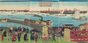
東京高輪海岸蒸氣車鐵道圖 / [Steam Train on the Railway along the Tokyo-Takanawa Coastline].
$4,000.00
Acquire
- Digital Map Information
- Suitable for large format printing
- Full resolution TIFF file
- ICC color profile embedded
- Delivered instantly via download link
A remarkable view of Japan's first modern railway, this ukiyo-e woodblock triptych was drawn by Utagawa Hiroshige III and published by Tsunajima Kamekichi in 1871. (more details)
Last surviving of the Seven Wonders of the Ancient World.
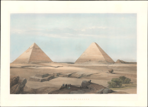
Pyramids of Geezeh.
$4,000.00
Acquire
- Digital Map Information
- Suitable for large format printing
- File Size: 17.81 MB
- File Type: ZIP / TIFF
- ICC color profile embedded
- Delivered instantly via download link
A scarce 1848 David Roberts' dramatic hand-tinted lithographic view of the Great Pyramids of Giza, Egypt - considered one of his most influential and iconic images. Roberts' work was influential in driving the Orientalism movement in 19th-century Europe. (more details)
The Rapid Expansion of Yokohama.
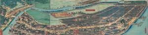
再改橫濱風景 / [Up-to-date View of Yokohama].
$4,000.00
Acquire
- Digital Map Information
- Suitable for large format printing
- Full resolution TIFF file
- ICC color profile embedded
- Delivered instantly via download link
This is a stunning 1861 panoramic set of six ukiyo-e (nishiki-e) Utagawa Sadahide woodblock prints depicting the port of Yokohama. The port opened to foreign trade in 1859, just two years earlier, becoming Japan's primary point of contact with the West. Sadahide was the most prolific among a school of woodblock artists chronicling these momentous changes. (more details)