
Fantasy Maps
Foundational thought behind the mouse, the chorded keyboard, hyperlinks, metatagging...
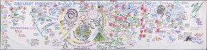
The ENGELBART HYPOTHESIS: How The Co-Evolution of Human Tools and Systems Raise Collective I.Q. to Solve Urgent and Complex Problems / Timeline 1925-2010.
$25,000.00
Acquire
An expansive hand-drawn mural drawn in 2008 by Eileen Clegg and Valerie Landau in collaboration with computer science pioneer Douglas Engelbart (signed). The mural illustrates the 'Engelbart Hypothesis', a theory of human-computer co-evolution and how it evolved from roughly 1925 to 2008. It was produced in Palo Alto for the 40th university of the 'Mother of all Demos', a landmark event on December 9, 1968 in which Engelbart and the Stanford Research Institute demonstrated prototypes for the mouse, the chorded keyboard, hyperlinks, meta tagging, and more, forming the bases of modern human-computer interface (worth watching on YouTube). (more details)
Bestiary of fantastical northern monsters - in a rare superior edition.
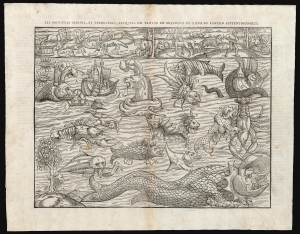
Les Monstres Marins, et Terrestres, Lesquelles on Trouve en Beaucoup di Lieux es Parties Septentrionales.
$5,000.00
Acquire
- Digital Map Information
- Suitable for large format printing
- Full resolution TIFF file
- ICC color profile embedded
- Delivered instantly via download link
Euphemistically referred to as Munster's Monsters, this is the rare 1575 Belleforest edition of Münster's bestiary of sea serpents and other astonishing monsters. Bellforest editions are highly desirable for their superior presentation and engraving. The image first appeared in the expanded 1550 editions of Munster's Cosmographia, a work which, for more than half a century, provided the European literate layperson their best source of information about the world. This scarce second block was cut in Paris for inclusion in the 1575 Belleforest edition of Cosmographia. (more details)
Futuristic city of Anarchy, with a death ray.
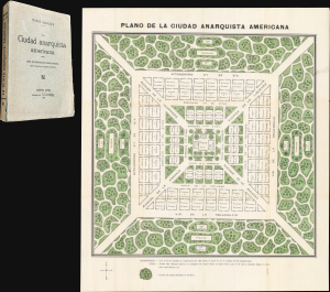
La Ciudad Anarquista Americana. / La Ciudad Anarquista Americana: Obra de Construcción Revolucionaria.
$3,750.00
Acquire
- Digital Map Information
- Suitable for large format printing
- Full resolution TIFF file
- ICC color profile embedded
- Delivered instantly via download link
This is a rare 1914 color-printed folding plan of French-Argentine Pierre Quiroule's Ciudad Anarquista Americana, a cartographic vision of an ideal anarchist city. Conceived as the physical setting for Quiroule's revolutionary utopian novel, La Ciudad Anarquista Americana: Obra de Construcción Revolucionaria, the plan translates radical political and social philosophy into a rigorously ordered urban landscape of monumental avenues, communal institutions, gardens, schools, and public gathering places. (more details)
French Catholicism and the Secular State.

Carte allégorique du Vice et de ses Résultats.
$3,750.00
Acquire
- Digital Map Information
- Suitable for large format printing
- Full resolution TIFF file
- ICC color profile embedded
- Delivered instantly via download link
This is a rare c. 1880 broadside allegorical map of Vice made by the French Catholic curate Abbé Faure. The image reflects the tensions facing French Catholicism, which was undergoing a transformation and gradual decline, caught between the legacy of tradition and the emergence of a secular Republican state. (more details)
Inspiration for the animated series 'Disenchantment'. - Matt Groening
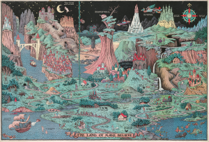
The Land of Make Believe.
$3,000.00
Acquire
- Digital Map Information
- Suitable for large format printing
- File Size: 118.23 MB
- File Type: ZIP / TIFF
- ICC color profile embedded
- Delivered instantly via download link
This is a 1930 second edition of the Jaro Hess pictorial map of the Land of Make Believe. It emerged at the height of the Great Depression (1929 - 1933) and offered much-needed escapism during those brutal times. The map incorporates some 60 nursery rhymes, fairy tales, and children's stories with creative, entertaining, and attractive illustrations. (more details)
Middle Earth 'The Wilderness'.
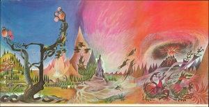
This is the rare 1965 Ballantine 'Wilderness' poster by Barbara Remington issued for the American release of the paperback edition of J. R. R. Tolkien's Lord of the Rings. The artwork was used as cover art for each of the three volumes, which, together, formed a triptych. The artwork was also issued, as here, in an enormous panoramic poster wherein all three images appear as one. Remington's work played a significant role in popularizing Tolkien's work worldwide. (more details)
Earliest obtainable printing of the iconic Tolkien promotional map.
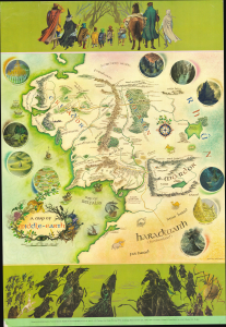
This is the English 'George Allen and Unwin' first trade printing of the iconic 1970 poster map of J. R. R. Tolkien's Middle Earth drawn by Pauline Baynes to promote the Lord of the Rings. It is the earliest obtainable iteration of the map, with notably superior production quality and printing over all subsequent editions. Tolkien heaped praise upon Baynes' work, saying, 'They are more than illustrations, they are a collateral theme. I showed them to my friends whose polite comment was that they reduced my text to a commentary on the drawings.' (more details)
Flash-in-the-Pan Poet or Utopian Visionary?
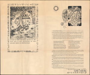
A map of the universe issued in 1909. The map is one beginning of the golden book of Springfield...
$1,500.00
Acquire
- Digital Map Information
- Suitable for large format printing
- File Size: 40.7 MB
- File Type: ZIP / TIFF
- ICC color profile embedded
- Delivered instantly via download link
This is a large-format signed 'map of the universe,' produced in 1929 by the author and poet Vachel Lindsay, whose work was characterized by ethereal imagery and esoteric influences. (more details)
Iconic Setting of Forgotten Realms.
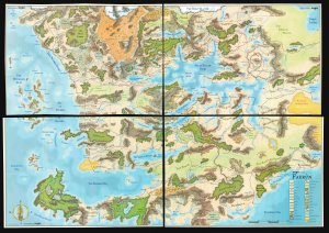
This is a scarce 2001 four-part wall map of the continent of Faerûn, the setting of numerous Forgotten Realms novels, video games, and related Dungeons and Dragons modules. (more details)
Origins of the American-style Renaissance Fair.
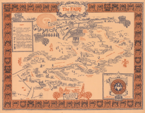
Jog Yur Deep and Mery Way to the Faire... / A Map of The Renaissance Pleasure Faire.
$950.00
Acquire
This is a 1973 Theme Events map of the Northern California Renaissance Pleasure Faire held in Novato, California. The Renaissance Pleasure Faire is primarily responsible for setting the mold for the American-style Renaissance fair, which spread in both geographic scope and popularity in the decades after the earliest fairs held in Southern and Northern California. (more details)
First Disney map of Never Never Land.
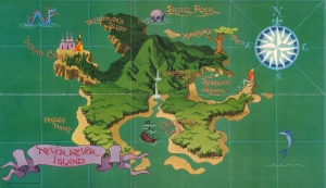
Never Never Island.
$950.00
Acquire
- Digital Map Information
- Suitable for large format printing
- File Size: 38.35 MB
- File Type: ZIP / TIFF
- ICC color profile embedded
- Delivered instantly via download link
This is a 1952 Walt Disney Productions pictorial map of Never Never Island from the movie Peter Pan. It is the first printed map of Disney's Never Never Island, published one year before the 1953 film Peter Pan was released. Recognizable locales include Mermaid Cove, Skull Island, and the Indian Camp. No characters from the movie appear, but they were incorporated in later editions. (more details)
Doomed! Doomed I say!
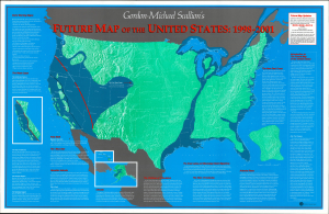
This is Gordon-Michael Scallion's 1993 doomsday map of the United States. A self-styled prophet, Scallion here lays out what he sees as a series of imminent catastrophes that will reshape the map of the country. (more details)
A 'Strange and Bewildering' Wonderland.
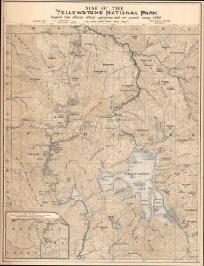
Map of the Yellowstone National Park. / Northern Pacific R.R. The Wonderland Route to the Pacific Coast / Alice's Adventures in the New Wonderland The Yellowstone National Park.
$850.00
Acquire
- Digital Map Information
- Suitable for large format printing
- Full resolution TIFF file
- ICC color profile embedded
- Delivered instantly via download link
This impressive, early promotional chromolithographic map of Yellowstone National Park was prepared by Carl J. Hals and Arvid Rydstrom in 1882 and was printed by Poole Brothers for the Northern Pacific Railroad. It coincided with the Northern Pacific's opening of a rail link to the park, the first easy means for the masses to access it, which helped boost the park's image in the popular imagination and spur Western American nature tourism. (more details)
Very Tall Tales.
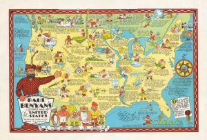
America's only folk-lore character Paul Bunyan's pictorial map of the United States Depicting Some of his Deeds and Exploits.
$500.00
Acquire
- Digital Map Information
- Suitable for large format printing
- File Size: 47.06 MB
- File Type: ZIP / TIFF
- ICC color profile embedded
- Delivered instantly via download link
An amusing c. 1935 pictorial map of the United States by Raymond Dewitt Handy celebrating the folklore of Paul Bunyan. (more details)
Land of Mother Goose characters and rhymes.
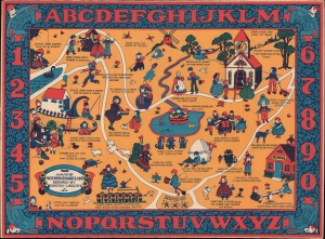
A Map of Mother Goose Land.
$500.00
Acquire
- Digital Map Information
- Suitable for large format printing
- File Size: 18.73 MB
- File Type: ZIP / TIFF
- ICC color profile embedded
- Delivered instantly via download link
This is a 1933 Dorothy Linscott pictorial map of Mother Goose Land drawn for nursery decoration. (more details)
Humpty-Dumpty, Little Bo Peep and more!
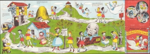
Jimmy and Sally in Mother Goose Land.
$450.00
Acquire
- Digital Map Information
- Suitable for large format printing
- File Size: 16.88 MB
- File Type: ZIP / TIFF
- ICC color profile embedded
- Delivered instantly via download link
This is a 1945 Jeffrey Victor and Neel Bate pictorial fantasy map of Jimmy and Sally’s adventures in Mother Goose Land. (more details)
Tolkien's Middle-Earth!
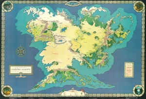
An Artist's Interpretation of Middle Earth including the Wild Lands - east, south, and north.
$450.00
Acquire
This is a 1982 map of J. R. R. Tolkien's fantasy world 'Middle-Earth' by Peter C. Fenlon. Fans of Tolkien will be quick to recognize the northeastern part of the map, generally known as the Westlands, encompassing the main theater of both the Hobbit and The Lord of the Rings. The cartography for these areas, from Forodwaith to Umbar and from the western ocean (Belegaer) to the Sea of Rhûn, is drawn directly from the iconic map that accompanied the The Lord of the Rings. (more details)
Hilarious temperance allegory and broadsheet promoting Walker's Vinegar Bitters.
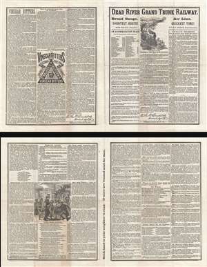
Dead River Grand Trunk Railway!
$400.00
Acquire
- Digital Map Information
- Suitable for large format printing
- File Size: 15.11 MB
- File Type: ZIP / TIFF
- ICC color profile embedded
- Delivered instantly via download link
An outrageously amusing c. 1869 temperance flyer in a small folio masquerading as a train schedule for the allegorical 'Dead River Grand Trunk Railroad.' The brochure rails against the twin evils of drunkenness and tobacco smoking while at the same time ... (more details)
Iconic Setting of Forgotten Realms adventures of Drizzit do'Urden.
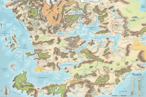
This is a scarce 2001 map of the continent of Faerûn, the setting of numerous Forgotten Realms novels, video games, and related Dungeons and Dragons modules. (more details)
Birthplace of the Renaissance.
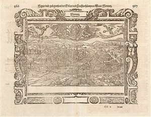
Figur und gelegenheit Edlen und hochberhuempten Statt Floretz.
$350.00
Acquire
- Digital Map Information
- Suitable for large format printing
- Full resolution TIFF file
- ICC color profile embedded
- Delivered instantly via download link
This is a woodcut view of Florence, Italy, included in Sebastian Münster's Cosmographei of 1614. A hub of medieval European trade and finance, Florence was among the wealthiest cities of the fifteenth century and is considered the birthplace of the Renaissance. An architectural and artistic treasure, Florence has been since 1982 a UNESCO World Heritage Site. Consequently, the 16th century city presented here is quite recognizable: the medieval walled city is bisected by the Arno, with four bridges spanning the flood. The Duomo, the baptistery of San Giovanni, and the Campanile are all easily found.
Despite the late date of this example, it was one of the earliest printed views of the city. At the time of its addition to the work in 1572, it was preceded in print only by the view from Hartmann Schedel's 1493 Liber chronicarum and the 1550 view in Münster's Cosmographia which the present work replaced. The same year of 1572 saw the publication of Braun and Hogenberg's city book, which also included a view of Florence - but the two have no resemblance, and one is not a copy of the other. Münster's publishers and heirs, Heinrich and Sebastian Petri, appear to have used the author's original map as the model for this woodcut. The main changes to that view are decorative elements: the ornate border woodcuts, the two winged Victories presenting the city with laurels, and (top and center,) the city coat of arms, flanked by two women with palm branches: also avatars of triumph. (more details)
Despite the late date of this example, it was one of the earliest printed views of the city. At the time of its addition to the work in 1572, it was preceded in print only by the view from Hartmann Schedel's 1493 Liber chronicarum and the 1550 view in Münster's Cosmographia which the present work replaced. The same year of 1572 saw the publication of Braun and Hogenberg's city book, which also included a view of Florence - but the two have no resemblance, and one is not a copy of the other. Münster's publishers and heirs, Heinrich and Sebastian Petri, appear to have used the author's original map as the model for this woodcut. The main changes to that view are decorative elements: the ornate border woodcuts, the two winged Victories presenting the city with laurels, and (top and center,) the city coat of arms, flanked by two women with palm branches: also avatars of triumph. (more details)
Cereal Serial.
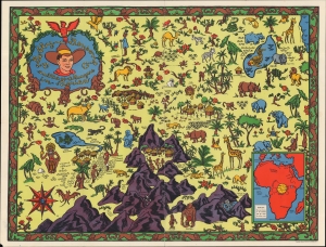
Bobby Benson and the H-O Rangers in Africa.
$250.00
Acquire
- Digital Map Information
- Suitable for large format printing
- File Size: 23.26 MB
- File Type: ZIP / TIFF
- ICC color profile embedded
- Delivered instantly via download link
A colorful pictorial map combining elements of actual geography with an imagined African landscape, prepared c. 1935 by the Hecker H-O Company to promote the radio show character Bobby Benson and, by extension, their cereal. (more details)
The great age of Radio.
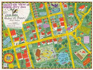
Eagle's Eye View of Weber City.
$150.00
Acquire
- Digital Map Information
- Suitable for large format printing
- File Size: 20.03 MB
- File Type: ZIP / TIFF
- ICC color profile embedded
- Delivered instantly via download link
This is a 1935 Amos 'n' Andy map of Weber City, a high-class housing development created for the Amos 'n' Andy radio show. All fictional, coverage extends from Amos Jones Alley to Van Porter Road and from the 'love nest were Mr. and Mrs. Andrew H. Brown is going to live' and 'Everybody's Church' to Weber Park and 'Bite-a-Minute Lake'. A comical look at a fictional town, Weber City evidently played a role in, or was the setting for, at least one Amos 'n' Andy radio show. (more details)