
Persia - Afghanistan
Iranian reaction to Russian Imperialism.
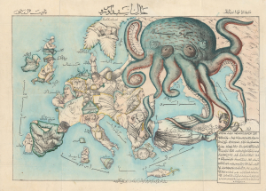
New Map of Europe. / خارطه جديده اوروپا
$24,000.00
Acquire
- Digital Map Information
- Suitable for large format printing
- Full resolution TIFF file
- ICC color profile embedded
- Delivered instantly via download link
A rare c. 1880 Iranian-issued Ottoman Turkish / Farsi version of Englishman Fred Rose's iconic 1877 Serio Comic War Map, in which expansionist Imperial Russia is analogized as a menacing, grasping octopus. The map was issued in Qajar Iran (Persia), but for an Ottoman Turkish audience (there is also a Farsi variant). Both countries were then being menaced by Russia, Turkey in the recent Russo-Turkish War of 1877-1878, and Iran as a field of contention in the Great Game - so the work would have proved widely resonant with a possible hope of fostering mutual support. Text is partially in Turkish, partially in Farsi. (more details)
An epic cartographic achievement.
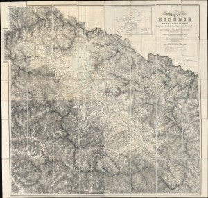
Map of Kashmir with part of Adjacent Mountains surveyed on the basis of the Great Trigonometrical survey of India, under the instructions of Lieutt. Colonel A. S. Waugh, Engineers, F.R.S. F. R.G.S. Survey General of India, by Captain T. G. Montgomerie, Engineers. F.R.G.S. 1st. Assistants under his orders, during 1855, 56 and 57.
$7,000.00
Acquire
- Digital Map Information
- Suitable for large format printing
- File Size: 264.53 MB
- File Type: ZIP / TIFF
- ICC color profile embedded
- Delivered instantly via download link
This is the first edition of Thomas G. Montgomerie's 1859 large-scale map of Kashmir and Jammu - considered the greatest achievement of one of the most epic concerted cartographic efforts in history, the Great Trigonometrical Survey of India. (more details)
First and largest chart of Karachi as an EIC Port.
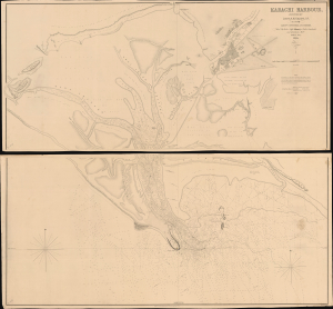
Karachi Harbour, surveyed by Lieut. A. M. Grieve, I.N. Assisted by Lieuts. Constable and Barker.
$6,000.00
Acquire
- Digital Map Information
- Suitable for large format printing
- DPI: 600
- File Size: 112.65 MB
- File Type: ZIP / TIFF
- ICC color profile embedded
- Delivered instantly via download link
A seminal 1854 large-scale Indian Navy Albany M. Grieve nautical map of Karachi Harbor, in the Sindh region of what is today Pakistan. This is the second and certainly the largest map of Karachi, and the first as an East India Company port. It was issued in the same year that marked Karachi Harbor's opening to EIC traders and the completion of the connecting Napier Mole causeway - illustrated here. (more details)
First Anglo-Afghan War.
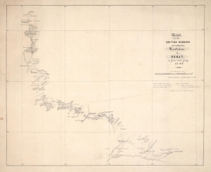
Route of the British Mission proceeding from Kandahar to Herat in June and July A.D. 1839.
$4,500.00
Acquire
- Digital Map Information
- Suitable for large format printing
- DPI: 600
- File Size: 14.01 MB
- File Type: ZIP / TIFF
- ICC color profile embedded
- Delivered instantly via download link
This is an 1839 James Bedford and H.M. Smith 'Great Game' map of Afghanistan, covering from Kandahar to Herat in the first few months of the First Angl-Afghan War (1838 - 1842). This map and the attendant conflicts mark the beginning of the Great Game. (more details)
Superb Original Color.
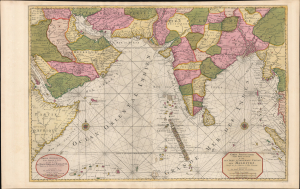
Carte Particuliere d'une Partie d'Asie ou sont Les Isles D'Andemaon, Ceylan, Les Maldives.../ Partie Occidentale d'une D'Asie ou sont les Isles De Zocotora De l'Amirante...
$4,000.00
Acquire
- Digital Map Information
- Suitable for large format printing
- Full resolution TIFF file
- ICC color profile embedded
- Delivered instantly via download link
This is a premium full-original-color example of Pierre Mortier's 1700 nautical chart and map of the Indian Ocean and the adjacent parts of eastern Africa, Arabia, Persia, India, and the Malay Peninsula. Countless islands are mapped, including the Maldives, Sri Lanka, and Sumatra. (more details)
Indian Army's Showcase Campaign in the Great War.
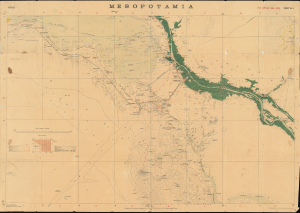
Mesopotamia. Sheet No. 1. Basrah. No.888 D.D.D. 1917 (2.D.O.) S.I. 2000.
$3,500.00
Acquire
- Digital Map Information
- Suitable for large format printing
- Full resolution TIFF file
- ICC color profile embedded
- Delivered instantly via download link
This is a rare 1917 Survey of India map focusing on the key strategic regions of Basra-Zubair in south-eastern Iraq and the adjacent Khorramshahr area of Persia, and it is one of the first maps to show Abadan, the first oil boomtown of the Middle East. It was also a showcase theater for the employment of units of the Indian Army, whose officers were given charge of the campaign at the beginning of the war. (more details)
A Remarkable Survival: an in-house Indian Survey map compiling manuscript results from contemporaneous exploration.
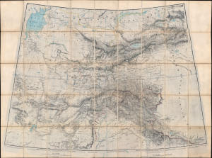
[Turkestan with the adjoining portions of the British and Russian territories.]
$3,500.00
Acquire
- Digital Map Information
- Suitable for large format printing
- File Size: 115.78 MB
- File Type: ZIP / TIFF
- ICC color profile embedded
- Delivered instantly via download link
This monumental c. 1869 British intelligence map from the height of the Great Game details the southern frontier of the Russian Empire in Asia, extending southwards to the British sphere of influence in Afghanistan, the Punjab, and Kashmir. This represented the primary theatre of the Great Game - the struggle for control in Central Asia between Russia and the British Empire. The map includes numerous manuscript annotations and updates, including records of George Hayward's ill-fated reconnaissance (spy) mission into the Pamirs. (more details)
The Route to the East Indies.
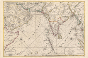
Carte Particuliere d'une Partie d'Asie ou sont Les Isles D'Andemaon, Ceylan, Les Maldives.../ Partie Occidentale d'une D'Asie ou sont les Isles De Zocotora De l'Amirante...
$2,800.00
Acquire
- Digital Map Information
- Suitable for large format printing
- DPI: 600
- File Size: 116.25 MB
- File Type: ZIP / TIFF
- ICC color profile embedded
- Delivered instantly via download link
This is a superb, original-color example of Pierre Mortier's 1700 chart and map of the Indian Ocean. This grand, two-sheet engraving also maps the surrounding lands of eastern Africa, Arabia, Persia, India, and the Malay Peninsula. Countless islands are mapped, including the Maldives, Sri Lanka, and Sumatra. As indicated by the presence of two separate cartouches, the two sheets could also be had as separate works; however, in Mortier's mammoth Neptune François they were frequently bound joined, as here. (more details)
First Anglo-Afghan War: One-of-a-kind manuscript map of Kandahar.
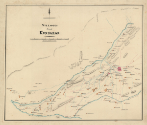
Villages of Kundahar.
$2,500.00
Acquire
- Digital Map Information
- Suitable for large format printing
- Full resolution TIFF file
- ICC color profile embedded
- Delivered instantly via download link
An exquisitely drafted manuscript map of Kandahar, Afghanistan, and its immediate environs during the First Anglo-Afghan War (1839 - 1842). Resplendently drafted and colored by the Indian Quartermaster General's Office (QMG), the map incorporates traditional Bengali handmade inks. During this conflict, Kandahar was the most important British base in Afghanistan, and the surrounding region was a theater of fierce and constantly evolving guerrilla war. The present map must be the result of direct field mapping, likely completed under wartime conditions, yet it nonetheless represents one of the earliest accurate maps of Kandahar and its immediate vicinity. This is, moreover, one of the very few surviving original manuscript maps from the First Anglo-Afghan War, the first (and not the last) major Western foray into Afghanistan. (more details)
'For an earnest collector of old maps of Persia, this could be the first map.' ~ Alai
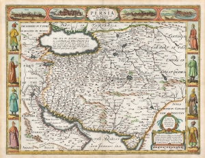
The Kingdome of Persia with the cheef Citties and Habites described. By John Speede.
$2,200.00
Acquire
- Digital Map Information
- Suitable for large format printing
- Full resolution TIFF file
- ICC color profile embedded
- Delivered instantly via download link
This is John Speed's map of Persia in its 1676 Bassett and Chiswell edition. This beautiful map is one of the most desirable early maps of the Near East, combining superb engraving, attractive Dutch styling, and entertaining and abundant English text. While Speed cannot be accused of innovation as a mapmaker, he was an accomplished historian and compiler. His atlases of the British Isles and the World are among the signal cartographic works of the 17th century. (more details)
On the brink of war in Central Asia.
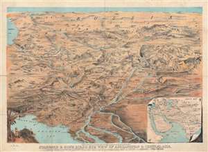
Stannard and Son's Bird's-Eye View of Afghanistan and Central Asia.
$2,200.00
Acquire
- Digital Map Information
- Suitable for large format printing
- File Size: 39.76 MB
- File Type: ZIP / TIFF
- ICC color profile embedded
- Delivered instantly via download link
This is a rare 1885 Alfred Concanen bird's-eye view map of Central Asia. Karachi, the Indus River Delta, and the Persian Gulf occupy the foreground and India, Iran, Afghanistan, reach toward the horizon, with Russia in the background. The Caspian Sea appears along the left border. Numerous important cities, including Kabul (Cabul), Samarkand, Bukhara, Tehran, Isfahan, Kandahar, Srinagar, and Hyderabad are all labeled, along with many others. Mountain ranges and mountain passes are identified. (more details)
Supplying the Soviet War Effort.
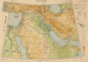
Persian Gulf. Asia Sheet 32 (1/M North F-J 36-40). M.D.R. 533/12035.
$1,500.00
Acquire
- Digital Map Information
- Suitable for large format printing
- Full resolution TIFF file
- ICC color profile embedded
- Delivered instantly via download link
This is a 1945 British War Office map of the Middle East, produced in the later stages of World War II (1939 - 1945). Among other features, it reflects improvements in rail and road infrastructure in Iran, which the Allies arranged to facilitate the ferrying of Lend-Lease supplies to the Soviet Union. (more details)
Colonial warfare in one of the British Empire's frontiers.
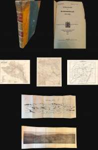
Operations in Waziristan 1919 - 1920. Confidential. Serial No. 224.
$1,400.00
Acquire
- Digital Map Information
- Suitable for large format printing
- Full resolution TIFF file
- ICC color profile embedded
- Delivered instantly via download link
This is the official 1921 confidential report on the British-Indian military campaign to Waziristan (1919 - 1920), compiled and published by the General Staff Army Headquarters in India, with maps produced by the Survey of India. The volume offers a comprehensive and rare account of the campaign and is essential for understanding British military strategy on the tumultuous Afghan frontier. (more details)
Afridi revolt in the Kyber.
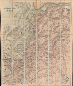
Stanford's Sketch Map of The North-Western Frontier of India.
$1,200.00
Acquire
- Digital Map Information
- Suitable for large format printing
- File Size: 41.73 MB
- File Type: ZIP / TIFF
- ICC color profile embedded
- Delivered instantly via download link
A remarkable 1887 map of northwestern Pakistan and northeastern Afghanistan produced at the height of the Great Game to satisfy British interest in the Tirah Campaign. Centered on Peshawar, the map covers modern-day Khyber Pakhtunkhwa (Khyber Pass), from Fayzabad (Faizabad), Afghanistan, to Jhelum, Pakistan, and parts of Punjab. (more details)
Anti-German propaganda mission in Tehran.
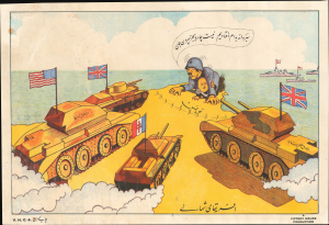
افریقا ی شمال ی / [North Africa].
$1,200.00
Acquire
- Digital Map Information
- Suitable for large format printing
- Full resolution TIFF file
- ICC color profile embedded
- Delivered instantly via download link
The only known surviving example of a 1943 propaganda broadside issued in Tehran, Iran, by Victory House - a propaganda arm of the British government operating in Iran during World War II (1939 - 1945). It is part of a series of extraordinary broadsides issued by the pro-British Victory House to sway Iranian political sentiment towards the Allies by promoting a message of inevitable victory. The image here illustrates American, British, and Free French tanks surging towards the fortified northern tip of Tunisia, where Hitler and Mussolini cower as a fleet of British battleships approaches from the sea - imagery representative of the Tunisian Campaign, which, when this was issued early in 1943, had driven the German/Italian Afrika Korps to a last stand. (more details)
Last Stage of the 'Great Game'.
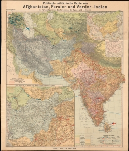
Politisch-militärische Karte von Afghanistan, Persien und Vorder-Indien : zur Veranschaulichung des Vordringens der Russen und Engländer.
$950.00
Acquire
- Digital Map Information
- Suitable for large format printing
- Full resolution TIFF file
- ICC color profile embedded
- Delivered instantly via download link
An intriguing c. 1900 by Paul Langhans map of Central and South Asia, focusing on Afghanistan. It coincided with the last stage of the 'Great Game' competition between Russia and Great Britain, whose military forces throughout the region are meticulously cataloged. (more details)
Tehran, before the Ayatollah.
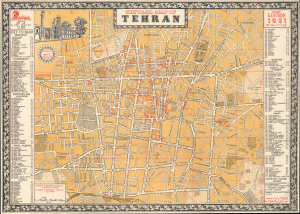
This is a 1961 Abbas Sahab city plan or map of central Tehran, Iran. It is one of the few obtainable maps of Tehran published in Tehran before the 1979 Islamic Revolution. (more details)
Oil and Geopolitics.
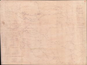
Distribution Map of Iran.
$750.00
Acquire
- Digital Map Information
- Suitable for large format printing
- File Size: 45.78 MB
- File Type: ZIP / TIFF
- ICC color profile embedded
- Delivered instantly via download link
This is a very curious c. 1950 diazotype map of Iran detailing the facilities and distribution system of the Anglo-Iranian Oil Co. It displays the country's oil distribution infrastructure around the time of the fateful 1953 coup, which had long-lasting implications for Iran's economic and political trajectory. (more details)
State of the Art Mapping of Afghanistan.
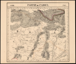
Partie du Caboul Asie no.67.
$750.00
Acquire
- Digital Map Information
- Suitable for large format printing
- DPI: 600
- File Size: 58.86 MB
- File Type: ZIP / TIFF
- ICC color profile embedded
- Delivered instantly via download link
This is the 1827 Vandermaelen map of Afghanistan, Pakistan, and the Hindu Kush. It is the first large-scale atlas map to focus on the area, and the first to be executed in lithography. The map's detail - drawn from the first-hand exploration of John Macdonald Kinneir on behalf of the British East India Company - was not superseded until the First Anglo-Afghan War (1838 - 1842). (more details)
Russian mapping of their southeastern frontier.
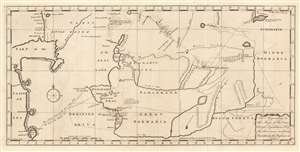
The Appendage to the Maps of the Orenburg Expedition, No. 1. and the Provinces in Siberia, No. 2. As taken by the Russians in 1747.
$650.00
Acquire
- Digital Map Information
- Suitable for large format printing
- Full resolution TIFF file
- ICC color profile embedded
- Delivered instantly via download link
This fascinating map of modern-day Turkmenistan, Uzbekistan and Tajikistan, engraved by John Gibson in 1753, was based on Russian maps Jonas Hanway included in his An Historical Account of the British Trade Over the Caspian Sea. Hanway supplemented the results of his own travels to the Caspian with a multiplicity of travelers' journals and the maps of other explorers, compiling an exhaustive collection of the most up to date geographical sources for this area, which remained one of the most obscure regions in the world. The map is centered on the Silk Route capitals of Samarkand and Bukhara, east of the Aral Sea. The cities of Tashkent and Badakshan are shown; the northeastern Caspian Sea and the lower part of the Ural River appears at the west; the eastern shore of the endoheiric Aral Sea is shown as well, but the western shore and indeed all the land between the Caspian and the Aral Sea is obscure. (The nomadic Tatars occupying that region were notoriously ill disposed towards travelers.) The map excels in detailing the regions south and east of the Aral, which include cities having 'plantations of trees' and 'mountains on which the Persians say is Gold and Silver and Lapis Lazuli.' (more details)
The most detailed chart of the Caspian Sea of the mid-18th century.
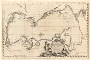
A Plain Chart of the Caspian-Sea, According to the Observations of Capt. John Elton, Author of Elton's Quadrant, and Thomas Woodroofe, Master of the British Ship Empress of Russia, Who navigated this Sea three years; Presented to Mr. Jonas Hanway of St. Petersburgh in 1745 by his most Obedient Servant Thomas Woodroofe.
$650.00
Acquire
- Digital Map Information
- Suitable for large format printing
- Full resolution TIFF file
- ICC color profile embedded
- Delivered instantly via download link
This superbly detailed chart of the Caspian Sea, engraved by John Gibson in 1753, was the first detailed charting of that sea following the work of Carl Van Verden, and arguably the better chart. It was produced for inclusion in Jonas Hanway's An Historical Account of the British Trade Over the Caspian Sea and relies on details provided Hanway by captains John Elton and Thomas Woodroofe, whose accounts have been preserved nowhere but in Hanway's work. (more details)
American priorities: oil before disputes.
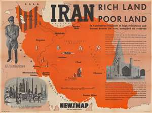
Iran. Rich Land Poor Land.
$550.00
Acquire
- Digital Map Information
- Suitable for large format printing
- Full resolution TIFF file
- ICC color profile embedded
- Delivered instantly via download link
This is a 1946 Army Information Branch pictorial map of Iran. Published during the Iran Crisis of 1946, dark brown stripes emphasize Iranian Azerbaijan, then occupied by Soviet troops and where two pro-Soviet separatist 'republics' were established. This crisis ranks as one of the first of the Cold War (1947 - 1991). (more details)
Russian mapping of their southeastern frontier.
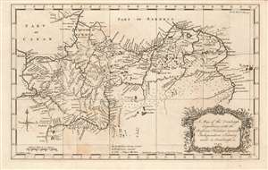
A Map of the Orenburgh Expedition, with the Russian Frontiers towards Independent Tartary, made in Orenburgh in 1747.
$550.00
Acquire
- Digital Map Information
- Suitable for large format printing
- Full resolution TIFF file
- ICC color profile embedded
- Delivered instantly via download link
This fascinating map, engraved by John Gibson in 1753, depicts modern-day southern Russia, along the empire's contentious frontier with the lands of the Kazakh and Oirat tribes. These and other tribes from what the map terms 'Independent Tartary' made regular incursions into Russian territory, and the first part of the 18th century was characterized by Russia's efforts to stem those incursions. Among these efforts was the construction of the Irtysh line, a series of fortifications clearly shown on this map spanning the Volga and the Irtysh Rivers, for much of the distance following the north bank of the Ural, or Yaik river. The map distinguishes between those fortifications already constructed, and those which were yet intended to be built. (more details)
Striking 19th century manuscript school-girl map of Persia.
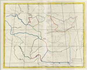
Oriens.
$500.00
Acquire
- Digital Map Information
- Suitable for large format printing
- DPI: 300
- File Size: 9.81 MB
- File Type: ZIP / TIFF
- ICC color profile embedded
- Delivered instantly via download link
An unusual and beautiful 1823 manuscript map of Persia and Afghanistan (Iran) in antiquity. The map generally follows the historical atlas work of the english cartographer James Wyld however is a fully independent and unique hand rendered production. The ... (more details)
First Lithograph Map of Iran and Afghanistan.
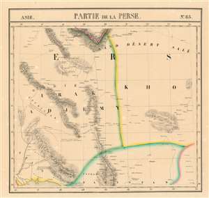
Partie de la Perse et du Caboul Asie no. 66.
$450.00
Acquire
- Digital Map Information
- Suitable for large format printing
- DPI: 600
- File Size: 23.58 MB
- File Type: ZIP / TIFF
- ICC color profile embedded
- Delivered instantly via download link
This is the 1827 Vandermaelen map of the eastern deserts of Iran and the Western part of Afghanistan. It is the first large-scale atlas map to focus on the area, and the first to be executed in lithography. (more details)
A wonderful road map of Iran highlighting its historic sites, including Persepolis and the Blue Mosque.
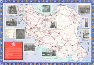
This is a c. 1970 Aziz Hatami pictorial road map of Iran. The map depicts the region from Iraq to Afghanistan and from the Caucasus, the Caspian Sea, and Turkmenistan to the Persian Gulf and the Gulf of Oman. Cities, towns, and villages throughout the country are labeled and connected by varying grades of roads. All roads are illustrated in red, with tarmac roads highlighted by two thick parallel lines connected by crosshatching. Solid, passable dirt roads are marked by two parallel red lines, and third-class roads, which the map advises to use only in dry weather, are marked by a single red line. Dashed lines, signifying tracks and caravan roads, 'should be used sparingly and not at all in winter'. Tehran, the capital of Iran, is marked by two concentric circles, while large red dots signify provincial capitals. Distances between cities are given in miles, and airports, historic sites, and gas stations are also identified. Railways and projected railways are also illustrated, as are Iran's rivers and lakes. The blue dashed lines appear to mark provinces, but there is no clear indication that this is so. The whole is surrounded by photographs of famous sites around Iran, including Persepolis, the Jum'a Mosque in Yazd, the Safavid City in Isfahan, and the Blue Mosque in Tabriz. (more details)
The beginning of events leading to the Second Anglo-Afghan War.

Map of Eastern Persia to illustrate the Paper by Major General Sir F. J. Goldsmid.
$350.00
Acquire
- Digital Map Information
- Suitable for large format printing
- File Size: 6.04 MB
- File Type: ZIP / TIFF
- ICC color profile embedded
- Delivered instantly via download link
This is an 1873 John Murray map of eastern Persia, or modern-day south-central Iran. A thin red line highlights Sir Frederic John Goldsmid's route through the region from Bandar Abbas on the Strait of Hormuz north to Mash-had. Goldsmid was dispatched to this region in order to enforce a British-negotiated Selstan frontier boundary settlement, a move in the 'Great Game' intended to secure Persia and Afghanistan as buffer provinces between Russia and British India. (more details)
The Infrastructure of Iran.
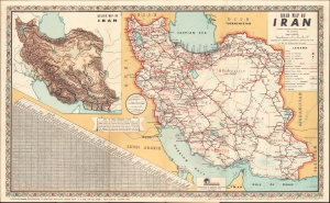
This is a 1960 folding road map of Iran, prepared by Abbas Sahab, Iran's most prominent contemporary map publisher. It reflects the heavy investments in infrastructure undertaken by the Shah's government in the preceding years. (more details)
The Ancient Roman World.
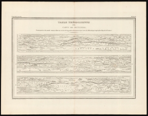
Table Théodosienne dite Carte de Peutinger.
$200.00
Acquire
- Digital Map Information
- Suitable for large format printing
- DPI: 600
- File Size: 27.64 MB
- File Type: ZIP / TIFF
- ICC color profile embedded
- Delivered instantly via download link
This is a 19th century printing of the Peutinger Table, one of the only and most important survivals of ancient Roman geography. It is a reduction of the only surviving example of an itinerarium pictum, a visual guide to the Roman road system. Its title here, Table Théodosienne, refers to the assumption that the map was drawn during the reign of Emperor Theodosius. (more details)
Beautiful mid-19th century map of the Middle East.
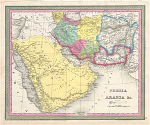
Persia Arabia etc.
$150.00
Acquire
- Digital Map Information
- Suitable for large format printing
- DPI: 300
- File Size: 6.78 MB
- File Type: ZIP / TIFF
- ICC color profile embedded
- Delivered instantly via download link
A fine example of Thomas Cowperthwait and S. A. Mitchell's 1854 map of Persia, Afghanistan, and Arabia. Centered on the Persian Gulf, this map covers from the Mediterranean and Red Sea eastward as far as India, including all of modern day Saudi Arabia, ... (more details)
Beautiful map of Persia Syria and the Holy Land.
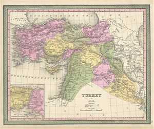
Turkey in Asia.
$150.00
Acquire
- Digital Map Information
- Suitable for large format printing
- DPI: 300
- File Size: 7.69 MB
- File Type: ZIP / TIFF
- ICC color profile embedded
- Delivered instantly via download link
A fine example of S. A. Mitchell's 1849 map of Turkey in Asia. Centered on the Holy Land, this map covers the Asian territories claimed by the Turkish Ottoman Empire. These include the modern day countries of Turkey, Cyprus, Syria, Jordan, Lebanon, and ... (more details)
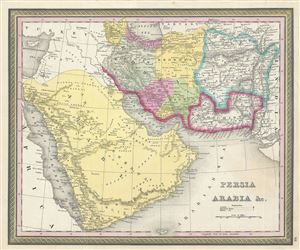
Persia Arabia etc.
$150.00
Acquire
- Digital Map Information
- Suitable for large format printing
- DPI: 300
- File Size: 7.45 MB
- File Type: ZIP / TIFF
- ICC color profile embedded
- Delivered instantly via download link
A fine example of Thomas Cowperthwait and S. A. Mitchell's 1850 map of Persia, Afghanistan, and Arabia. Centered on the Persian Gulf, this map covers from the Mediterranean and Red Sea eastward as far as India, including all of modern day Saudi ... (more details)