
Japanese Maps
First Buddhist map of the world.
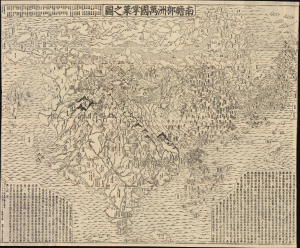
南瞻部洲萬國掌菓之圖 / Nansen bushū bankoku shōka no zu / [Map of the Countries in Jambudvipa].
$25,000.00
Acquire
- Digital Map Information
- Suitable for large format printing
- File Size: 187.54 MB
- File Type: ZIP / TIFF
- ICC color profile embedded
- Delivered instantly via download link
This is the seminal 1710 (Hoei 7) woodblock Buddhist world map composed by the monk Rokashi Hotan. It is the first Japanese printed map to depict the world, including Europe and America, from a Buddhist cosmographical perspective. Inspired by the 1653 publication of Si-yu-ki (or Xiyuji 西域記), a pilgrimage narrative of the Chinese monk Hsuang-Tsang's (or Xuanzang 玄奘, 602 - 604 CE) travels to India in search of sacred Sanskrit writings, it attempts to reconcile Buddhist and Western cartography. (more details)
The first official Japanese regional map using western cartographic technology. A wonder of copper engraving!

峨羅斯及亞西亞ノ圖 / [Map of Russia and Asia].
$12,000.00
Acquire
- Digital Map Information
- Suitable for large format printing
- File Size: 109.25 MB
- File Type: ZIP / TIFF
- ICC color profile embedded
- Delivered instantly via download link
An extraordinary 1867 (Keio 3) map of Siberia and Alaska illustrates a moment of cultural collision and transformation. Printed in Japan using a remarkable multi-color copperplate process, the map is a conic projection covering Asia from the Caspian Sea to the Bering Strait. It extends farther east to include Alaska, and south to encompass Nepal, Korea, Tibet, most of China, and all of Japan. This is the first Japanese regional map to incorporate contemporaneous western cartographic technology for official strategic and military use. (more details)
Japanese diplomatic and propaganda con-job on the Qing.
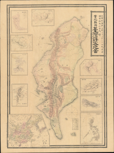
Detailed Map of Taiwan Field Survey. / 實地踏測台灣詳密地圖
$11,000.00
Acquire
- Digital Map Information
- Suitable for large format printing
- Full resolution TIFF file
- ICC color profile embedded
- Delivered instantly via download link
This 1895 Nakamura Yoshimatsu map of Taiwan is one of the most unsung but influential examples of persuasive cartography ever published. The large-scale map of Taiwan appeared at the end of the First Sino-Japanese War (August 1, 1894 - April 17, 1895), just prior to the Treaty of Shimonoseki (April 17, 1895) and the Japanese invasion of Taiwan (May 29, 1895 - October 21, 1895). The map, attributed to a likely fictional British naval officer named John Waters, employs creative cartography to reshape Taiwan, while retaining the overall area, effectively reducing the size of Qing-controlled Formosa and increasing the size of the ungoverned 'savage zones' - a ploy that played into the Japanese position that the Qing did not truly possess the island. It was likely presented at the Shimonoseki negotiations, where the Japanese were able to take advantage of Qing China's infamous lack of cartographic knowledge about Formosa to formally seize the island. This is the first edition of this map, published on January 20, 1895. It also accompanies the booklet Taiwan-tō Chishi-yō (臺灣島地誌撮要), a combination gazetteer of Taiwan and historiographical justification of the Japanese seizure of the island using Confucian political morality and just-war rhetoric. (more details)
Japan's view of the world, and its place, with some exaggeration.
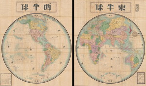
東半球 / Eastern Hemisphere / 西半球 / Western Hemisphere.
$10,000.00
Acquire
- Digital Map Information
- Suitable for large format printing
- File Size: 455.86 MB
- File Type: ZIP / TIFF
- ICC color profile embedded
- Delivered instantly via download link
This is a very scarce and enormous Meiji 9 or 1876 Japanese double hemisphere world map set by Hayami Iwakichi. Aside from its sheet immensity, the map is notable for reflecting changing Japanese understanding of world geography in the fallout from the Meiji Restoration. Hayami offers a very Japanese worldview superimposed upon a modern world map, with some places are diminished and others exaggerated in size to reflect not only their importance to Japan, but also Japan's perspective regarding its own position on the world stage. (more details)
Making Light of Perry's Gunboat Diplomacy.
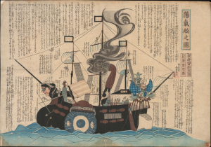
陽氣舩之圖 / [View of the Merry Ship].
$6,500.00
Acquire
- Digital Map Information
- Suitable for large format printing
- Full resolution TIFF file
- ICC color profile embedded
- Delivered instantly via download link
This is a rare c. 1854 kawaraban satirical woodblock print, produced by the pseudonymous Kanoka Mamaro (寒翁窠馬麿), depicting one of Commodore Matthew Perry's 'black ships.' It demonstrates that, even amid a strict regime of censorship, Japanese publishers sought to profit by informing and entertaining the public, including with irreverent takes on the historically significant events underway. (more details)
Foreigners so strange.
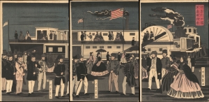
亜墨利加國蒸気車往來 / [The Comings and Goings of an American Steamship].
$5,500.00
Acquire
- Digital Map Information
- Suitable for large format printing
- Full resolution TIFF file
- ICC color profile embedded
- Delivered instantly via download link
This is Utagawa Yoshikazu's 1861 ukiyo-e woodblock triptych of an American steamship and passengers at Yokohama, an intriguing depiction of foreigners in Japan from the early days after Yokohama's opening as a treaty port. It is notable for reflecting both the curiosity of Japanese artists about the new arrivals and their imperfect understanding of these visitors. (more details)
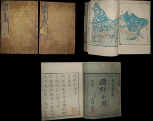
Entitled Kokugun Zenzu and printed c. 1838 (Tenpo 9), this is an early Japanese atlas of exceptional rarity, beauty and importance. Compiled by Motonobu Aoo and Toshiro Eirakayu based upon the works of Japan's 18th century master cartographer Ino Tadataka, this set ... (more details)
Japan's first train.
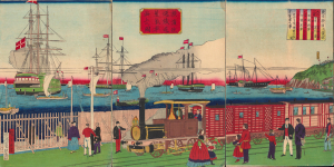
橫濱往返鐵道蒸氣車海上之圖 / [View of Steam Engine on the Seaside Yokohama Line].
$4,500.00
Acquire
- Digital Map Information
- Suitable for large format printing
- Full resolution TIFF file
- ICC color profile embedded
- Delivered instantly via download link
A fascinating 1874 ukiyo-e triptych by Utagawa Hiroshige III celebrating Japan's first passenger railway and the astonishing modernization of Yokohama under the Meiji. Opened between Yokohama and Tokyo in 1872, the steam railway became one of the most potent symbols of a country transforming itself at extraordinary speed, linking Japan's leading international treaty port with the imperial capital. Published two years after the railway's inauguration, the triptych captures not simply a train, but a defining moment in the Meiji Restoration, when foreign technology was being rapidly absorbed and transformed into the infrastructure of modern Japan. (more details)
Tokyo's Foreign Quarter in the Early Meiji Period.
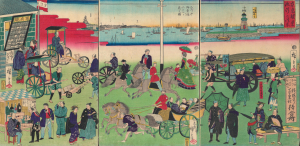
東京繁榮流行の往来 / [The Comings and Goings of Prosperity and Fashions in Tokyo].
$4,500.00
Acquire
- Digital Map Information
- Suitable for large format printing
- Full resolution TIFF file
- ICC color profile embedded
- Delivered instantly via download link
This is an 1870 ukiyo-e depiction of the Tsukiji neighborhood of Tokyo, drawn by Utagawa Hiroshige III and published by Masadaya Heikichi. It displays the neighborhood just months after it was designated as the foreign residence quarter of Tokyo following the Meiji Restoration, emphasizing the rapid importation of foreign technologies, fashion, and manners. (more details)
Planning the Colonial Capital.
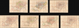
附圖第一號 京城都市計畫區域圖, 附圖第二號 京城都市計畫地域圖... / [Appendix Map No. 1. Keijo Capital City Plan Area Plan, Appendix Map No. 2. Keijo Capital City Plan Land Use Map...].
$4,500.00
Acquire
- Digital Map Information
- Suitable for large format printing
- Full resolution TIFF file
- ICC color profile embedded
- Delivered instantly via download link
This is a set of seven large-format c. 1925 planning maps of Seoul (Keijō), produced during the Japanese colonial period. Together, they constitute a remarkable survival from the Japanese colonial era and provide a window into a forgotten chapter in the history of one of the world's largest cities. (more details)
A lost map...
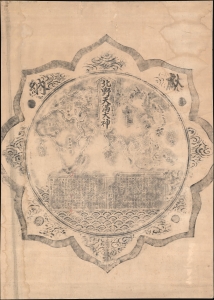
北野天満大神 / [The Great 'Kami' of Kitano Shrine].
$4,500.00
Acquire
- Digital Map Information
- Suitable for large format printing
- File Size: 87.3 MB
- File Type: ZIP / TIFF
- ICC color profile embedded
- Delivered instantly via download link
This is a unique rubbing of a Meiji 13 or 1880 map of the Eastern Hemisphere from a carving on the back of a bronze mirror at Kitano Tenmangū Shrine, Kyoto. The mirror and the map were given by the Nissan Nagamori-kō to the Kitano Tenmangū Shrine in 1880. Nonetheless, the map was forgotten until 2015, when it was rediscovered by shrine caretakers, but this rubbing dates to the early Meiji, shortly after the mirror-map was carved. This rubbing was thus likely done for or by one of the Nissan Nagamori-kō, or possibly a pilgrim to the shine shortly after it was donated, but before the mirror was mounted - hiding the map and making all further rubbings impossible. (more details)
Yokohama emerging as an international port.
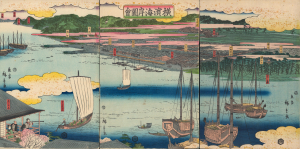
橫濱海岸圖會 / [View of the Coast at Yokohama.]
$4,000.00
Acquire
- Digital Map Information
- Suitable for large format printing
- Full resolution TIFF file
- ICC color profile embedded
- Delivered instantly via download link
An early 1860 ukiyo-e triptych by Utagawa Hiroshige II, capturing Yokohama, Japan, as it emerged as an international treaty port. Published just months after Yokohama opened to foreign trade in 1859, this panoramic view presents a city poised between the insular world of Tokugawa Japan and the profound transformations that would soon accompany sustained contact with the West. Among the earliest printed views of Yokohama, it offers a Japanese vision of the nascent port: cherry blossoms, temples, teahouses, theaters, and the notorious Miyozaki pleasure quarter occupy a landscape only beginning to accommodate global commerce. Most evocative is a woman seated in a waterfront teahouse, telescope in hand, gazing across the harbor - an image that seems to encapsulate Japan itself, watching with fascination as an unfamiliar world approaches. (more details)
Internal WWII power struggle between the Japanese Navy and Army.
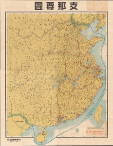
支那要圖 / [Map of China].
$4,000.00
Acquire
- Digital Map Information
- Suitable for large format printing
- File Size: 237.76 MB
- File Type: ZIP / TIFF
- ICC color profile embedded
- Delivered instantly via download link
This enormous 1938 wall map of China was produced by the propaganda arm of the Imperial Japanese Navy to document bombing raids. It is also propaganda vehicle related to the power struggle between the Japanese Army and Navy and their tussle for influence with the government, the Supreme War Council (軍事参議院), and the Emperor. The outcome of this struggle - in favor of the navy - ultimately came to define the Japanese Pacific War strategy. Of note, given this map's rarity and lack of publication information typical of the period (indicating both printing and publication dates), it is evident that this map was produced exclusively for internal naval use. (more details)
Japan's First True Railway.
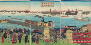
東京高輪海岸蒸氣車鐵道圖 / [Steam Train on the Railway along the Tokyo-Takanawa Coastline].
$4,000.00
Acquire
- Digital Map Information
- Suitable for large format printing
- Full resolution TIFF file
- ICC color profile embedded
- Delivered instantly via download link
A remarkable view of Japan's first modern railway, this ukiyo-e woodblock triptych was drawn by Utagawa Hiroshige III and published by Tsunajima Kamekichi in 1871. (more details)
Pan-Eurasian Unity?
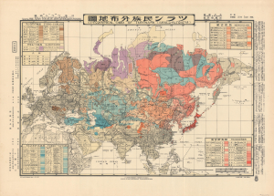
ツラン民族分佈地圖 / [Ethnographic Card of Turanians (Uralo-Altaians)].
$4,000.00
Acquire
- Digital Map Information
- Suitable for large format printing
- File Size: 36.62 MB
- File Type: ZIP / TIFF
- ICC color profile embedded
- Delivered instantly via download link
An intriguing piece of ethnographic Interwar-WWII propaganda, this bilingual Japanese-English map, based on a 1933 manuscript by Kato Ryūshirō, displays the purported peoples of the 'Turanian' community. The present example was printed in 1943 in Hungary by the Turan Federation of Hungary and the Royal Hungarian Defense Cartography Institute. (more details)
The Rapid Expansion of Yokohama.
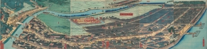
再改橫濱風景 / [Up-to-date View of Yokohama].
$4,000.00
Acquire
- Digital Map Information
- Suitable for large format printing
- Full resolution TIFF file
- ICC color profile embedded
- Delivered instantly via download link
This is a stunning 1861 panoramic set of six ukiyo-e (nishiki-e) Utagawa Sadahide woodblock prints depicting the port of Yokohama. The port opened to foreign trade in 1859, just two years earlier, becoming Japan's primary point of contact with the West. Sadahide was the most prolific among a school of woodblock artists chronicling these momentous changes. (more details)
Early Japanese connections with San Francisco.

亜墨利迦州迦爾波爾尼亜港出帆之圖 / [View of Ships Departing from the Port of California, America].
$4,000.00
Acquire
- Digital Map Information
- Suitable for large format printing
- Full resolution TIFF file
- ICC color profile embedded
- Delivered instantly via download link
A magnificent Ukiyo-e woodblock triptych in the distinctive Yokohama-e style, produced in 1862 by the genre's most prolific master, Utagawa Sadahide. It portrays a group of American ships leaving the 'port of California,' almost certainly San Francisco, presumably bound for Japan. This work is especially notable as it depicts a purely foreign scene, rather than the more common illustrations of foreigners in Yokohama or elsewhere in Japan. (more details)
Passion for foreign technology.
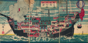
獨逸國軍艦内郭機械圖 / [Drawing of the Internal Workings of a German Navy Ship].
$3,500.00
Acquire
- Digital Map Information
- Suitable for large format printing
- Full resolution TIFF file
- ICC color profile embedded
- Delivered instantly via download link
A scarce c. 1874 ukiyo-e (more specifically, nishiki-e) triptych depicting lively scenes aboard a German naval ship, prepared by the artist Unsen. It is an example of Japan's flourishing interest in foreign technology and practices in the early Meiji period and specifically represents the special connection between the Prussian-led German Empire and the Empire of Japan. (more details)
Yokohama's Yoshiwara.
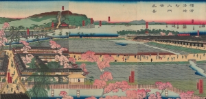
横浜港崎町大門橋真景 / [An Accurate View of the Miyozaki Great Gate and Bridge in Yokohama].
$3,500.00
Acquire
- Digital Map Information
- Suitable for large format printing
- Full resolution TIFF file
- ICC color profile embedded
- Delivered instantly via download link
This is a ukiyo-e triptych of Yokohama, prepared in 1860 by Sadahide, the master of the Yokohama-e subgenre of ukiyo-e woodblock prints. It depicts a view from the Miyozaki pleasure quarter, one of the main sites of cultural contact and mutual curiosity between foreigners and Japanese in Yokohama. (more details)
First Bird's-Eye View of Japan.
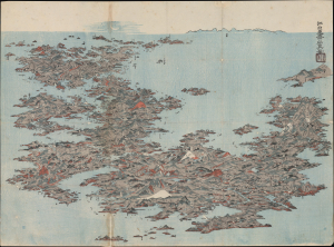
[日本名所之繪 / Picture of the Famous Places of Japan]
$3,500.00
Acquire
- Digital Map Information
- Suitable for large format printing
- File Size: 22.57 MB
- File Type: ZIP / TIFF
- ICC color profile embedded
- Delivered instantly via download link
This is an important c. 1805 Ukiyo-e bird's-eye view of Japan prepared by Kitao Masayoshi. It is the first artistic bird's-eye view of the Japanese archipelago, and influenced the work of Katsushika Hokusai and later Japanese bird's-eye-view artists. (more details)
Japan's First Railway in the year it was built.
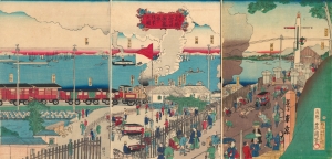
東京高縄品川口蒸氣車往來之圖 / [View of the Coming and Going of the Steam Train at Tokyo Takanawa - Shinagawa].
$3,000.00
Acquire
- Digital Map Information
- Suitable for large format printing
- Full resolution TIFF file
- ICC color profile embedded
- Delivered instantly via download link
This is a ukiyo-e triptych drawn by Kunisada II and engraved by Kokaiya Katsugorō in 1872. It depicts Japan's first modern railway, which opened the same year, on its route between Tokyo and Yokohama. The line not only helped revolutionize Japan's economy but also changed basic notions of space and time, setting Japan on a path toward becoming one of the world's premier railway nations. (more details)
Mapping Taiwan, with an Eye towards Expansion.
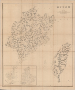
福建省全圖 / [Complete Map of Fujian Province].
$3,000.00
Acquire
- Digital Map Information
- Suitable for large format printing
- Full resolution TIFF file
- ICC color profile embedded
- Delivered instantly via download link
This is a rare c. 1882 large-format folding map of Fujian and Taiwan, produced by the General Staff of the Japanese Imperial Army. Made in the wake of Japan's 1874 Punitive Expedition to Taiwan, this map presages the 1895 conquest and colonization of Formosa. (more details)
An Early View of Yokohama's Red-Light District.
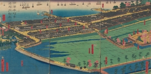
橫濱本町景港崎街新廓 / [View of Yokohama Honmachi and the New Miyozaki Quarter].
$3,000.00
Acquire
- Digital Map Information
- Suitable for large format printing
- Full resolution TIFF file
- ICC color profile embedded
- Delivered instantly via download link
This is a c. 1860 ukiyo-e triptych of Yokohama highlighting, among other elements, the Miyozaki Pleasure Quarter, prepared by Sadahide and published by Yamaguchiya Tōbei. The city, hitherto a small fishing village, rapidly developed after being opened to foreign traders and residents in 1859, building new districts, including Miyozaki, in a handful of months. (more details)
Origins of Modern Japan's Banking System.
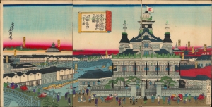
東京海運橋第一國立銀行の全圖并近圓の市中一覽の圖/ [Complete View of the First National Bank at the Tokyo Kaiun Bridge, with a View of the Nearby Cityscape].
$3,000.00
Acquire
- Digital Map Information
- Suitable for large format printing
- Full resolution TIFF file
- ICC color profile embedded
- Delivered instantly via download link
This stunning 1876 Ukiyo-e triptych, depicting the Dai-Ichi Bank Building in Tokyo, was drawn by the artist Yoshitora and published by Takekawa Seikichi. Both the bank and its building, along with several other financial institutions in the same area, were key signifiers of Japan's modernization in the early Meiji period. (more details)
Defending the borders in the wake of Commodore Perry.
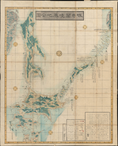
蝦夷闔境輿地全圖 / [Complete Map of All Lands within the Borders of Ezo].
$2,750.00
Acquire
- Digital Map Information
- Suitable for large format printing
- Full resolution TIFF file
- ICC color profile embedded
- Delivered instantly via download link
This is an important 1854 (Kaei 7) Japanese Edo period Fujita Ryou chromoxylographic map illustrating Hokkaido, Sakhalin, and the Kuril Islands. It was issued following the 1853 arrival of Commodore Matthew Perry, anticipating the opening of Hakodate as one of the five Japanese treaty ports. (more details)
Keeping Time in Yokohama.
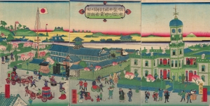
橫濱繁榮本町通時計臺神奈川縣全圖 / [Complete View of the Clock Tower in Yokohama's Flourishing Neighborhood of Honcho, Kanagawa Prefecture].
$2,500.00
Acquire
- Digital Map Information
- Suitable for large format printing
- Full resolution TIFF file
- ICC color profile embedded
- Delivered instantly via download link
A scarce and brightly-colored ukiyo-e 1874 woodblock triptych by Utagawa Kunitsuru depicting Yokohama's town hall (横浜町会所), constructed in 1874 (Meiji 7), one of many new marvels depicted in Yokohama-e prints of the era. Bridging past and present, Kunitsuru employed established nishiki-e conventions but added relatively new, vibrant pink, yellow, and purple aniline inks, most imported from Europe, that eventually became distinctive of Meiji-era woodblock prints. (more details)
How a wood and paper city burns.
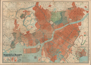
帝都大震火災系統地圖 / Map of the Fire of Tokyo.
$2,500.00
Acquire
- Digital Map Information
- Suitable for large format printing
- Full resolution TIFF file
- ICC color profile embedded
- Delivered instantly via download link
An exceptional example of an infographic masterpiece detailing the ignition and development of the Great Fire of Tokyo following the 1923 Great Kanto Earthquake. This partially bilingual 1923 map of the Great Tokyo Fire was issued by the Relief Information Bureau of Tokyo Imperial University just four months after the disaster. It focuses on ignition points and on the strong winds that coincided with the earthquake, which caused fire to spread rapidly and eventually burn down much of the dense wooden city. This example includes the original index, which we have never seen before, as well as its paper sleeve. (more details)
One of the Most Influential Japanese Maps of the 19th Century. / Japanese recognition of the Sea of Korea.
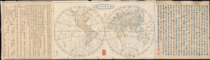
新製輿地全圖 / [Newly-Made Complete Map of the World].
$2,500.00
Acquire
- Digital Map Information
- Suitable for large format printing
- File Size: 30.62 MB
- File Type: ZIP / TIFF
- ICC color profile embedded
- Delivered instantly via download link
This is a fascinating 1844 Mitsukuri Shōgo double-hemisphere world map with descriptive text. Based on a somewhat earlier French map, it is important in the migration of Western geographic knowledge to Japan, even in the years before Japan was 'forced open' by American warships, hastening the end of its period of isolation. It is also unusual as one of the very few Japanese maps to recognize the 'Sea of Korea' toponym. (more details)
Exceptional large-format wartime Japanese map of the Philippines.
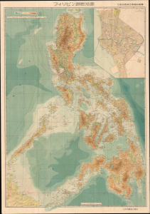
フィリピン詳密地圖 / Detailed Map of the Philippines. / Firipin shomitsu chizu.
$2,400.00
Acquire
- Digital Map Information
- Suitable for large format printing
- Full resolution TIFF file
- ICC color profile embedded
- Delivered instantly via download link
This is Kawamata Tetsuya's rare 1944 (Showa 19) Japanese large-format map of the Philippines, issued just 5 days after the WWII Philippines Campaign (1944 - 1945) began. The map is an expansion on a similar map issued for the 1942-43 'Greater East Asia Co-Prosperity Sphere' map series, which it stylistically resembles despite being four times the size. (See our listing coprosperityset-showa18-1943 for more detail on this series.) This map was issued to satisfy an increased Japanese need for information and reconnaissance following General Douglas MacArthur's landing at Leyte. (more details)
Geographical Games.
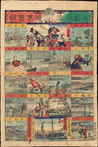
各國航海境界雙錄[六] / [Sugoroku of Each Country's Maritime Boundaries].
$2,250.00
Acquire
- Digital Map Information
- Suitable for large format printing
- Full resolution TIFF file
- ICC color profile embedded
- Delivered instantly via download link
A brilliantly-colored game from the early Meiji, this c. 1870 ukiyo-e sugoroku sheet reflects the interests of the times, focusing on foreign countries and modern naval technology. (more details)
The Tokugawa Scheme to Control Daimyo.
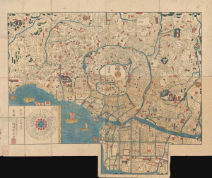
[Edo].
$2,200.00
Acquire
- Digital Map Information
- Suitable for large format printing
- Full resolution TIFF file
- ICC color profile embedded
- Delivered instantly via download link
This is a 1845 Murataya Hikobē map of Edo (Tokyo), Japan, the capital of the Tokugawa Shogunate. It is particularly notable for recording the residences, often multiple residences, and family crests of daimyo from throughout Japan in Edo, a critical piece of the Tokugawa's measures to control them and ensure national unification. (more details)
Renovating Nihonbashi.
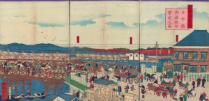
東京第一名所 日本橋御摸檨替繁榮之圖 / [Famous Places of Tokyo No. 1 View of the Prospering Nihonbashi Replacement Bridge].
$2,000.00
Acquire
- Digital Map Information
- Suitable for large format printing
- Full resolution TIFF file
- ICC color profile embedded
- Delivered instantly via download link
An engaging 1873 Ukiyo-e triptych produced by Kuniteru II depicting the new Nihonbashi Bridge in Central Tokyo. The most culturally significant bridge in Japan, the historical terminus of the Tōkaidō highway, the Edo-era arched bridge had been replaced by a Western-style flat bridge the year before this print's publication, both a practically and symbolically important change. (more details)