
One-of-a-Kind
Most comprehensive record of the My Lai Massacre in private hands.
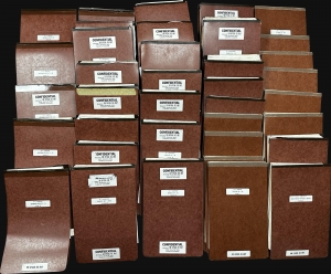
This is a 37-volume archive of documents from the 1971 My Lai Massacre court-martial of Colonel Oran K. Henderson. Henderson was the highest-ranking officer tried in connection with My Lai, one of the most horrific events in American military history, and the last soldier to face a court-martial. The court-martial lasted 62 days and on December 17, 1971, Henderson was found not guilty. Henderson's court-martial ties for the longest court-martial in U.S. Army history with that of Lieutenant William Calley, the only member of the U.S. Army found guilty in connection with My Lai. (more details)
First scientific survey of the Islamic holy city of Madinah.

حرم شريف ايله سائر اماكين مباركه وعسكريه وباشلوجه اسواقى كوسترر مدينه منوره شهرينك طپوغرافياى منظمه اصوليله اخذ اولنان خريطه سيدر. / [Map of the Prophet’s Mosque (Haram Sharif) with All Sacred Places, Military Buildings and Main Squares Showing Topography of the City of Medina Al-Munawwarah with a Legend]
$85,000.00
Acquire
- Digital Map Information
- Suitable for large format printing
- File Size: 35.58 MB
- File Type: ZIP / TIFF
- ICC color profile embedded
- Delivered instantly via download link
A seminal map. This large-scale Arabic manuscript map is the first scientific survey of the Islamic holy city of Medina (المدينة المنورة / Madinah), in modern-day Saudi Arabia. The map was compiled for Abd al-Mutalib ibn Ghalib, Emir and Grand Sharif of Mecca, known for his pro-slavery anti-Ottoman positions, as well as for his modernization of infrastructure in both Mecca and Medina. (more details)
Bockscar's in-flight navigation map of Nagasaki Bombing.
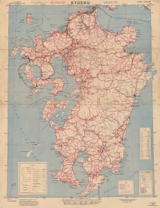
Recording one of the most significant moments in the 20th century, this is a 1945 U.S. Army Corps of Engineers 'Special Strike Map' of Kyushu, Japan, featuring manuscript notations tracing the inbound flight path of Bockscar during 'Fat Man' atomic bombing attack on Nagasaki, Japan, on August 9, 1945. This map was likely used by Bockscar's in-flight navigator James Van Pelt (1918 - 1994) to redirect the mission from the primary target, Kokura, to the secondary target, Nagasaki. (more details)
Largest and Most Detailed Early-19th Century Map of China.

This is a massive (98 x 134 in) 64-sheet 1832 wall map of Qing China, prepared by Dong Fangli and Li Zhaoluo. Building on administrative maps of the early-mid Qing, it represented the most detailed and accurate mapping of China and surrounding territories under Qing suzerainty produced in the early 19th century. (more details)
The first Chinese designed and issued commercial map.
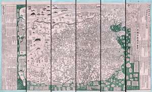
古今地舆全圖 / Full Modern and Ancient Map.
$65,000.00
Acquire
- Digital Map Information
- Suitable for large format printing
- Full resolution TIFF file
- ICC color profile embedded
- Delivered instantly via download link
A rare and important discovery, this is Mingjie Liu's (刘明杰) (1857 - 1911) important 1892 (Guangxu 18) Qing Era xylographic (woodcut) map of China - the earliest known example of what is considered China's first commercial map and possibly the first Chinese comical map. The map was revolutionary when Liu created it, as this was neither administrative nor religious; instead, it was a commercially marketed folk piece, muban nianhua (木版年画), created in Yangjiabu, Shandong, for traditional Chinese New Year festivals. Coverage extends to all of China, as well as marginal inclusions in the form of tenuous mappings of foreign places, including European countries, Southeast Asia, India, and apocryphal destinations. (more details)
Rare, Distinctive World Map with a Unique Projection.
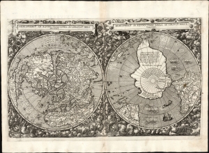
Hemispheriū Ab Aequinoctli Linea, Ad Circulū Poli Arctici / Hemispheriū Ad Circulū Poli Ātarctici.
$62,500.00
Acquire
- Digital Map Information
- Suitable for large format printing
- DPI: 600
- File Size: 26.2 mb
- File Type: TIFF
- # of Files: 1
- ICC color profile embedded
- Delivered instantly via download link
This is Cornelis De Jode's rare 1593 double-polar projection map of the world. It is among the most striking early world maps and among the earliest to introduce the double hemispheric polar projection. Moreover, as a competitor to Ortelius' cartography, it is the sole obtainable map to preserve the innovative Guillaume Postel/Antwerp Unicum cartography. The map is quite rare, having been published in only a single edition. (more details)
Unobtainable first state of one of the most influential maps of New England ever made.
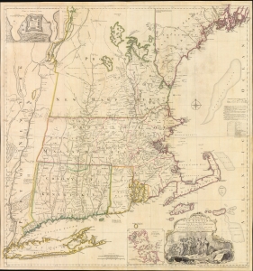
A MAP of the most INHABITED part of NEW ENGLAND, containing the PROVINCES of MASSACHUSETS BAY and NEW HAMPSHIRE, with the COLONIES of KONEKTIKUT AND RHODE ISLAND. Divided into Counties and Townships: The whole composed of Actual Surveys and its situation adjusted by ASTRONOMICAL OBSERVATIONS.
$55,000.00
Acquire
- Digital Map Information
- Suitable for large format printing
- File Size: 35.46 MB
- File Type: ZIP / TIFF
- ICC color profile embedded
- Delivered instantly via download link
This is the rare 1755 first state of Braddock Mead's French and Indian War Era map of New England - one of the most significant and iconic American maps ever produced. It is one of the first large-format regional maps of any part of North America and was the most comprehensively researched and detailed map of contemporary New England. (more details)
First Municipal Council Maps - the origins of modern Shanghai.
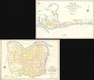
Plan of the English Settlement at Shanghae. / Plan of the Hong Kew (Hong Que.) or American Settlement, at Shanghae.
$45,000.00
Acquire
- Digital Map Information
- Suitable for large format printing
- Full resolution TIFF file
- ICC color profile embedded
- Delivered instantly via download link
The holy grail of Shanghai cartography, this 1866 map set is the most important, largest scale, and most beautiful early presentation of Shanghai. These are the first maps issued by the Shanghai Municipal Council, resulting from a landmark 1864-66 survey that followed the consolidation of the British Concession with the American Settlement. Their issue ended two decades of development lethargy and launched major urbanization and modernization projects that established Shanghai as the major gateway to China. As such, these maps, more than any other, represent the birth of Shanghai as a modern city. (more details)
Early American Political Satire: In the wake of the Boston Tea Party.
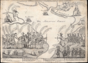
Liberty Triumphant; or The Downfall of Oppression.
$45,000.00
Acquire
- Digital Map Information
- Suitable for large format printing
- DPI: 600
- File Size: 169.18 MB
- File Type: ZIP / TIFF
- ICC color profile embedded
- Delivered instantly via download link
An iconic 1774 American political cartoon by Henry Dawkins lampooning the Tax Act and the Boston Tea Party. This is likely the most important political cartoon issued in the lead-up to the American Revolutionary War (1775 - 1783). It was published after the Tea Party but before the Intolerable Acts. The image is innovative in its use of cartographic imagery, larger-than-life representations of key political figures, and use of allegory. Moreover, it stands out for its remarkable encapsulation of the complex pre-Revolution political environment. (more details)
First printed English Nautical Chart of New York and New England. / First use of the name 'Connecticut' in any form.
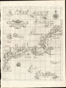
Carta particolare della nuova Belgia è parte della nuova Anglia La longitudiné Cominca da l'Isola di Pico d'Asores. D'America Carta II.
$40,000.00
Acquire
- Digital Map Information
- Suitable for large format printing
- File Size: 14.46 MB
- File Type: ZIP / TIFF
- ICC color profile embedded
- Delivered instantly via download link
This is a superb example of Robert Dudley's 1647 / 1661 nautical map of the coast of New York and New England - according to Burden, the 'first printed sea chart of New England and the New Netherlands.' Moreover, it is the first chart of New England to be produced by an Englishman. The chart's portolan-like lines and exquisite Florentine calligraphy distinguish it as one of the most beautiful works dedicated to the region. It is a rarity on the market, and a prize map for collectors of New York and New England. (more details)
First full-size folio map of North America.
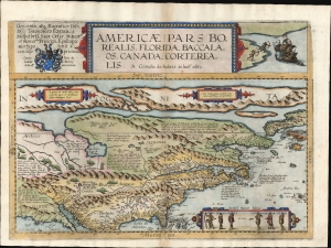
Americae Pars Borealis, Florida, Baccalaos, Canada, Corterealis.
$37,500.00
Acquire
- Digital Map Information
- Suitable for large format printing
- Full resolution TIFF file
- ICC color profile embedded
- Delivered instantly via download link
This is Cornelis De Jode's rare map of North America, printed in a single edition of 1593. The first full-size folio map specifically of North America, it was among the updated maps added to the De Jode atlas specifically to compete with Ortelius' Theatrum Orbis Terrarum. To this end, it combined cartographic information from current sources with a level of decorative flourish that had not yet appeared in any atlas. In the case of this map, Cornelis focused on a part of the world omitted from the elder De Jode's 1578 atlas. (more details)
Foundational manuscript plan of colonial Saigon.
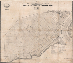
Batiments Civils Projet de Ville de 500,000 Ames Saîgon.
$35,000.00
Acquire
- Digital Map Information
- Suitable for large format printing
- File Size: 36.53 MB
- File Type: ZIP / TIFF
- ICC color profile embedded
- Delivered instantly via download link
This is Lucien Florent Paul Coffyn's 1862 manuscript masterplan of Saigon - the first and most significant map of Saigon (Ho Chi Minh City). Coffyn was the French military engineer tasked with transforming a war-torn fort into a model colonial capital. Following the 1861 French occupation of Saigon, authorities resolved to build a new city on the wartorn site at a monumental scale, reflecting boundless imperial ambition. Coffyn, driven by an unwavering belief in the colony's promise, envisioned a grand, European-style metropolis designed to accommodate half a million residents across 25 square kilometers. The present map - exquisitely drafted and signed by both Coffyn and Vice Admiral Louis Bonard, Governor of Cochinchina - is the likely original manuscript submitted for formal approval. Over the subseqeunt decades, Coffyn's street layout and placement of major sites were implemented with fidelity, though not comprehensively, marking this as the foundational document of colonial Saigon. It stands as a unique testament to French imperial planning and an unparalleled artifact of Asian colonial urbanism. (more details)
Most important chronicle and map of early Singapore.
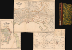
Notices of the Indian Archipelago, and adjacent countries; being a collection of papers relating to Borneo, Celebes, Bali, Java, Sumatra, Nias, the Philippine Islands, Sulu, Siam, Cochin China, Malayan Peninsula, etc.
$32,000.00
Acquire
- Digital Map Information
- Suitable for large format printing
- Full resolution TIFF file
- ICC color profile embedded
- Delivered instantly via download link
A rare example of John Henry Moor's 1837 Notices of the Indian Archipelago, containing within the most important early map of Singapore, as well as otherwise lost reprints of important articles from the Singapore Chronicle, and additional maps of Penang, Singapore Strait, the East Indian Archipelago, Malacca, and Borneo. Moor's work is considered one of the most significant records of early Singapore and one of the first books published in Singapore. (more details)
Early Photogrammetric Aerial Survey of Qatar.
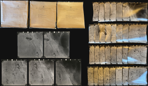
An exceptional discovery: three 1958 portfolios containing 80 original photogrammetric photographs, encompassing three aerial 'runs' over Qatar by Hunting Aerosurveys. They were produced on behalf of J.D. and D.M. Watson, British consulting engineers contracted by Qatar to engineer a stable, clean water supply for the rapidly expanding Doha. Coverage focuses on a peninsula-wide strip just north of Doha commiserate with the site of the ongoing Lusail megadevelopment. (more details)
Holy Grail Map - 1st Map of the North Pole.
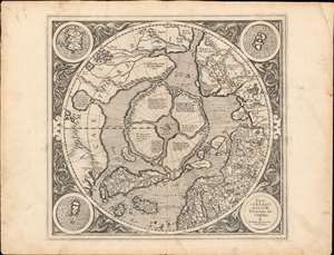
Septentrionalium Terrarum descriptio.
$30,000.00
Acquire
- Digital Map Information
- Suitable for large format printing
- Full resolution TIFF file
- ICC color profile embedded
- Delivered instantly via download link
This is the first edition, first state of Gerard Mercator's seminal 1595 map of the Arctic, the great cartographer's most interesting and important atlas map. In this first edition, it is the scarcest of Mercator's atlas maps and a holy grail for any Arctic collector. For all its flaws and inaccuracies, it is a schematized interpretation of factual voyages between Norway, England, Iceland, Greenland, and Labrador (Markland). (more details)
Beginnings of American commercial chart publishing.

General Chart of the West Indies from the latest Marine Journals and Surveys.
$30,000.00
Acquire
- Digital Map Information
- Suitable for large format printing
- DPI: 600
- File Size: 50.2 MB
- File Type: ZIP / TIFF
- ICC color profile embedded
- Delivered instantly via download link
An important c. 1789 - 1794 nautical map of the West Indies, Florida, the Bahamas, and the Gulf of Mexico littoral by Osgood Carleton and John Norman. This is the second edition of John Norman's first published nautical chart, representing one of the first instances of post-Revolutionary American commercial chart making, predating the publication of the Clark Pilot by several months. (more details)
The Philippines mapped with unprecedented accuracy - the first large-scale synthesis of Malaspina and Aragón, and one of the rarest landmarks of Philippine cartography.
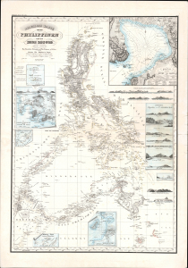
Reduzierte Karte von den Philippinen und den Sulu Inseln.
$28,000.00
Acquire
- Digital Map Information
- Suitable for large format printing
- Full resolution TIFF file
- ICC color profile embedded
- Delivered instantly via download link
This is a striking 1832 Heinrich Berghaus map of the Philippines. It was issued for Berghaus' loose-leaf Atlas von Asien, the best-informed general cartographic work on Asia to appear in the mid-19th century. It is the first large-scale map to comprehensively incorporate both the Malaspina hydrography and Ildefonso de Aragón's (c. 1826) geographical surveys. It thus offers unprecedented accuracy and the first substantial critical analysis of Philippine hydrography and cartography, making it a seminal chapter in the archipelago's mapping. (more details)
The first English Printed Nautical Chart to the Indies.
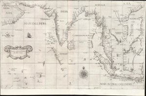
Carta prima Generale dell' Asia.
$25,000.00
Acquire
- Digital Map Information
- Suitable for large format printing
- File Size: 28.34 MB
- File Type: ZIP / TIFF
- ICC color profile embedded
- Delivered instantly via download link
This is a superb, first-state example of Robert Dudley's 1646 general nautical map of South Asia, from the Arabian Peninsula to the Philippines, including the coastlines of India, the Malay Peninsula, Cochinchina, and southern China. Countless islands of the Indian Ocean are charted, as are the western parts of the East Indies. It is the first printed chart of the route to the Spice Islands produced by an Englishman; it is the first to utilize the Mercator Projection, and the first to show prevailing winds, currents, and magnetic variation. The chart's portolan-like lines suggest its origin in the manuscript charts that informed it. Aesthetically, they distinguish this chart as one of the most elegant works dedicated to the region. It is a rarity on the market and a prize map for collectors. (more details)
First published nautical chart of Bermuda.
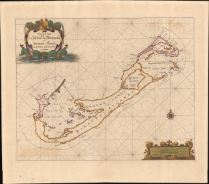
Pascaert van 't Eÿland la Bermuda of Sommer Ilands en de andere Eÿlanden daer bÿ geleeghen.
$25,000.00
Acquire
- Digital Map Information
- Suitable for large format printing
- File Size: 19.23 MB
- File Type: ZIP / TIFF
- ICC color profile embedded
- Delivered instantly via download link
This is a stunning old-color example of Arent Roggeveen's 1675 map of Bermuda, considered to be the first sea chart of the solitary archipelago. (more details)
Foundational thought behind the mouse, the chorded keyboard, hyperlinks, metatagging...

The ENGELBART HYPOTHESIS: How The Co-Evolution of Human Tools and Systems Raise Collective I.Q. to Solve Urgent and Complex Problems / Timeline 1925-2010.
$25,000.00
Acquire
An expansive hand-drawn mural drawn in 2008 by Eileen Clegg and Valerie Landau in collaboration with computer science pioneer Douglas Engelbart (signed). The mural illustrates the 'Engelbart Hypothesis', a theory of human-computer co-evolution and how it evolved from roughly 1925 to 2008. It was produced in Palo Alto for the 40th university of the 'Mother of all Demos', a landmark event on December 9, 1968 in which Engelbart and the Stanford Research Institute demonstrated prototypes for the mouse, the chorded keyboard, hyperlinks, meta tagging, and more, forming the bases of modern human-computer interface (worth watching on YouTube). (more details)
Merrill's own manuscript draft of New Hampshire's first town plan.
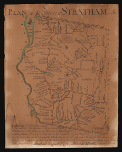
Plan of the Town of Stratham.
$25,000.00
Acquire
- Digital Map Information
- Suitable for large format printing
- File Size: 3.77 MB
- File Type: ZIP / TIFF
- ICC color profile embedded
- Delivered instantly via download link
An extraordinary discovery, this is Phinehas Merrill's 1792 original manuscript draft of his important Plan of the Town of Stratham, published a year later in 1793. Not only is this the first map of any New Hampshire town, it is a key example of early American mapmaking, comparable in many ways to Christopher Colles' 1789 Roads. Moreover, while the printed map is in and of itself significant - and rare, existing in just 12 known examples - this unprecedented example is Merrill's own working draft, drawn by his own hand and exhibiting signs of an evolving production. (more details)
Largest and Best Map of Lower Canada after the War of 1812.
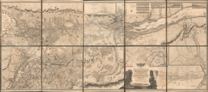
To His Royal Highness George Augustus Frederick, Prince of Wales, Duke of Cornwall ... and Prince Regent of the United Kingdom of Great Britain and Ireland; this Topographical map of the Province of Lower Canada, shewing its division into Districts, Counties, Seigniories, and Townships with all the Lands reserved both for the Crown and the Clergy ... Is with his Royal Hyghnes's Special Permission, Most gratefully dedicated by a Faithful and Zealous Canadian Subject, and His Royal Highnes's Most Obedient and Devoted Servant, Joseph Bouchette, His Majesty's Surveyor General of the Province and Lieutt. Colonel C.M.
$25,000.00
Acquire
- Digital Map Information
- Suitable for large format printing
- File Size: 317.57 MB
- File Type: ZIP / TIFF
- ICC color profile embedded
- Delivered instantly via download link
This is Joseph Bouchette's monumental 10-sheet map of Lower Canada. Appearing at the end of the War of 1812, this is the largest, best, and most influential map of Canada issued in the 19th century. David Rumsey correctly praises it, saying that the 'graphic elegance of the large map is the equal (or perhaps the superior) of any of the contemporary maps that I have seen'. In its pre-publication manuscript form, it played a significant role in the Treaty of Ghent, which ended the War of 1812 and began the establishment of formal U.S.-Canada borders. Due to its extreme rarity, the significance of this map is often overlooked, and it is poorly represented in scholarly literature. (more details)
Stunning 18th Century Manuscript Wall Map of Pisa.
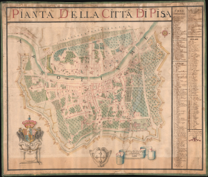
Pianta della Citta di Pisa.
$25,000.00
Acquire
- Digital Map Information
- Suitable for large format printing
- File Size: 64.13 MB
- File Type: ZIP / TIFF
- ICC color profile embedded
- Delivered instantly via download link
An incredible discovery, this large-format 1760 manuscript map of Pisa, Italy, was prepared by Ranieri Spadaccini and Ignazio Pellegrini. It provides a unique and highly detailed historical record of the city's walls, streets, Medieval religious structures, and other infrastructure in the mid to late 18th century. (more details)
Iranian reaction to Russian Imperialism.
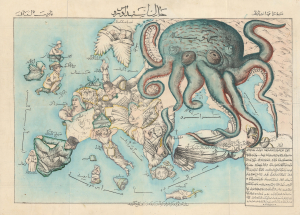
New Map of Europe. / خارطه جديده اوروپا
$24,000.00
Acquire
- Digital Map Information
- Suitable for large format printing
- Full resolution TIFF file
- ICC color profile embedded
- Delivered instantly via download link
A rare c. 1880 Iranian-issued Ottoman Turkish / Farsi version of Englishman Fred Rose's iconic 1877 Serio Comic War Map, in which expansionist Imperial Russia is analogized as a menacing, grasping octopus. The map was issued in Qajar Iran (Persia), but for an Ottoman Turkish audience (there is also a Farsi variant). Both countries were then being menaced by Russia, Turkey in the recent Russo-Turkish War of 1877-1878, and Iran as a field of contention in the Great Game - so the work would have proved widely resonant with a possible hope of fostering mutual support. Text is partially in Turkish, partially in Farsi. (more details)
First scientific hydrographic survey of Bermuda.

To his Excellency Alured Popple Esq. Governour of Bermuda, or the Summer Islands This Map From a new Survey, Correcting ye Dangerous Errors in all ye Charts of that Place hitherto Published is Humbly Dedicated by C. Lempriere, and W. H. Toms, 1738.
$22,500.00
Acquire
- Digital Map Information
- Suitable for large format printing
- File Size: 20.39 MB
- File Type: ZIP / TIFF
- ICC color profile embedded
- Delivered instantly via download link
A holy grail of Bermuda map collecting, this is the 1738 first-edition first-state of Clement Lemprière's separately and independently published map of Bermuda. It is considered the first scientifically verified hydrographic survey of Bermuda and the first published map to correctly identify the archipelago's longitude. It surpassed and superseded the 17th-century Arent Roggeveen survey, thus becoming the basis for most subsequent maps of the archipelago until the Hurd surveys (1783-97). (more details)
Greatest view of San Francisco.
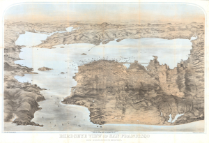
Birdseye View of San Francisco and Surrounding Country.
$22,000.00
Acquire
- Digital Map Information
- Suitable for large format printing
- Full resolution TIFF file
- ICC color profile embedded
- Delivered instantly via download link
This is George Henry Goddard's stunning chromolithograph bird's-eye view of San Francisco Bay, city, and environs, here in its 1880 edition. A product of Goddard's artistic virtuosity, this is not only the best early view of the San Francisco Bay area but also one of the finest American views ever made, offering a unique and outstanding artistic take on the genre. (more details)
The French set their eyes on Singapore.
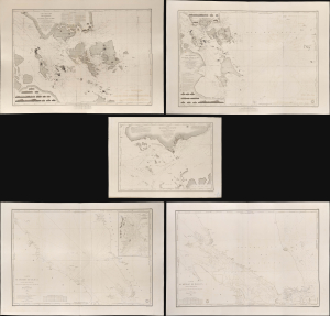
Carte des Atterrages de Singapore. / Carte Particulière des détroits de Singapore, Durian et Rhio. / Carte des Détroits de Singapore, Durian et Rhio et des Parages Environnants. / Carte du Détroit del Malacca Partie Septentrionale. / Carte du Détroit de Malacca Partie Méridionale.
$22,000.00
Acquire
- Digital Map Information
- Suitable for large format printing
- Full resolution TIFF file
- ICC color profile embedded
- Delivered instantly via download link
An exceptional set of five rare 1840s nautical maps/charts detailing Singapore, Malaya, and the Straits of Malacca and Singapore compiled by Urban Dortet de Tessan for the French Dépôt-Général de la Marine. The charts correspond to the Lagrené Mission, a French attempt to establish a colonial presence in East and Southeast Asia that challenged British regional hegemony. (more details)
Most comprehensive and detailed mid-19th century map of Arabia.

A Map of Arabia and Syria Laid down chiefly from original Surveys Under the Supervision of Leiut. Colonel Chesney, R.A. F.R.S. and drawn by W. H. Plate, L.L.D.
$22,000.00
Acquire
- Digital Map Information
- Suitable for large format printing
- Full resolution TIFF file
- ICC color profile embedded
- Delivered instantly via download link
This is William Henry F. Plate's important 1849 map of Arabia, the Persian Gulf, Syria, and Mesopotamia. The product of a wave of new exploration and surveys in the first half of the 19th century, this map is the most significant and detailed map of Arabia and the Persian Gulf to appear in the mid-19th century. (more details)
'A masterpiece designed to give a general picture of the Old and New' - Old Maps of Korea
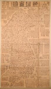
海左全図 [Haezwa Jeon-do / Map of the Country in the West of the Sea.]
$22,000.00
Acquire
- Digital Map Information
- Suitable for large format printing
- Full resolution TIFF file
- ICC color profile embedded
- Delivered instantly via download link
A rare discovery, this c. 1850 woodblock map is one of the few early Korean maps of Korea to be found outside of Korea. It is significant on many levels, being a record of Korea following the reign of King Sunjo (조선 순조; 1790 - 1834), a period when Korea was facing increased pressure from foreign powers, including Japan, Russia, and China. It is also significant for illustrating Korea's disputed island, Dokdo. (more details)
First large-scale view of Paris published in Paris.
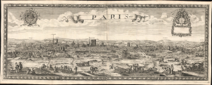
Paris 1660.
$22,000.00
Acquire
- Digital Map Information
- Suitable for large format printing
- File Size: 58.35 MB
- File Type: ZIP / TIFF
- ICC color profile embedded
- Delivered instantly via download link
This is the only known example of Nöel Cochin and Nicolas Berey's 1660 view of Paris - the earliest known large-format view of Paris published in Paris (an earlier large view was issued in Amsterdam). This view is likely a proof state or perhaps a study for a larger view of the same issued two years later in 1662 (c.f. Boutier #105). (more details)
Battle for the Fate of the Levant.
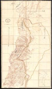
ردشمنلوا میسرت كنویامه هیرب هناخسدنهم هطیرح وبشا [This map was drawn by the Imperial Engineering Office].
$20,000.00
Acquire
- Digital Map Information
- Suitable for large format printing
- Full resolution TIFF file
- ICC color profile embedded
- Delivered instantly via download link
An extraordinary, one-of-a-kind large-format manuscript folding map of Ottoman Syria produced by the sultan's Imperial Engineering Office c. 1832. It was made in the context of the First Egyptian Ottoman War (1831 - 1833), which saw the region temporarily come under Egyptian rule. (more details)
Quod est superius est sicut quod est inferius, et quod inferius est sicut quod est superius.
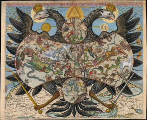
Speculum Uranico-Romanum S. Astroscopium Aquilae Romanae Sacrum Erhardi Weigelis Mathem. Prof. P. Jena.
$20,000.00
Acquire
- Digital Map Information
- Suitable for large format printing
- Full resolution TIFF file
- ICC color profile embedded
- Delivered instantly via download link
This is Erhard Weigel's rare and striking 1661 astroscopium, or allegorical chart of the constellations, framed by the janiform eagle of the Holy Roman Empire. The map is titled 'Speculum Uranico-Romanum', which translates to 'Roman Celestial Mirror', underscoring the mirroring of the celestial and political realms. As-above-so-below, the map presents Weigel's cosmographical framework, in which astronomy (mathematics) and politics were divinely sanctioned and mutually reinforcing: astronomy revealed God's mathematically ordered universe, while the Holy Roman Empire embodied His ordained Christian order. This fascinating image underwent several changes during its printing history: the present example is likely a proof state. (more details)