
Donnet, Alexis

Alexis Donnet (1782 - 1867), aka Aleixo, was a French map geographical engineer, architect, map publisher, and cartographer active in France in the first half of the 19th century. Donnet was born in Lyon. During the First Empire he was an ingénieur-géographe attached to Cadastre de la France. His work is scarce on the market, but well represented in official collections within France, particularly the Bibliothèque Nationale de France (BnF). In addition to cartographic work, he published an architectural study of the theaters of Paris (1821).
Redefining the French national identity in the Bourbon Restoration.
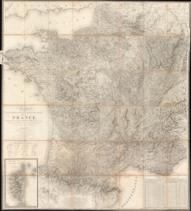
Carte Topographique, Minéralogique et Statistique de la France, Réduite de celle de Cassini, a L'Échelle de 1:388800.
$5,000.00
Acquire
- Digital Map Information
- Suitable for large format printing
- File Size: 122.13 MB
- File Type: ZIP / TIFF
- ICC color profile embedded
- Delivered instantly via download link
A massive 1826 map of France by Alexis Donnet and Hyacinthe Langlois. The map was issued as the definitive map of France during the Bourbon Restoration (1814 - 1830), as the nation recovered and reorganized in the wake of the Napoleonic Wars (1803 - 1815). (more details)